Legal Descriptions
400 likes | 602 Vues
Legal Descriptions. Legal descriptions. An appraiser has to have a basic, working knowledge of the legal descriptions, especially for the area where they work If an appraisal requires knowledge beyond the working knowledge the appraiser needs to rely on professional surveyor or abstractor. .

Legal Descriptions
E N D
Presentation Transcript
Legal descriptions • An appraiser has to have a basic, working knowledge of the legal descriptions, especially for the area where they work • If an appraisal requires knowledge beyond the working knowledge the appraiser needs to rely on professional surveyor or abstractor.
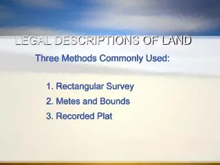
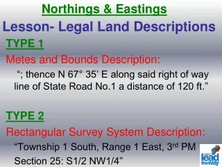
Legal descriptions • Three common methods to legally describe real property; • Rectangular survey system • Metes and bounds system • Lot and block system
Rectangular Survey System • Most common system in the US • RSS was originally implemented in US May 20, 1785 through legislation passed by the Continental Congress for disposal of land in the Western Territory • Sometimes referred to as Government survey system or Government System
Rectangular Survey System • Each state divided into arbitrary north-south lines called Meridians and into arbitrary east-west lines called Baselines • These are arbitrary and not related to geographical meridians • Each meridian is unique and crossed by its own baseline
Rectangular Survey System • Every 6 miles from the principal meridian another line was drawn; resulting columns are called ranges • Every 6 miles from the baseline another line was drawn and the resulting space was called a township. • Each range and township are 6 miles square
Rectangular Survey System • Arkansas, Iowa, Minnesota, Missouri, N and S Dakota use 5th Principal Meridian established in 1815
Range Meridian Township Base Line
Rectangular Survey System • Each section has 640 acres and each acre contains 43,560 square feet • Always to remember to read the location backwards when finding a parcel with the rectangular system
Rectangular Survey System • Every 24 miles there are corrections lines to adjust so that the townships fit with the curvature of the earth. • Quarter sections on the north and west boundary take up excess or shortages in the township. These are known as fractional or government lots.
One Section of Land is 640 Acres - One Mile by One Mile (5280' x 5280')
Examples • W½NE¼, NE¼NE¼ & 6a. W½SE¼NE¼ 15-93-4 • W½NW¼, SE¼NW¼ & NW¼SW¼ 8-69-37 • E½NW¼ 9-72-41
Metes and Bounds • Based on early land descriptions in America; used natural or man made objects • From Hartford, CN 1812 court records for land description. “Commencing at a heap of stone about a stone’s throw from a certain small clump of alders, near a brook running down off a certain marked white birch….”
Metes and Bounds • Metes describe the direction from one reference point to another as well as the distance between the points • Bounds refer to the Point of Beginning (POB) of a description (this is also the point of return) and all intermediate points. • From a permanent marker the parcel is described in distance (lineal measure) and bearing (angle) from that point
Metes and Bounds • Distance usually measured in feet to nearest tenth of one-hundredth of a foot • Chain = 66.0 feet • Rod = 16.5 feet (5.5 yards) • Link = 7.92 inches
Metes and Bounds • Bearing measured in degrees, minutes and seconds • For legal descriptions we use 90 degree segments • 60 minutes (60’) in one degree • 60 seconds (60”) in each minute
Metes and Bounds • A metes and bounds description moves from point to point following the course laid out in the description. • Courses are in degrees, minutes and seconds of an angle from the north or south.
Metes and Bounds • There have been Permanent Reference Marks (Bench Marks) established (4.5 inch disks in steel or concrete • The bench marks are referenced to each other by distance and direction • Key point is to have a starting point that can be found again.
Metes and Bounds • N80 0’0” East, 152 feet to the point of beginning; • Thence S80 degree 0’0” East 180.0 feet; • Thence S15 degree 0’0” West, 160.00 feet; Thence S85 degrees 0’0” West 151.00 feet; • Thence N4 degrees 10’58” East 199.50 feet to the point of beginning
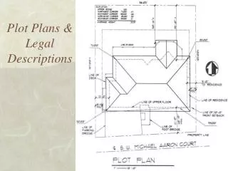
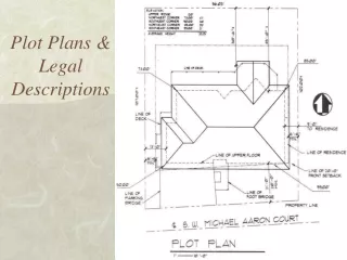
Recorded Plat System • This is for land ready for subdivision into homes and businesses into blocks and lots. • Simplest and most convenient to describe small lots or tracts within a subdivision • Metes and bounds to survey an show the parcel; parcel assigned a lot number, Each block given a block number and the tract given a name or number
Other • Vertical land description; measured in terms of vertical measurements. Used for air rights or subsurface • Topographic maps; contour maps used for land that will be developed and soil to be moved, etc.