Download
1 / 25
320 likes | 1.17k Vues
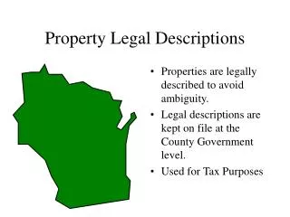
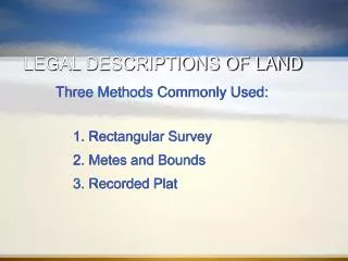
LEGAL DESCRIPTIONS OF LAND. Three Methods Commonly Used: 1. Rectangular Survey 2. Metes and Bounds 3. Recorded Plat. RECTANGULAR SURVEY. Also known as the Government Survey System. Established by a land ordinance in 1785 Used in the first public land survey in 1786 in Ohio.

E N D
LEGAL DESCRIPTIONS OF LAND Three Methods Commonly Used: 1. Rectangular Survey 2. Metes and Bounds 3. Recorded Plat
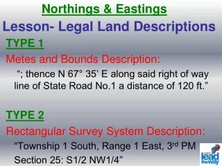
RECTANGULAR SURVEY • Also known as the Government Survey System. • Established by a land ordinance in 1785 • Used in the first public land survey in 1786 in Ohio. • Principal method used for land west of the Ohio and Mississippi rivers and in Florida, Alabama & Mississippi. • East-West lines established for survey are base lines.
… RECTANGULAR SURVEY • North-South lines are called principal meridians. • Each principal meridian has a unique name and is crossed by its own base line.
… RECTANGULAR SURVEY • Rectangular survey system is based on a system of north-south lines which are six miles apart and called range lines and by east-west lines six miles apart called township lines. • Rectangles created by these intersecting lines are called townships (6 mi. X 6 mi.)
METES AND BOUNDS • Metes and bounds system was used in the U.S. prior to the development of the rectangular survey system • Metes and bounds system is based on distances (metes) and bearings (bounds) from succeeding reference points around the perimeter of the real estate.
METES AND BOUNDS • Describes the property using natural and man-made objects as reference points. • Start at the point of beginning (POB) and move through several intermediate reference points before finally returning to POB. • Points are survey reference points and may refer to marked stones, trees, a creek or corner of another property. Modern metes and bounds includes monuments at these points.
…METES AND BOUNDS • The courses that one moves from point to point are identified in degrees, minutes and seconds of an angle from the north or south and typically measured linearly in feet.
…METES AND BOUNDS • Metes and bound system is the primary method of describing real property in 21 states: Connecticut, Delaware, Georgia, Hawaii, Kentucky, Maine, Maryland, Massachusetts, New Hampshire, New Jersey, New York, North Carolina, Pennsylvania, Rhode Island, South Carolina, Tennessee, Texas, Vermont, Virginia, parts of Ohio and Oregon, and the District of Columbia.
…METES AND BOUNDS Example: • “Begin at the middle of a large, white pine stump standing in the west side line of Simon Vender Cook’s land and on the south side of the main road that leads to the new city, and there is also a fence that stands a little to the west of Simon Vender Cook’s barn, which said fence if it were to run cross the said field southerly, would run to the middle of said stump; and running thence north 2 degrees east 19 chains and 50 links to a small white oak tree…” and so on, until one gets to the point of beginning. Source: LAND: The 1958 Yearbook of Agriculture. The U.S. Department of Agriculture. P.206
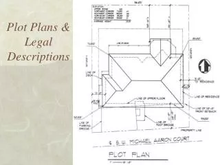
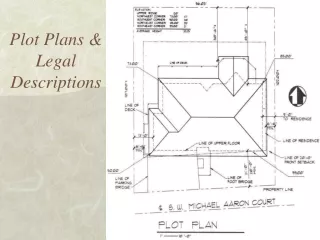
RECORDED PLAT • Also known as lot and block, lot-block-tract, recorded map or recorded survey system • Developed as an outgrowth of the rectangular survey system • Used to simplify the locational descriptions of small parcels • Established when land developers subdivided land and assigned lot numbers to individual sites within blocks • Maps of subdivisions are filed with the local government to establish a public record of their precise locations. Each block identified precisely using a ground survey or established monuments.
… RECORDED PLAT • Each Parcel is assigned a Lot Number -- -- Each Block is assigned a Block Number -- -- The Tract is assigned a name or Number prior to being recorded. • Lot 10 of Woodridge Creek Unit (Block 1), a Subdivision of the Southeast quarter of Section 18 Township 10 North, Range 7 East of the Mt. Diablo Meridian