Download
1 / 44
470 likes | 1.06k Vues
Biogeography: Climate, Biomes, and Terrestrial Biodiversity. G. Tyler Miller’s Living in the Environment 13 th Edition Chapter 6. Key Concepts. Factors influencing weather. Factors influencing climate. Effect of climate on distribution of biomes. Characteristics of major biome types.

E N D
Biogeography: Climate, Biomes, and Terrestrial Biodiversity G. Tyler Miller’s Living in the Environment 13th Edition Chapter 6
Key Concepts • Factors influencing weather • Factors influencing climate • Effect of climate on distribution of biomes • Characteristics of major biome types
Weather and Climate: A Brief Introduction • Weather – current conditions or physical properties in the Troposphere, the lowest level of atmosphere. Include (1) temperature, (2) pressure, (3) humidity, (4) precipitation, (5) sunshine, (6) cloud cover, and (7) wind direction and speed • Front – boundary between two air masses with different temperatures and densities • Warm front – boundary between warm air mass advancing on cold • Cold front – leading edge of advancing cold air mass • High & Low pressure air masses Fig. 6-2 p. 111
Weather and Climate: A Brief Introduction cont. Rising winds exit from the storm at high altitudes. The calm central eye usually is about 24 kilometers (15 miles) wide. Gales circle the eye at speeds of up to 320 kilometers (200 miles) per hour. Moist surface winds spiral in towards the center of the storm • Wind – always blows from high pressure to low pressure regions • Wind - regulates global temperatures, transports nutrients; transports harmful pesticides, toxic metals, viruses, bacteria, fungi (coral reef killer), algae (red tides) • Hurricanes – extreme tropical storms that occur in Atlantic ocean. These storms are called typhoons in the Pacific ocean and cyclones in the Indian ocean.
Tornadoes – occurs when there are violent updrafts and downdrafts.
Climate Fig. 6-6p. 115 • Climate – general weather over long period of time • Average Temperature • Average Precipitation • Regional climates are effected by Global Air Circulation caused by: (1) uneven heating of Earth’s surface, (2) seasonal changes in T & P, (3) rotation of the Earth (coriolis effect), (4) long term variation in solar energy, and (5) Properties of air and water (6) rotation of earth on its axis
Seasons Fig. 6-8 p. 116 • Seasonal variations affected by tilt of Earth’s axis • Long term climate variations affected by wobble of Earth’s axis or precession (22,000 year cycle) and change in tilt ranging from 24.5º to 22.1º every 44,000 years.
Air Circulation – Hadley Cells Fig. 6-9 b & c p. 117 Fig. 6-11 p. 118
Short-Term Climate Changes: ENSO • El Nino-Southern Oscillation: 1) prevailing westerly winds weaken, 2) surface water along N. and S. American coasts becomes warmer, 3) upwellings are suppressed causing sharp decline in some fish species; causes major weather changes that can impact an area for several years, 4) E. to W. currents slow and sometimes reverse to W. to E. Fig. 6-14 p. 119
Figure 6-13Page 119 Upwelling : cold nutrient rich water brought up from deeper parts of ocean to surface Movement of surface water Wind Diving birds Fish Upwelling Zooplankton Phytoplankton Nutrients
Figure 6-15 page 120 El Niño Drought Unusually high rainfall Unusually warm periods
La Nina +3 1982–83 1997–98 El Niño conditions La Niña conditions +2 +1 Temperature/Change (°F) 0 -1 -2 1950 1955 1960 1965 1970 1975 1980 1985 1990 1995 2000 2005 Year • La Nina: cooling counterpart to El Nino; More hurricanes, colder winters in Canada/N.E., warmer/drier winters in S.E and S.W., wetter winters in Pacific N.W., torrential rains in S.E. Asia, lower wheat yields Argentina, more wildfires Florida • . Fig. 6-14 p. 119
Greenhouse Effect • UV converted to infrared radiation IR (heat) and absorbed by H2O, CO2, CH4, N2O, and CFCs; natural effect enhanced by humans. Alters precipitation patterns, shifts crop areas, raises average sea levels, shifts habitats. Fig. 6-17 p. 121
Microclimates created by topographic featuresRain Shadow Effect Fig. 6-19 p. 122
Sea Breeze and Land Breeze • Sea Breeze is the movement of cool air on land to replace the the warm air as it ascends. At daytime • Land Breeze is the movement of cool air from land to sea as the warm air ascends. At nightime.
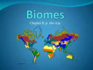
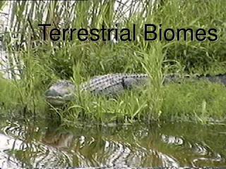
Earth’s Major Biomes Biome A large, relatively distinct terrestrial region with a similar climate soil, plants, and animals, regardless of where it occurs in the world Nine major biomes Location of each biome is primarily determined by: Temperature (varies with both latitude and elevation) Precipitation Biomes can also be defined by Winds, rapid temperature changes, fires, floods, etc.
Biomes: Latitude and Altitude Fig. 6-22 p. 124 Refer to Fig. 6-20 p. 123
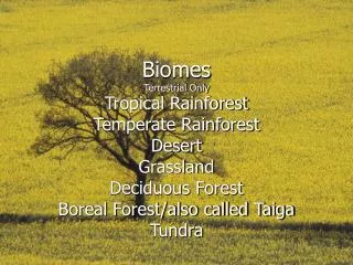
Biomes Earth’s Major Biomes Tundra, Boreal Forests, Temperate Rainforest, Temperate Deciduous Forests, Grasslands, Chaparral, Deserts, Savanna, & Tropical Rainforests Vertical Zonation Aquatic Ecosystems Freshwater ecosystems Estuaries Marine Ecosystems Interaction of Life Zones and Humans
Tundra: Polar Grasslands Treeless biome in the far north with harsh, cold winters and extremely short summers Precipitation 10-25 cm/yr Temperature Short growing season 50-160 days
Tundra Nutrient poor soils with little organic material Permafrost present • Low species richness • Veg is mostly grasses and sedges • Very simple food web • Low primary productivity
Boreal Forests :Taiga A region of coniferous forests in the northern hemisphere Just south of tundra Covers 11% of earth’s land Growing Season A little longer than tundra Precipitation ~ 50 cm/yr
Boreal Forests Soils are acidic and mineral poor Vegetation comprised of drought resistant conifers • White spruce • Balsam fir • Eastern larch • Mostly small animals and migrating birds • Some large animals are present • Wolves, bear, moose
Temperate Rainforest Coniferous biome with cool weather, dense fog and high precipitation Ex: Northwest US Precipitation > 127 cm/yr Heaviest in winter Temperature Winters are mild Summers are cool
Temperate Rainforest Soils are nutrient-poor, but high in organic material (dropped needles) Cool temperatures slow decomposition Dominant Vegetation Large evergreen trees Old-growth forest Variety of cool climate animal life Very high species richness Heavily logged
Temperature Deciduous Forests Forest biome that occurs in temperate areas with a moderate amount of precipitation Precipitation 75-150 cm/yr Temperature Seasonality Hot summers and cold winters
Temperate Deciduous Forest Topsoil is rich in organic material and underlain by clay • Vegetation is primarily deciduous • Oak, maple, beech • Animals • Deer, bear and small animals • Most of this biome land area has been regenerated after farming & timber harvest
Grassland Grasslands with hot summers, cold winters and too little precipitation to support trees Precipitation 25-75 cm/yr Tall grass prairies Short grass prairies 90% of this biome has been lost to farmland
Grassland Soil has thick, organic material rich organic horizon Periodic fires keep the dominant vegetation grasses Animals Once covered with bison- no longer true Smaller animals
Chaparral Also called a Mediterranean Climate Ex: Southern California Ex: Greece Temperature Mild, moist winters Hot, dry summers Frequent fires
Chaparral Soil is thin and often not fertile Vegetation Dense growth of evergreen shrubs Lush during the growing season Animals Mule deer, chipmunks, many species of birds
Savanna Tropical grassland with widely scattered trees Temperature Varies little throughout the year Precipitation Seasons regulated by precipitation, not temperature 76-150 cm/yr
Savanna Soil low in nutrients due to leaching Vegetation Wide expanses of grass Occasional Acacia trees • Have fire adaptive characteristics • Animals • Herds of hoofed animals • Large predators- lions, hyenas, etc.
Figure 6-33Page 134 Conversion of savanna and temperate grassland to cropland Release of CO2 to atmosphere from burning and conversion of grassland to cropland Overgrazing of tropical and temperate grasslands by livestock Human impacts on grasslands
Deserts Biome where lack of precipitation limits plant growth Temperature Can very greatly in 24-hr period, as well as yearly (based on location) Precipitation < 25 cm/yr
Deserts Soils low in nutrients and high in salts Vegetation sparse cactus and sagebrush Animals are very small to regulate temperature
Figure 6-26Page 128 Large desert cities Soil destruction by vehicles and urban development Soil salinization from irrigation Depletion of underground water supplies Land disturbance and pollution from mineral extraction Storage of toxic and radioactive Wastes Large arrays of solar cells and solar collectors used to produce electricity Human impact on Deserts
Tropical Rainforest Lush, species-rich biome that occurs where climate is warm and moist throughout the year Precipitation 200-450 cm/yr Very productive biome Most species-rich biome
Tropical Rainforest Ancient, weathered, nutrient-poor soil Nutrients tied up in vegetation, not soil Vegetation 3 distinct canopy layers Animals Most abundant insect, reptiles and amphibians on earth
Figure 6-41Page Clearing and degradation of tropical forests for agriculture, livestock grazing, and timber harvesting Clearing of temperate deciduous forests in Europe, Asia, and North America for timber, agriculture, and urban development Clearing of evergreen coniferous forests in North America, Finland, Sweden, Canada, Siberia, and Russia Conversion of diverse forests to less biodiverse tree plantations Human impact on forests
Lesson from Geographic Ecology • Climate of an area (determined by temp. and precipitation. Patterns determines the type of biome. The plants and animals in each have evolved adaptations designed to fit the climate