Download
1 / 18
180 likes | 522 Vues
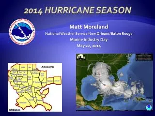
Matt Moreland National Weather Service New Orleans/Baton Rouge Marine Industry Day May 22, 2014. 2014 Hurricane Season. Communicating Risk. Isaac didn’t fit people’s preconceived notions. ?. Communicating Risk. “This is just a CAT 1 hurricane” “It has never flooded here before”

E N D
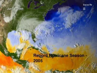
Matt Moreland National Weather Service New Orleans/Baton Rouge Marine Industry Day May 22, 2014 2014 Hurricane Season
Communicating Risk Isaac didn’t fit people’s preconceived notions ?
Communicating Risk • “This is just a CAT 1 hurricane” • “It has never flooded here before” • “I’ve been through Katrina and Gustav, this is nothing” • “I saw the news break into programming, that GFS thing says it won’t come here, phew!” • “This is the same surge forecast as Gustav and I didn’t flood then” • “My app has most of those lines way east of here. I like the one that says CLIPER” • “We are going to evacuate for all CAT1 hurricanes from now on” • “Ah great, I have a GIS map. Finally something accurate” • “We just had our 100 year storm last year”
Saffir-Simpson Scale • Categorizes hurricanes into 5 levels of intensity based on wind speeds alone • Ignores other threats such as wind duration, storm surge, heavy rainfall, river flooding, etc • No such thing as “just a category 1” or “only a tropical storm” • Can give people a dangerous and false sense of safety/security
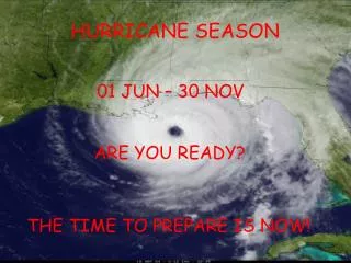
Lead time is great… IF you have it. • National Hurricane Center Provides 5 Day Forecasts. • However, advisories are only issued when weather system has been classified as a tropical depression or storm. • Systems that develop in northwest Caribbean or Gulf may not always allow 5 days of lead time and preparation.
2014 Seasonal Outlook El Nino Conditions Expected El Niño or La Niña Watch: Issued when conditions are favorable for the development of El Niño or La Niña conditions within the next six months. El Nino tends to decrease the number of storms in the Atlantic basin
2014 Seasonal Outlook • NOAA Outlook issued today! • Development of El Nino circulation will be a major factor *CAUTION* It only takes one storm to make a “bad” season
1957: Inactive Season High Impact for FL/LA • Moderate El Niño • Below normal activity • 8 Named Storms • 2 Hurricanes • 1 Major Hurricane • Audrey – Cat 4
1965: Inactive Season High Impact for FL/LA • Strong El Niño • Well below normal activity • 6 Named Storms • 1 Tropical Storm • 5 Hurricanes • Betsy caused significant impacts across FL and LA
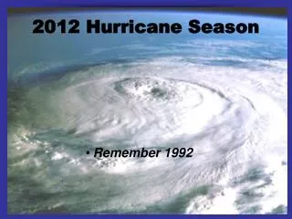
1992: Inactive Season High Impact for FL/LA • Neutral El Niño • Well below normal activity • 7 Named Storms • 3 Tropical Storms • 4 Hurricanes • Andrew caused significant impacts across FL and LA
1997: Inactive Season Moderate Impact for LA/MS • Moderate El Niño • 6* Named Storms • 3 Tropical Storms • 3 Hurricanes • Hurricane Danny: moderate impacts in LA/MS, but heavy rains had significant impact in AL *2 additional named storms were re-classified as non-tropical in post-season analysis
Inundation GraphicsComing this year… • Based on P-Surge output • Developed in concert with social science research • Implementation of experimental inundation graphic will commence this year • Will NOT indicate potential overtopping of levees
You Are NOT Always in the Office • Emergency Response Support Mobile Tool
NWS New Orleans2014 Hurricane Season • One PowerPoint, One Message! • Decisions based on the same sheet of music • Use the briefings in your EOCs and your briefings • Spot Forecasts • Explosions • Leaks, Spills, Collisions • Fires • Security Operations • ***Adding Aviation Soon***
WFO New Orleans Media Deployments Briefings SWERV
Stronger Social Media Presence • Website: www.weather.gov • Twitter: @NWSNewOrleans • Facebook: US National Weather Service New Orleans
NWS New Orleans Contact Info • Website – www.weather.gov/neworleans • Briefings (INTERNAL) http://weather.gov/neworleans/?n=embrief • Telephone – 985-649-0429 x4 504-522-7330 x4 • Ken Graham – Meteorologist-in-Charge • Kenneth.Graham@noaa.gov • Frank Revitte – Warning Coordination Meteorologist • Frank.Revitte@noaa.gov • Matt Moreland – Emergency Response Meteorologist • Matt.Moreland@noaa.gov