Download
1 / 17
170 likes | 195 Vues
Join the UK national programme between NERC and the Hadley Centre for high-resolution modeling of the Earth system. Explore mechanisms of climate variability, nonlinear processes, and coupling of atmospheric and oceanic dynamics for better understanding and simulations.

E N D
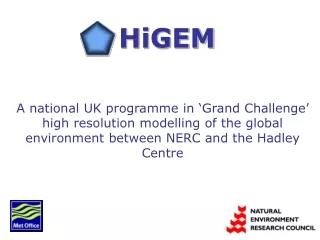
HiGEMA national UK programme in ‘Grand Challenge’ high resolution modelling of the global environment between NERC and the Hadley Centre
HiGEM Goals • Science Aims: • To achieve a major advance in the fidelity of simulations of the Global Environment by developing an Earth System Model with unprecedented resolution, comprehensively evaluated and verified. • To perform a ‘Grand Challenge’ multi-century simulation with the new Earth System Model, HiGEM • To study mechanisms of climate variability and change on timescales of days to centuries • To improve our understanding of non-linear processes that lead to interactions between small and large spatial scales, and between high and low frequencies, within the Earth system.
HiGEM Goals • 2. Strategic Aims: • To integrate the global environment modelling activities across NERC • To support the formation of a national partnership between NERC and the Hadley Centre • To exploit the major increases in computing power afforded by HPCx (UK) and the Earth Simulator (Japan)
HiGEM Timeline • A three year programme (2004-2006) to build on the HadGEM1 model: • Hadley Centre: ~3 atmosphere ~1 ocean • HiGEM 2004: 1 atmosphere 1/3 ocean • HiGEM 2006: 2/3 atmosphere 1/6 ocean
Why a consortium is needed: • Complexity of the Hadley Centre Global Environment Model • No single group has the combined expertise to develop, evaluate and exploit HiGEM • ‘Grand Challenge’ science requires highly coordinated approach
HiGEM Partners • Hadley Centre: Provision of HadGEM1, expert advice on climate modelling • NCAS/CGAM: Atmospheric processes, coordination, HPC expertise • British Antarctic Survey: Polar processes, modelling the cryosphere • Centre for Ecology and Hydrology: Land surface processes and modelling • Environmental Systems Science Centre: Clouds and radiation processes, model evaluation against satellite data • Southampton Oceanography Centre: Ocean processes and modelling, remote sensing • University of East Anglia: Ocean processes and modelling • British Atmospheric Data Centre: Data management
Why a move to higher resolution is necessary: • Non-linear feedbacks in space and time in the climate system • Improvements in parametrisations can only reduce the systematic errors in models so far, some processes need to be explicitly resolved • Organisation and coupling in atmospheric and oceanic processes requires representation of nonlocal interactions (waves need to be adequately resolved) • Local variations in land surface types and orogaphy can have very large impacts on local climate (e.g. precipitation) • Better understanding and quantification of physical processes in models that look more like the real world
Water vapour and window channel radiances from Meteosat-7 Same fields from HadAM3 at climate resolution Complexity in the atmosphere
Better weather systems in a high resolution model Precipitation in HadAM3 with 150km (left) and 300km (right) atmosphere ……and stronger storm tracks High pass (<10 days) 500hPa geopotential height variance
Northern Hemisphere Blocking – based on theta on PV=2 • Blocking frequency increases with horizontal resolution of model Gill Martin (Hadley Centre)
Complexity in the ocean …. and as simulated by OCCAM 10 1/40 1/120 SSTs in the Gulf stream from infrared measurements aboard MODIS
Complexity in the land surface How the Rockies appear in a standard resolution (~400km) model … and in a high resolution (~60km) model. Large variations in vegetation are not resolved but have impacts on local climate
Scales of orography that are credibly resolved • Alps 500 km (~ 2 gridpoints 3 resolution model) • Andes 300 km • Rockies 1200 km Davies and Brown (2001)
Complexity in the cryosphere AVHRR image of the southern Weddell Sea showing coastal polynyas (typically 100km x 20km). Polynyas are sites of intense air-sea interaction and play a major role in production of Antarctic bottom water
Progress Update: • Port of HadGEM1 to HPCx to start very soon • Defining ancillary files to work with 1 atmosphere 1/3 ocean (land/sea mask from GEBCO dataset) • Development and testing of HiGEM model due to start May 2004 to coincide with upgrate to HPCx
General Bathymetry Chart of the Oceans - GEBCO • New 1-minute grid available • Will be used to define 1/3 HiGEM ocean model • Needs careful checking as to representation of islands, straights and sills appropriate for this resolution
HPCx • 40 IBM pSeries 690 Regatta nodes • Each node has 32 POWER4 processors • 1280 processors total • April-June 2004 upgrade to 2X performance with faster switches