Download
1 / 33
330 likes | 371 Vues
Explore how visual literacy through maps can simplify concepts and structure information, aiding in interdisciplinary teaching and enhancing map skills for students. Understand the significance of maps in increasing cultural awareness and knowledge acquisition across subjects. Learn how visual texts break the monotony of traditional learning and engage visual learners effectively.

E N D
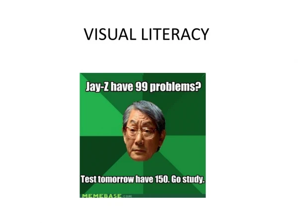
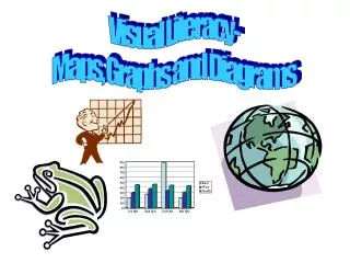
Visual Literacy- Maps, Graphs and Diagrams
"Some pictures do not have obvious actions occurring, yet we understand them to be conveying something about the world. Things such as flow charts, maps or labeled images in an information book are more likely to show a concept or idea rather than actions…" –Jon Callow
Visual Texts • Help to show how facts and details are connected • Tend to simplify and generalize topics • Show Structure in organizing a topic
World Map of the effects of the light pollution on the night sky (infrared scale)
“Images like abstract graphs and diagrams on the one hand, and written text on the other hand, contribute differentially to the construction of meaning” -Lemke WRITTEN TEXT + IMAGE = MEANING
Application to Genres • Recount- using a timeline • Explanation- flow chart • Procedure- symbols/pictures • Narrative- use a diagram • Argument- flow chart • Discussion- table (for/against) • Information Report- concept map Like Written Texts, Visual Texts can be applied to each genre
Why use Visual Texts? • Many people are visual learners • Children generally understand diagrams before the written word, so visual texts are familiar • Breaks the monotony of Traditional Learning
Why Concentrate on Maps? • Gives students an orientation in the world • Increases cultural awareness • Map literacy is important in all other subjects when discussing politics, economics, and history. Thus, maps are great tools for interdisciplinary teaching • Map skills create a base for other skills of knowledge (graphing and diagrams)
Concept Maps help organize our thoughts, schedules and plans
In Large cities, maps for Transportation are just as influential.
Weather watching probably gives Americans more exposure to global maps than anything else.
Vocabulary • Key/Legend • Latitude/Longitude • Scale • Compass/Direction • Equator/Poles
When studying images, what are some things to look for? • COLOR/SYMBOLS • SCALE • ARRANGMENT/PERSPECTIVE
Specifically with MAPS, what do students consistently need to question??? • How was this map produced? • What type of map is this? • Who made the map? • What is the map’s purpose? • Is the map drawn to scale? • Do different colors represent different things? • When was the map created? • How is the map arranged? (Orientation)
Perspective: Prime Meridian Scale: Look at Greenland!!
Perspective: International Date Line Scale: Look at Antarctica!!
Perspective: The Americas Scale: Again… Look at Greenland and Antarctica
Perspective: Magnetic North has been switched to south How would your perspective change if this were how we saw the world in these “New Times”? Where is Antarctica now?
What are these maps suggesting??? Why should we believe it?
Construction and Deconstruction of Global Maps
Round Earth, Flat Maps Activity 1: Give students a tangerine and have them draw a global map on it. Peel the fruit and try to superimpose the drawing onto a flat map surface
Flat Map onto Round Earth Activity 2: Give students a flat global map (one of two types- divided and whole) and have them try to wrap it over a baseball
Which map would be easier to cover a round surface? WHY? What does this tell us about Greenland and Antarctica?