Understanding Atmospheric Forces: Why Wind Blows and the Role of Fronts
430 likes | 555 Vues
This discussion explores the fundamental forces behind wind movements, focusing on pressure gradient forces, Newton's Laws, and the Coriolis effect. It covers the formation of various atmospheric fronts, including warm, cold, stationary, and occluded fronts, along with their implications on weather patterns. By examining geostrophic balance and introducing concepts like frictional forces, the discussion provides insights into upper and lower-level wind dynamics. Practical experiments, such as the Front Collapse Experiment, further illustrate these principles in atmospheric science.

Understanding Atmospheric Forces: Why Wind Blows and the Role of Fronts
E N D
Presentation Transcript
Atmospheric Forces AOS 101 Discussion Sections 302 and 303
Why Does the Wind Blow? • What makes the wind blow? • We need to think about Newton's Laws • 1st Law • An object at rest will remain at rest; an object in motion will remain in motion as long as no force is exerted on the object. • 2nd Law • The total force exerted on an object is equal to the acceleration of the object times its mass
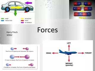
Pressure Gradient Force • Compels fluids to move from high pressure to lower pressure
Coriolis Force • An apparent force • Results from the constant rotation of the Earth • Northern Hemisphere • Acts at a 90°angle to the right of the object in motion (such as the wind) • This means that a wind from the south would have a CF acting toward the east
Missile starts at Dallas, which is at a latitude of 37.28 N, rotates with the Earth at a speed of 465.11 m/s.
Missile travels toward Winnipeg which, at a latitude of 52.00 N, rotates with the Earth at a speed of 286.35 m/s
Geostrophic Balance L 996 mb X 1000 mb 1004 mb H
Geostrophic Balance Pressure Gradient Force L 996 mb 1000 mb 1004 mb H
Geostrophic Balance Pressure Gradient Force L 996 mb 1000 mb Coriolis Force 1004 mb H
Geostrophic Balance Pressure Gradient Force L 996 mb Geostrophic Wind 1000 mb Coriolis Force 1004 mb H
Upper Level Flow PGF CF
Friction Force Friction Wind
Friction Force • This throws the wind out of geostrophic balance • There is now a net force acting on the wind in the direction opposite its motion PGF FR Wind CF
Friction Force • Upper Level Wind • Balance: PGF/ CF • Lower Level Wind • Balance: PGF/ CF/ Friction • Friction causes wind to cross isobars at ~30°angle at surface
Atmospheric Fronts AOS 101 Discussion Sections 302 and 303
Warm Front • Drawn as a red line with red semi-circles pointing in the direction of the front’s movement
Cold Front • Drawn as a blue line with blue triangles pointing in the direction of the front’s movement
Stationary Front • Stalled • No movement of the temperature gradient • Convergence of wind • Drawn as alternating segments of red semicircles (warm front) and blue triangles (cold front) in opposite directions
Occluded Front • A region where a faster moving cold front has caught up to a slower moving warm front. • Generally occurs near the end of the life of a cyclone • Drawn with a purple line with alternating semicircles and triangles
Cold Occlusion • The type most associated with mid-latitude cyclones • Cold front "lifts" the warm front up and over the very cold air • Associated weather is similar to a warm front as the occluded front approaches • Once the front has passed, the associated weather is similar to a cold front • Vertical structure is often difficult to observe
Warm Occlusion • Cold air behind cold front is not dense enough to lift cold air ahead of warm front • Cold front rides up and over the warm front • Upper-level cold front reached station before surface warm occlusion
Identifying Fronts We know that we need to look for low pressure and a boundary of cold and warm air. To pinpoint the parts of our cyclone, look for specifics in the observation maps • Find the center of cyclonic rotation • Find the large temperature gradients • Identify regions of wind shifts • Identify the type of temperature advection • Look for kinks in the isobars