Lovejoy Wharf Condos
1.32k likes | 1.38k Vues
In 2012 Lovejoy Wharf was somewhat still an idea and this report was presented. http://www.lovejoywharf.net/

Lovejoy Wharf Condos
E N D
Presentation Transcript
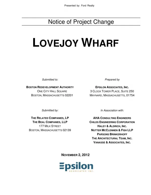
Presented by: Ford Realty Notice of Project Change LOVEJOY WHARF Prepared by Submitted to: BOSTON REDEVELOPMENT AUTHORITY ONE CITY HALL SQUARE BOSTON,MASSACHUSETTS 02201 Submitted by: THE RELATED COMPANIES,LP THE BEAL COMPANIES,LLP 177MILK STREET BOSTON,MASSACHUSETTS 02139 EPSILON ASSOCIATES,INC. 3CLOCK TOWER PLACE,SUITE 250 MAYNARD,MASSACHUSETTS,01754 In Association with: AHACONSULTING ENGINEERS CHILDS ENGINEERING CORPORATION HALEY &ALDRICH,INC. NUTTER MCCLENNEN &FISH LLP PARSONS BRINKERHOFF THE ARCHITECTURAL TEAM,INC. VANASSE &ASSOCIATES,INC. NOVEMBER 2,2012
Table of Contents Table of Contents
Table of Contents Table of Contents 1.0 1.0 1-1 1-1 1-1 1-2 1-4 1-5 GENERAL INFORMATION AND PROJECT DESCRIPTION GENERAL INFORMATION AND PROJECT DESCRIPTION 1.1 Introduction 1.2 Project Team 1.3 Project History 1.4 Project Description 1.4.1 1.4.2 1.4.3 Public Benefits Legal Information 1-5 1-6 1-6 1-6 1-8 Project Site Site Context Updates to Previously Approved Project 1.5 1.6 1.6.1 1.6.2 1.6.3 1.6.4 Regulatory Controls and Permits Schedule Public Communication 1-8 1-8 1-8 1-8 1-9 1-9 1-9 Legal Judgments or Actions Pending Concerning the Project History of Tax Arrears on the Property Related Site Control / Legal Easements Zoning 1.7 1.8 1.9 2.0 2.0 2-1 2-1 2-1 2-1 2-2 TRANSPORTATION TRANSPORTATION 2.1 Introduction 2.2 Summary 2.3 Conclusion 3.0 3.0 3-1 3-1 3-1 3-1 3-1 3-2 3-2 3-3 DEVELOPMENT REVIEW COMPONENT DEVELOPMENT REVIEW COMPONENT 3.1 Introduction 3.2 Wind 3.3 Shadow 3.4 Daylight 3.5 Solar Glare 3.6 Air Quality 3.6.1 3.6.2 3-3 3-3 3-4 3-5 3-5 3-9 3-9 3-9 Introduction Microscale Analysis 3.6.2.1 3.6.2.2 3.6.2.3 3.6.2.4 3.6.2.5 Microscale Analysis Results Intersection Selection Emissions Calculations (MOBILE6.2) Receptors and Meteorology Inputs Impact Calculations (CAL3QHC) Background Concentrations 3.6.3 Table of Contents (continued) Table of Contents (continued) 3487/Lovejoy Wharf/NPC i Table of Contents Epsilon Associates, Inc.
3.6.4 Water Quality/Stormwater Flood Hazard Zones/Wetlands 3-10 3-12 3-13 Conclusions 3.7 3.8 3.8.1 3.8.2 Groundwater/Geotechnical 3-13 3-13 3-13 FEMA Flood Hazard Zones Wetland Resources 3.9 3.9.1 3.9.2 3.9.3 Solid and Hazardous Wastes 3-14 3-14 3-14 3-15 Groundwater Geotechnical Geotechnical and Groundwater Impacts 3.10 3.10.1 3.10.2 3.10.3 3.10.4 3-15 3-16 Solid Waste Generation During Operation Recycling During Operation Hazardous Materials - Compliance with Massachusetts Contingency Plan3-16 Potential Demolition Impacts 3.10.4.1Recycling During Construction 3-17 3-18 3-18 3-18 3-19 3-19 3-19 3-21 3.11 3.12 3.13 3.14 3.15 3.16 Noise Construction Impacts Tidelands – Chapter 91/Municipal Harbor Plan Sustainability Urban Design Historic and Archaeological Resources 3.16.1 3-21 3-21 3-21 3-22 3-22 3-22 Status of Review with Historical Agencies 3.16.1.1Section 106 Review 3.16.1.2State Register Review 3.16.1.3Article 85 of the Boston Zoning Code Impacts to Historic Resources Infrastructure 3.16.2 3.17 3.17.1 3.17.2 3.17.3 3-23 3-23 3-23 3-23 3-23 Sanitary Sewer System Water Supply System Stormwater Management 3.17.3.1Existing Conditions 3.17.3.2Proposed Conditions 3487/Lovejoy Wharf/NPC ii Table of Contents Epsilon Associates, Inc.
List of Attachments List of Attachments Attachment A Survey Attachment B Transportation Attachment C Air Quality Attachment D Noise Attachment E Sustainability and LEED Checklists Attachment E Sustainability and LEED Checklists Attachment A Survey Attachment B Transportation Attachment C Air Quality Attachment D Noise List of Figures List of Figures Figure 1-1 Figure 1-2 Figure 3-1 1-10 1-11 Aerial Locus Map Lovejoy Wharf North Elevation Link and Receptor Locations for CAL3QHC modeling of Intersection 1: the intersection of Causeway Street, Commercial Street, and North Washington Street Link and Receptor Locations for CAL3QHC modeling of Intersection 2: the intersection of Causeway Street, Merrimac Street, Staniford Street and Lomasney Way Link and Receptor Locations for CAL3QHC modeling of Intersection 3: the intersection of Causeway Street, Haverhill Street and Legends Way 3-6 Figure 3-2 3-7 Figure 3-3 3-8 List of Tables List of Tables Table 3-1 Table 3-2 Table 3-3 Table 3-4 Observed Ambient Air Quality Concentrations and Selected Background Levels 3-10 Summary of Microscale Modeling Analysis (No-Build 2017) Summary of Microscale Modeling Analysis (Build 2017) Solid Waste Generation 3-11 3-12 3-15 3487/Lovejoy Wharf/NPC iii Table of Contents Epsilon Associates, Inc.
Section 1.0 Section 1.0 General Information and Project Description
1.0 1.0 GENERAL INFORMATION AND PROJECT DESCRIPTION GENERAL INFORMATION AND PROJECT DESCRIPTION 1.1 1.1 Introduction Introduction The Beal Companies LLP and The Related Companies LP (“the Proponent”), as authorized agent of North Washington Wharf LLC and Beverly Wharf, LLC (together, “the Owner”), are pleased to submit this Notice of Project Change (NPC) for the Lovejoy Wharf Project (the “Project”), a project previously approved by the Boston Redevelopment Authority (“BRA”) in December 2006, but the commencement of construction of which was delayed due to several external factors. The Proponent is committed to proceeding with the Project in a manner which is consistent with that which was originally approved, and which includes the many public benefits and amenities contemplated for the Project. This filing is being made in accordance with the provisions of Section 80A-6 of the Boston Zoning Code (“the Code”) due to the fact that there have been more than three years since the issuance of the adequacy determination and commencement of construction, and in an effort to update the BRA and interested stakeholders as to the Project’s status. As before, this Project will play a central role in rejuvenating Lovejoy Wharf and making it a vibrant waterfront center reflective of both its history and its distinguished location within the City of Boston. The primary modification to the Project relates to the fact that the floors of the 160 North Washington Street Building originally approved for residential purposes are now anticipated to be used for office purposes. The residential use of the 131 Beverly Street Building remains as originally approved. Additional proposed modifications of the originally approved Project are limited to specific design changes of a scale typically associated with final design and engineering review. There are no changes proposed to the building footprint for either the existing 160 North Washington Street Building or the originally approved 131 Beverly Street Building, and there is no proposed change in height. The Project is a mixed-use redevelopment project for the long under-utilized 2.1-acre Lovejoy Wharf waterfront parcel (see Figure 1-1 at the end of this chapter). The Project includes the rehabilitation of the existing 160 North Washington Street Building, the demolition and replacement of the 131 Beverley Street Building, the reconstruction of the site wharf and the construction of a two-level Pavilion building linking North Washington Street to the wharf below. An elevation drawing of the Project buildings is presented in Figure 1-2. The ground floors of the two buildings will continue to be primarily devoted to a mix of Facilities of Public Accommodation (FPAs), including retail, special public destination facility space, and restaurant uses. Consistent with the original approval, the Project includes the replacement of the existing wharf and the provision of approximately three-quarters of an acre of publicly-accessible waterfront open space, including an extension of the City of Boston Harborwalk along the water’s edge of the parcel. Constructed in 1909, the wharf has never been open for public use, is in significant disrepair, and remains closed to the public except for limited surface parking. The Project will transform this dilapidated wharf into a fully restored, fully- 3487/Lovejoy Wharf/NPC 1-1 General Information and Project Description Epsilon Associates, Inc.
activated, landscaped open space at the water’s edge complete with seasonal market activities, retail vendors, seating, dining, performance space, temporary recreational boat dockage, and public water transportation facilities. Finally, as per the original approval, the Project provides connections between the North Washington Street grade and the wharf level located a story below by way of a new two- story Pavilion structure connected to the North Washington Street Bridge and the 160 North Washington Street Building. This unique structure will include a public terrace overlooking the water and out to the Leonard P. Zakim Bunker Hill Bridge, FPA space on both levels, and both a public staircase and a public elevator connecting North Washington Street to the revitalized wharf below. Project construction, including the wharf reconstruction and construction of the Pavilion, is expected to commence in 2013 and be completed within 36 months. Upon review of the information set forth herein, the Proponent respectfully requests that the BRA determine that there is no change or other material factors resulting in the need for additional review of the Project. 1.2 1.2 Project Team Project Team Proponent: The Related Companies, LP 60 Columbus Circle, 19th Floor New York, NY 10023 Jennifer A. McCool The Beal Companies, LLP 177 Milk Street Boston, MA 02109-3410 (617) 451-2100 Peter A. Spellios Architect: The Architectural Team, Inc. 50 Commandant’s Way at Admiral’s Hill Chelsea, MA 02150 (617) 889-4402 Jay Szymanski Tom Schultz Legal Counsel: Nutter McClennen & Fish LLP Seaport West 155 Seaport Boulevard Boston, MA 02210-2604 (617) 406-6000 Mary T. Marshall Colin C. Macdonald 3487/Lovejoy Wharf/NPC 1-2 General Information and Project Description Epsilon Associates, Inc.
Permitting and Historic Resource Consultants: Epsilon Associates, Inc. 3 Clock Tower Place, Suite 250 Maynard, MA 01754 (978) 897-7100 Andrew Magee Geoff Starsiak Taya Dixon Transportation and Parking Consultant: Vanasse and Associates 10 N.E. Business Center Drive Andover, MA 01810-1066 (978) 474-8800 Giles Ham Shaun P. Kelly Civil Engineer: Parsons Brinckerhoff 75 Arlington Street, 9th Floor Boston, MA 02116 (617) 338-0063 Andy Boyd MEP Engineer: AHA Consulting Engineers 24 Hartwell Avenue, Third Floor Lexington, MA 02421 781-372-3000 Daniel A. Campia Geotechnical Consultant: Haley & Aldrich 465 Medford Street, Suite 2200 Boston, MA 02129 (617) 886-7400 Eliot Steinberg Mark Haley Marine Engineers: Childs Engineering Corporation 34 William Way Bellingham, MA 02109 508-966-9092 David L. Porter Suffolk Construction 65 Allerton Street Boston, MA 02119 (617) 445-3500 Jim Grossman Construction Consultant: 3487/Lovejoy Wharf/NPC 1-3 General Information and Project Description Epsilon Associates, Inc.
Communications and Community Outreach McDermott Ventures 30 Rowes Wharf Boston, MA 02110 (617) 557-9190 Pamela McDermott Carolyn Spicer 1.3 1.3 Project History Project History The Project represents a significant opportunity to restore the dilapidated Lovejoy Wharf and to rehabilitate and renew the buildings fronting the wharf at this gateway Boston waterfront location. In The Beal Companies LLP / The Related Companies LP team the Project has a strong sponsor dedicated to carrying the Project forward to completion in a timely manner. As summarized below and discussed throughout this document, the Project has undergone extensive public and City, State, and Federal review through both regulatory and planning processes. The Project was originally presented for public review in December of 2004 through the submittal of a joint Project Notification Form/Environmental Notification Form to the Boston Redevelopment Authority (BRA) and the Massachusetts Executive Office of Environmental Affairs (now Energy and Environmental Affairs) – Massachusetts Environmental Policy Act (MEPA) office, respectively. These initial submittals were followed by the preparation and submittal of Draft and Final Project Impact Reports (PIRs) to the BRA, and Draft and Final Environmental Impact Reports (EIRs) to MEPA. In recognition of the Project’s compliance with local zoning and local planning initiatives, the BRA Board voted on or about November of 2006 to authorize the issuance of an Adequacy Determination for the Final PIR for the Project and an Adequacy Determination was issued on January 12, 2007. Similarly, on December 1, 2006 the Secretary of Environmental Affairs issued a Certificate on the Final EIR finding that it complied with MEPA and its implementing regulations. In addition to the above City and State planning and environmental reviews, the Project and Project site were the subject of an Amendment to the Boston Municipal Harbor Plan (MHP, or “the Harborpark Plan”) issued by the Secretary of Environmental Affairs on October 12, 2006. Consistent with other approved MHP Amendments proximate to the Project site, including the adjacent development at 226-234 Causeway Street, the MHP Amendment for Lovejoy Wharf was approved in recognition of the Project site’s unique existing conditions and significant potential for enhancing the City of Boston waterfront. The Secretary’s decision found the MHP Amendment request for Lovejoy Wharf was adequate and adopted certain substitute conditions and off-setting amenities provided by the Project. The subsequent Final EIR and Chapter 91 License application included thorough analyses demonstrating the Project’s consistency with the Lovejoy Wharf MHP Amendment. 3487/Lovejoy Wharf/NPC 1-4 General Information and Project Description Epsilon Associates, Inc.
Finally, the Project has also proceeded through several major permitting processes, including Chapter 91 review through the issuance of a Written Determination (a draft License), the co-signing of a Memorandum of Agreement with Massachusetts Historical Commission, the Massachusetts Department of Environmental Protection (MassDEP), and the Boston Landmarks Commission, the issuance of an Order of Conditions from the Boston Conservation Commission and subsequent Superseding Order of Conditions from MassDEP, and US Army Corps of Engineers Section 404/Section 10 permitting. 1.4 1.4 Project Description Project Description The following section summarizes the Project as currently configured, which is consistent with the existing approval. Modifications to the use and contemplated design refinements are reviewed in Section 1.5 and are primarily associated with use of the 160 North Washington Street Building and are consistent with those typically associated with final design and engineering review. Most significantly, the Project retains its commitments to the overall program and the extensive public benefits described in the original filings for the Project. 1.4.1 1.4.1 Project Site Project Site The Project site is an approximately 2.1 acre (91,390 square-foot) waterfront parcel that includes two adjoining buildings and a wharf structure currently in need of extensive repair and/or replacement. The site is generally bounded by North Washington Street to the east, Lovejoy Place to the south, Beverly Street to the west, and by the Boston Inner Harbor to the north. The location of the site is shown in Figure 1-1. A recent survey of the Project site is included in Attachment A. The existing nine-story building at 160 North Washington Street was historically used for a variety of office and other commercial and industrial uses, but is no longer actively occupied or used, while the nine-story building at 131 Beverly Street is dilapidated and abandoned. In consideration of its condition and public safety, the 131 Beverly Street Building is scheduled for demolition in early 2013. Approximately one-third of the existing wharf structure was until recently used for surface parking (along Beverly Street), while the remainder (towards North Washington Street) is deteriorated, fenced off, and unsafe for use. The site also includes a portion of Lovejoy Place to the centerline, which represents approximately 9,508 square feet of the Project site. Lovejoy Place is a private way not open for public travel. 3487/Lovejoy Wharf/NPC 1-5 General Information and Project Description Epsilon Associates, Inc.
1.4.2 1.4.2 Site Context Site Context The Project site is located within an area of the City of Boston that has experienced significant public and private investment and redevelopment. With its gateway location on the Boston waterfront the Project is an integral part of these on-going improvements. To the east of the Project site is the North End, with a mix of offices, residences, retail, and other uses. To the south is the Bulfinch Triangle with older buildings, new developments, and approved developments on the parcels left vacant by the depression of the central artery by the Central Artery/Tunnel (CA/T) project and the removal of the elevated MBTA Green Line along Causeway Street. To the west is the TD Garden, around which several projects have been completed, are under construction or proposed, and North Station. 1.4.3 1.4.3 Updates to Previously Approved Project Updates to Previously Approved Project As described in the Final PIR, the Project is an approximately 448,000 square-foot mixed- use redevelopment project designed to revitalize this long under-utilized 2.1-acre waterfront site. The Project includes the construction of a new residential building at 131 Beverly Street and the rehabilitation of the 160 North Washington Street Building. The primary modification to the Project relates to the fact that the floors originally approved for residential use in the 160 North Washington Street Building are now anticipated to be used for office purposes. The residential use of the 131 Beverly Street Building remains as originally approved. Additional proposed modifications of the originally approved Project are limited to specific design changes of a scale typically associated with final design and engineering review. There are no changes proposed to the building footprint for either the existing 160 North Washington Street Building or the originally approved 131 Beverly Street Building, and there is no proposed change in height. All of the waterfront public amenities associated with the Project will be carried forward with the Project’s implementation. These waterfront amenities are described in detail in the approved Final PIR, the City of Boston MHP Amendment for Lovejoy Wharf, and the Chapter 91 Written Determination for the Project, and are noted in Section 1.5. 1.5 1.5 Public Benefits Public Benefits The Project offers the opportunity to revitalize a critical block on the Boston waterfront by preserving and substantially rehabilitating the historic 160 North Washington Street Building and providing a new complementary adjoining structure in place of the unsalvageable 131 Beverly Street Building. The benefits of this Project were described in detail in the Final PIR for the Project and all of those benefits will be carried forward with the Project’s implementation. The Proponent is excited to be able to move forward with this long delayed Project, and to be able to provide the many benefits of the Project. Among the many benefits described previously, the Project will: 3487/Lovejoy Wharf/NPC 1-6 General Information and Project Description Epsilon Associates, Inc.
Preserve and rehabilitate the 160 North Washington Street Building. Entirely replace and landscape the existing dilapidated wharf, providing approximately three-quarters of an acre of landscaped waterfront open space available to the public for formal and informal gatherings, seasonal markets/vending carts, events, public displays of music, art, and dance, and other events designed to enliven the waterfront. Create a pedestrian stair at the eastern side of the site along the Charlestown Bridge at the 160 North Washington Street Building that will connect the Bridge sidewalk to the wharf and Harborwalk below. An internal, prominently located and accessible elevator between the sidewalk and wharf levels will also be provided within the associated Pavilion structure. Create a new 12-foot wide Harborwalk connection along the entire length of the Project site’s waterfront. The Harborwalk will be constructed at the elevation of the CA/T-constructed Harborwalk section passing under the North Washington Street/ Charlestown Bridge. Create an approximately 250-foot long floating dock at the edge of the wharf for touch-and-go dockage, on-call water taxi services, and other temporary boat docking. Provide a water transportation subsidy of approximately $794,000 as in-kind support for water transportation and operating subsidy for water transportation services. Provide approximately 100 residential units so as to contribute to the transformation of the neighborhood into a vibrant 24 hour mixed-use community. Pull back the 131 Beverly Street Building from Beverly Street, a significant architectural gesture that will improve pedestrian and visual access to the water. This corner of the site, which is now narrow, will thus be opened up at the pedestrian level and will become an easily accessible avenue from Causeway Street to the Boston waterfront. Provide 2,000 square feet of rent-free building space for use as a Visitor Center by a non-profit organization. Meet the requirements of the Mayor’s Executive Order addressing the provision of affordable housing. Provide a Development Impact Project contribution to the Neighborhood Housing Trust and Neighborhood Jobs Trust. 3487/Lovejoy Wharf/NPC 1-7 General Information and Project Description Epsilon Associates, Inc.
Prepare and implement a Transportation Demand Management program for the site targeted at reducing automobile dependency and encouraging transportation by other modes. Provide approximately 300 to 350 construction jobs. 1.6 1.6 Legal Information Legal Information 1.6.1 1.6.1 Legal Judgments or Actions Pending Concerning the Project Legal Judgments or Actions Pending Concerning the Project The Proponent is not aware of any legal judgments in effect or actions pending with respect to the Project. 1.6.2 1.6.2 History of Tax Arrears on the Property Related History of Tax Arrears on the Property Related A review of the records of the City’s Assessing Department and of the record title to the property has not revealed any evidence of taxes due and owing with respect to the Project. The Proponent does not have a history of tax arrears on any property it owns within the City of Boston. 1.6.3 1.6.3 Site Control / Legal Easements Site Control / Legal Easements The Project site consists of the site shown on a survey entitled “ALTA/ACSM Land Title Survey 160 North Washington Street and 131 Beverly Street Boston, Mass.” dated August 20, 2012, prepared by Otte & Dwyer, Inc. (“the Survey”). A copy of this survey is provided in Attachment A. North Washington Wharf LLC holds title to the land identified as “Lot C” on the survey, and Beverly Wharf LLC holds title to the land identified as “Remainder of Lot D” on the survey. The metes and bounds description of the Project site are provided on the survey. The Proponent has examined title to the Project, including easements on the site, and there are no easements or rights of others which would affect or otherwise preclude development and use of the Project. The Project site is owned by the Owner as defined above, but will be acquired by the Proponent prior to the commencement of construction of the Project. 1.6.4 1.6.4 Zoning Zoning The Project site is located in its entirety within the General Area Subdistrict the North Station Economic Development Area (“North Station EDA”), as shown on Map 1B of the Boston Zoning Maps, and within the Restricted Parking Overlay District. Development and use of Property within the North Station EDA is governed by the provisions of Article 39 of the Boston Zoning Code. The relevant use and dimensional requirements are summarized as follows: Uses: Multifamily residential, office, retail and restaurant uses are allowed. 3487/Lovejoy Wharf/NPC 1-8 General Information and Project Description Epsilon Associates, Inc.
Parking: Parking is allowed as-of-right only if accessory to a residential use, and not for retail and restaurant uses. Accessory parking uses (such as for restaurant or retail uses) or non-accessory parking (such as parking for the general public) can be provided as a conditional use under Article 6 of the Code. The Project has obtained conditional use permits which continue to be in effect. Dimensions: An as-of-right height of 125 feet is allowed, and a maximum as-of-right height of 155 feet is allowed for projects that undergo Article 80B Large Project Review. The maximum floor-area-ratio (FAR) is 8.0 as-of-right, with 10.0 as-of-right if the project is reviewed under Article 80B Large Project Review. The Project will comply with all existing zoning requirements with the benefit of Large Project Review in accordance with Article 80B, and relief from the Board of Appeal. If any zoning non-conformity is identified in the future, the Proponent will seek relief from the BRA, Boston Zoning Board of Appeal or Boston Zoning Commission, as appropriate. 1.7 1.7 Regulatory Controls and Permits Regulatory Controls and Permits As identified in the filings leading to the Project’s approval, the Project is subject to a number of local, state and federal ordinances. The Project’s status as regards BRA Article 80B, MEPA, Chapter 91, the MHP Amendment, and the Wetlands Protection Act are summarized In Section 1.3. No new permits or approvals are anticipated. 1.8 1.8 Schedule Schedule It is anticipated that demolition of the 131 Beverly Street Building will commence in January of 2013. It is anticipated that the construction will commence in early 2013. Once begun, construction is expected to last approximately 36 months. 1.9 1.9 Public Communication Public Communication The Proponent is committed to effective community outreach and will continue to engage the community to insure public input on the Project. The Proponent will continue to undertake community outreach in connection with the Project, including working with the Impact Advisory Group for the Project. 3487/Lovejoy Wharf/NPC 1-9 General Information and Project Description Epsilon Associates, Inc.
G:\Projects2\MA\Boston\3487\aerial.mxd MAURICE TOBIN BRIDGE MAURICE TOBIN BRIDGE 0 75 150 300 CONSTITUTION ROAD Scale 1:3,600 1 inch = 300 feet Feet Basemap: 2008 Orthophotography, MassGIS NORTH WASHINGTON STREET 93 1 CHARTER STREET Project Site JOHN F FITZGERALD EXPRESSWAY SNOWHILL STREET 3 3A COMMERCIAL STREET BEVERLY STREET HULL STREET LOVEJOY PLACE LEVERETT CIRCLE CONNECTOR SHEAFE STREET CLEVELAND PLACE MEDFORD STREET ENDICOTT COURT CAUSEWAY STREET PRINCE STREET THACHER COURT NORTH STATION MBTA BUS ACCESS LOMBARD PLACE HAVERHILL STREET THACHER STREET ENDICOTT STREET CANAL STREET LYNN STREET NOYES PLACE NORTH MARGIN STREET FRIEND STREET PORTLAND STREET COOPER STREET CROSS STREET LANCASTER STREET BARTLETT PLACE ANTHONY RIP VALENTI WAY WIGET STREET STILLMAN STREET MERRIMAC STREET MORTON STREET October 25, 2012 Aerial Locus Map Figure 1-1 Lovejoy Wharf
Lovejoy Wharf North Elevation Lovejoy Wharf Figure 1-2
Section 2.0 Section 2.0 Transportation
2.0 2.0 TRANSPORTATION TRANSPORTATION 2.1 2.1 Introduction Introduction In connection with the prior Final PIR filing and 2006 approvals for the Lovejoy Wharf Project, a transportation study was submitted and approved by the BRA (the “Approved Transportation Analysis”). In connection with this NPC filing, the Approved Transportation Analysis has been updated to address the impacts on the transportation system associated with Project as modified herein. Specifically, the Approved Transportation Analysis has been updated to address the use of the existing building at 160 North Washington Street for approximately 187,187 square feet of office space (the “Office Use”), and 20,543 square feet of commercial space, including restaurant space that would accommodate 300 seats. A copy of the updated Approved Transportation Analysis is included as Attachment B and summarized below. As described therein, the redevelopment program for the 131 Beverly Street property remains substantially unchanged since the Approved Traffic Analysis. 2.2 2.2 Summary Summary The updated traffic analysis presented in Attachment B was performed in accordance with the Executive Office of Energy and Environmental Affairs/Executive Office of Transportation (EEA/EOT) guidelines for the preparation of Traffic Impact Assessments (TIAs), and the Boston Redevelopment Authority requirements for the preparation of this filing. The scope of this transportation analysis was determined during meetings with Boston Transportation Department (BTD) officials. The summary findings are as follows: ♦The Project as modified by this filing does not result in a significant change in vehicular traffic operations (motorist delays or queuing) at the study area intersections over No-Build conditions. ♦The Project as modified is projected to result in minimal increases to area transit ridership as compared to No-Build conditions, and is not anticipated to result in a significant impact on transit capacity in the area. ♦The Project as modified is not projected to result in a significant increase to pedestrian activity over No-Build conditions, and is not expected to result in a notable impact to pedestrian traffic within the study area. ♦Parking for the Project will be provided on-site, with a total of 315 parking spaces provided, including a proposed parking garage at 131 Beverly Street. ♦Loading activities for the Project will occur as previously approved in designated off-street areas via Lovejoy Place and Beverly Street. 3487/Lovejoy Wharf/NPC 2-1 Transportation Vanasse and Associates
♦The Proponent is committed to developing and implementing a comprehensive transportation demand management (TDM) program to reduce automobile dependency and encourage travel by non-automobile modes. ♦The Proponent and general contractor will develop a comprehensive construction management plan to ensure safety and minimize the impact of construction activities on pedestrian and vehicular traffic. 2.3 2.3 Conclusion Conclusion The Project is uniquely designed and situated to take advantage of the existing and expanding transportation infrastructure in the North Station area, including enhanced and improved access to the regional roadway network, proximate public transportation access, and pedestrian facility improvements. It is expected that the availability of public transportation services in the vicinity of the Project site coupled with the implementation of a comprehensive TDM program as a part of the Project will minimize the potential traffic impacts associated with the Project. Finally, the Project Proponent will be required to formalize the commitments to Project mitigation with the City of Boston via a Transportation Access Plan Agreement (TAPA) to be entered into by the Proponent (or its affiliates) and the Boston Transportation Department. 3487/Lovejoy Wharf/NPC 2-2 Transportation Vanasse and Associates
Section 3.0 Section 3.0 Development Review Component
3.0 3.0 DEVELOPMENT REVIEW COMPONENT DEVELOPMENT REVIEW COMPONENT 3.1 3.1 Introduction Introduction As discussed in Section 1.0, the Lovejoy Wharf Project includes updates related to use - specifically, a change from residential to office space in the 160 North Washington Street building - and certain design refinements. As noted in Section 1.0, the Project and its impacts were previously reviewed and approved through the filings of a joint PNF/ENF, a Draft PIR and a Final PIR/Draft EIR. As described in this section the findings presented in those filings relating to development review remain valid for the Project as modified by this filing. 3.2 3.2 Wind Wind A qualitative assessment of Pedestrian-Level Winds (PLWs) was presented in the Final PIR that evaluated the effects of the proposed Project, a No Build Alternative (the existing condition), and a Chapter 91 Alternative on PLWs at 48 locations on and near the site. The results of the assessment were that none of the 48 locations were estimated to have PLWs that exceed the BRA guideline wind speed of 31 miles per hour (mph) more often than once in 100 hours for all three scenarios. All 48 locations were estimated to be a Category 3 (Comfortable for Walking) or better. On an annual basis, only six of the 48 locations were estimated to change category between the existing and proposed build conditions, and three of those represented improvements in wind conditions. The Project as modified by this filing does not change the footprint of the existing 160 North Washington Street Building or the originally approved 131 Beverly Street Building. Additionally, the top floors will continue to be set back from the main facades. In light of the foregoing, the impact on PLWs is anticipated to be similar to that which was described in the Final PIR. 3.3 3.3 Shadow Shadow An analysis of existing and future shadow conditions was conducted in accordance with the BRA Scoping Determination and presented in the Final PIR. The shadow study included an analysis of impacts to the area surrounding Lovejoy Wharf, including on-site and nearby open spaces. Results of the analysis indicated that the Project will not generate significant impacts to the surrounding area due to the fact that the site is currently fully developed and the approved Project represents only a minor increase in height. As mentioned above, the Project as modified herein does not change the footprint of the existing 160 North Washington Street Building or the originally approved 131 Beverly Street Building, does not extend the existing façades of the North Washington Street Building higher than the existing building, and the top floors of the North Washington Street 3487 Lovejoy Wharf 3-1 Development Review Component Epsilon Associates, Inc.
Building will continue to be set back from the main facades. In light of the foregoing, the shadow impact from the Project is anticipated to be similar to that which was described in the Final PIR and to the existing condition. 3.4 3.4 Daylight Daylight The purpose of the daylight analysis is to estimate the extent to which a proposed project affects the amount of daylight reaching the streets and pedestrian ways in the immediate vicinity of the project site. As required by the BRA Scoping Determination for the Final PIR, the daylight analysis for the Project considered the daylight obstruction values for the existing condition (a No Build Alternative), the proposed condition (the Project), and an as- of-right zoning condition (maximum height of 155 feet with no setbacks). The analysis also looked at the existing daylight conditions in the surrounding area. The results of the daylight analysis conducted for the Project using the BRADA program indicated that the Project is generally consistent with both existing conditions at the Project site and daylight conditions in the surrounding area. Further, the results indicate that for seven of the eight viewpoints of the site the proposed Project results in lower daylight obstruction values than the as-of-right building condition. As mentioned above, the Project as modified herein does not change the footprint of the existing 160 North Washington Street Building or the originally approved 131 Beverly Street Building, does not extend the existing façades of the North Washington Street Building higher than the existing building, and the top floors of the North Washington Street Building will continue to be set back from the main facades. In light of the foregoing, the daylight obstruction is anticipated to be similar to that which was described in the Final PIR and to the existing condition. 3.5 3.5 Solar Glare Solar Glare An analysis of the potential for reflective glare from the Project’s building facades was presented in the Final PIR for the Project. The analysis presented in the Final PIR was deemed conservative as it assumed the exterior skin of the Project buildings would be smooth, specular and 100 percent reflective glass. In reality, the exterior will be composed of varying materials (i.e., metal and glass), with approximately 72 percent of the façade glazed, and of a Low-E glass with a reflectivity that is less than 40 percent, substantially less than the 100 percent assumed in the analysis. The solar glare analysis presented in the Final PIR concluded that the Project as analyzed would result in only minor solar glare impacts. This was in part due to the fact that, for the most part, any solar reflection would be outside the cone of vision for pedestrians and vehicular traffic. Additionally, the number of setbacks and changes in the façade surface of the proposed building would insure that any reflected glare would be diffused and scattered. 3487 Lovejoy Wharf 3-2 Development Review Component Epsilon Associates, Inc.
The Project refinements do not include additional areas of glass, and the glass is not anticipated to be highly reflective; therefore, it is anticipated that the solar glare impacts will be similar to those described in the Final PIR. 3.6 3.6 Air Quality Air Quality The Final PIR confirmed that the Project satisfied all applicable laws regarding air quality. Since the Final PIR, the Transportation Analysis has been revised and therefore a revised microscale analysis has been completed, as presented below. As discussed, the Project continues to satisfy applicable laws regarding air quality. 3.6.1 3.6.1 Introduction Introduction A microscale analysis is typically performed to evaluate the potential air quality impacts of carbon monoxide (CO) due to traffic flow around a project area. The results of the analysis are added to monitored background values and compared to the Federal National Ambient Air Quality Standards (NAAQS) developed by the United States Environmental Protection Agency (EPA) to protect the human health against adverse health effects with a margin of safety. The modeling methodology utilized herein was developed in accordance with the latest MassDEP modeling policies and Federal modeling guidelines.1 The air quality analysis results show that CO concentrations at all receptors studied are well under NAAQS thresholds. Modeling assumptions and backup data for results presented in this section are provided in the Attachment C. 3.6.2 3.6.2 Microscale Analysis Microscale Analysis A microscale analysis is used to determine the effect on air quality of the increase in traffic generated by a project. A microscale analysis is typically required for a project at intersections where (1) project traffic would impact intersections or roadway links currently operating at Level of Service (LOS) D, E, or F or would cause LOS to decline to D, E, or F; (2) project traffic would increase traffic volumes on nearby roadways by 10% or more (unless the increase in traffic volume is less than 100 vehicles per hour); or, (3) a project will generate 3,000 or more new average daily trips on roadways providing access to a single location.2 The microscale analysis involves modeling of carbon monoxide (CO) 140 CFR 51 Appendix W, Guideline on Air Quality Models, 70 FR 68228, Nov. 9, 2005 2BRA, Development Review Guidelines, 2006. 3487 Lovejoy Wharf 3-3 Development Review Component Epsilon Associates, Inc.
emissions from vehicles idling at and traveling through signalized intersections. Predicted ambient concentrations of CO for the Build and No-Build cases are compared with federal and state ambient air quality standards for CO. The microscale analysis typically examines breathing-level (1.8 meter) CO impacts due to traffic queues in the immediate vicinity of a project. CO is used in microscale studies to indicate roadway pollutant levels since it is the most abundant pollutant emitted by motor vehicles and can result in so-called "hot spot" (high concentration) locations around congested intersections. NAAQS have been established by the EPA for CO to protect the public health (known as primary standards). These standards do not allow ambient CO concentrations to exceed 35 parts per million (ppm) for a one-hour averaging period and 9 ppm for an eight-hour averaging period more than once per year at any location. The widespread use of CO catalysts on late-model vehicles has reduced the occurrences of CO hotspots. Air quality modeling techniques (computer simulation programs) are typically used to predict CO levels for both existing and future conditions to evaluate compliance of the roadways with the standards. The analysis followed the procedure outlined in EPA’s intersection modeling guidance.3 The microscale analysis has been conducted using the latest versions of EPA MOBILE6.2 and CAL3QHC to estimate CO concentrations at sidewalk receptor locations. Future year (2017) emission factor data calculated from the MOBILE6.2 model, along with traffic data, were input into the CAL3QHC program to determine CO concentrations due to traffic flowing through the selected intersections. Existing background values at the nearest CO monitor location (Kenmore Square) were obtained from MassDEP. CAL3QHC and AERMOD results were then added to background CO values of 1.9 ppm (one-hour) and 1.5 ppm (eight-hour), as provided by MassDEP, to determine total air quality impacts due to the Project. This value was compared to the NAAQS for CO of 35 ppm (one-hour) and 9 ppm (eight-hour). 3.6.2.1 3.6.2.1 Intersection Selection Intersection Selection An analysis of the five intersections from the Project traffic study was conducted (see Section 2.0). Microscale modeling was performed for the intersections that met the aforementioned criteria for microscale analyses, specifically: ♦Causeway Street, Commercial Street, and North Washington Street; ♦Causeway Street, Merrimac Street, Staniford Street and Lomasney Way; and, 3U.S. EPA, Guideline for Modeling Carbon Monoxide from Roadway Intersections; EPA-454/R-92-005, November 1992. 3487 Lovejoy Wharf 3-4 Development Review Component Epsilon Associates, Inc.
♦Causeway Street, Haverhill Street and Legends Way. The traffic volumes and LOS calculations provided in Section 2.0 form the basis of evaluating the traffic data versus the microscale thresholds. 3.6.2.2 3.6.2.2 Emissions Calculations (MOBILE6.2) Emissions Calculations (MOBILE6.2) The EPA MOBILE6.2 computer program was used to estimate motor vehicle emission factors on the roadway network. Emission factors calculated by the MOBILE6.2 model are based on motor vehicle operations typical of daily periods. The Commonwealth’s statewide annual Inspection and Maintenance (I&M) program was included, as well as the state specific vehicle age registration distribution. The input files for MOBILE6.2 for the build year (2017) are provided by MassDEP. As is typical, minor edits to the files were necessary to allow the program to output emission factors for the various speeds used in the analysis. The current version of MOBILE6.2 does not explicitly calculate idle emissions. However, idle emissions can be obtained from a vehicle speed of 2.5 mph (the lowest speed MOBILE6 will model). The resulting emission rate given in (grams/mile) is then multiplied by 2.5 mph to estimate idle emissions (in grams/hour). Moving emissions are calculated based on actual speeds at which free-flowing vehicles travel through the intersections. A speed of 30 mph is used for all free-flow traffic. Speeds of 10 and 15 mph were used for right (and U-turns, if necessary) and left turns, respectively. Winter CO emission factors are typically higher than summer. Therefore, winter vehicular emission factors were conservatively used in the microscale analysis. 3.6.2.3 3.6.2.3 Receptors and Meteorology Inputs Receptors and Meteorology Inputs Sets of up to 200 receptors were placed in the vicinity of each of the modeled intersections. Receptors extended approximately 500 feet on the sidewalks along the roadways approaching the intersection. The roadway links and receptor locations of the modeled intersections are presented in Figure 3-1 through 3-3. For the CAL3QHC model, limited meteorological inputs are required. Following EPA guidance4, a wind speed of one m/s, stability class D (4), and a mixing height of 1,000 meters was used. To account for the intersection geometry, wind directions from 0° to 350°, every 10°, were selected. A surface roughness length of 321 cm was selected.5 4U.S. EPA, Guideline for Modeling Carbon Monoxide from Roadway Intersections. EPA-454/R-92-005, November 1992. 5U.S. EPA, User’s Guide for CAL3QHC Version 2: A Modeling Methodology for Predicting Pollutant Concentrations Near Roadway Intersections. EPA –454/R-92-006 (Revised), September 1995. 3487 Lovejoy Wharf 3-5 Development Review Component Epsilon Associates, Inc.
Causeway & North Washington Streets Lovejoy Wharf Figure 3-1
Causeway, Staniford and Merrimac Streets Lovejoy Wharf Figure 3-2
Causeway & Haverhill Streets Lovejoy Wharf Figure 3-3
3.6.2.4 3.6.2.4 Impact Calculations (CAL3QHC) Impact Calculations (CAL3QHC) The CAL3QHC model predicts one-hour concentrations using queue links at intersections, worst-case meteorological conditions, and traffic input data. The one-hour concentrations were scaled by a factor of 0.7 to estimate eight-hour concentrations.6 The CAL3QHC methodology was based on EPA CO modeling guidance. Signal timings were provided directly from the traffic modeling runs. The CAL3QHC input parameters are also described in Attachment C. 3.6.2.5 3.6.2.5 Background Concentrations Background Concentrations To estimate background pollutant levels representative of the area, the most recent air quality monitor data reported by the MassDEP in their Annual Air Quality Reports was obtained for 2007 to 2011. MassDEP guidance specifies the use of the latest three years of available monitoring data from within 10 km of the Project site. Since some pollutants are no longer monitored, data prior to the most recent three years is used. The closest monitor is located 174 North Street in Boston with others at One City Square in Charlestown, and at Kenmore Square, in Boston. A summary of the background air quality concentrations are presented in Table 3-1. All observed concentrations are currently in compliance with applicable NAAQS. Background CO concentrations were determined from the closest available monitoring stations to the proposed Project. For use in the microscale analysis, background concentrations of CO in ppm were required. The corresponding maximum background concentrations in ppm were 1.9 ppm for one-hour and 1.5 ppm for eight-hour CO. 3.6.3 3.6.3 Microscale Analysis Results Microscale Analysis Results The results of the maximum one-hour predicted CO concentrations from CAL3QHC are provided in Tables 3-2 and 3-3 for the 2017 scenarios. Eight-hour average concentrations are calculated by multiplying the maximum one-hour concentrations by a factor of 0.7.7 The results of the one-hour and eight-hour maximum modeled CO ground-level concentrations from CAL3QHC were added to EPA supplied background levels for comparison to the NAAQS. These values represent the highest potential concentrations at the intersection as they are predicted during the simultaneous occurrence of "defined" worst case meteorology. The highest one-hour traffic-related concentration predicted in the area of the Project for the modeled conditions (1.9 ppm) plus background (1.9 ppm) is 3.8 6U.S. EPA, Screening Procedures for Estimating the Air Quality Impact of Stationary Sources; EPA-454/R-92-019, October 1992 7U.S. EPA, Screening Procedures for Estimating the Air Quality Impact of Stationary Sources; EPA-454/R-92-019, October 1992 3487 Lovejoy Wharf 3-9 Development Review Component Epsilon Associates, Inc.
ppm. The highest eight-hour traffic-related concentration predicted in the area of the Project for the modeled conditions (1.3 ppm) plus background (1.5 ppm) is 2.8 ppm. Both concentrations are well below the one-hour NAAQS of 35 ppm and the eight-hour NAAQS of 9 ppm. It would be expected that any other mitigation measures implemented to improve traffic flow at any of the modeled intersections would result in further improved air quality conditions. 3.6.4 3.6.4 Conclusions Conclusions Using conservative estimates, the CO concentrations at the nearest receptors for impacts from the intersection, plus monitored background values, are well under the CO NAAQS thresholds. Table 3-1 Table 3-1 Observed Ambient Air Quality Concentrations and Selected Background Levels Observed Ambient Air Quality Concentrations and Selected Background Levels Background Concentration (µg/m³) (µg/m³) 127.4 88.4 31.5 6.5 44.0 17.9 24.3 10.2 140.8 38.3 2166 1710 Background Concentration Averaging Averaging Time Time 1-Hour 3-Hour 24-Hour Annual 24-Hour Annual 24-Hour 4 Annual 5 1-Hour 6 Annual 1-Hour 8-Hour Pollutant Pollutant 2009 2009 65 88.4 23.4 6.5 44 17.9 24.1 10.2 112.8 37.788 1596 1254 2010 2010 69.94 62.4 21.84 5.824 32 15.1 24.8 10.03 119.38 35.908 2166 1710 2011 2011 127.4 49.4 31.46 6.136 39 15.9 23.9 10.32 140.812 38.2768 1710 1482 NAAQS NAAQS 195 365 1,300 80 150 50 35 15 188 100 40,000 10,000 Location Location KEN KEN KEN KEN CTY CTY NTH NTH KEN KEN KEN KEN SO2 1,7,8 PM-10 PM-2.5 NO2 3 CO 2 From 2007-2011 MassDEP Annual Data Summaries KEN = Kenmore Sq. Boston; CTY = 1 City Sq. Boston, NTH = 174 North St. Boston 1 SO2 reported in ppm or ppb. Converted to µg/m3 using factor of 1 ppm = 2600 µg/m3. 2 CO reported in ppm or ppb. Converted to µg/m3 using factor of 1 ppm = 1140 µg/m3. 3 NO2 reported in ppm or ppb. Converted to µg/m3 using factor of 1 ppm = 1880 µg/m3. 4 Background level for 24-hour PM-2.5 is the average concentration of the 98th percentile for three years. 5 Background level for annual PM-2.5 is the average for three years. 6 Maximum annual 1-hr concentrations. 7 The 24-hour and Annual standards were revoked by EPA on June 22, 2010, Federal Register 75-119, p. 35520. 8 The 2010 & 2011 SO2 3-hr value is not reported. Years 2007-2009 used instead. 3487 Lovejoy Wharf 3-10 Development Review Component Epsilon Associates, Inc.
Table 3-2 Table 3-2 Summary of Microscale Modeling Analysis (No-Build 2017) Summary of Microscale Modeling Analysis (No-Build 2017) CAL3QHC Modeled CO Impacts CAL3QHC Modeled CO Impacts (ppm) (ppm) Monitored Background Concentration (ppm) (ppm) Monitored Background Concentration Total CO Impacts (ppm) (ppm) Total CO Impacts NAAQS NAAQS (ppm) (ppm) Intersection Intersection Peak Peak One-Hour One-Hour AM 1.8 1.9 3.7 35 Causeway Street, Commercial Street & North Washington Street PM 1.9 1.9 3.8 35 AM 1.3 1.9 3.2 35 Causeway Street, Staniford Street, Merrimac Street & Lomasney Way PM 1.1 1.9 3.0 35 AM 1.1 1.9 3.0 35 Causeway Street, Haverhill Street, & Legends Way PM 1.2 1.9 3.1 35 Eight-Hour Eight-Hour AM 1.3 1.5 2.8 9 Causeway Street, Commercial Street & North Washington Street PM 1.3 1.5 2.8 9 AM 0.9 1.5 2.4 9 Causeway Street, Staniford Street, Merrimac Street & Lomasney Way PM 0.8 1.5 2.3 9 AM 0.8 1.5 2.3 9 Causeway Street, Haverhill Street, & Legends Way PM 0.8 1.5 2.3 9 Notes: CAL3QHC eight-hour impacts were conservatively obtained by multiplying one-hour impacts by a screening factor of 0.7. 3487 Lovejoy Wharf 3-11 Development Review Component Epsilon Associates, Inc.
Table 3-3 Table 3-3 Summary of Microscale Modeling Analysis (Build 2017) Summary of Microscale Modeling Analysis (Build 2017) CAL3QHC Modeled CO Impacts CAL3QHC Modeled CO Impacts (ppm) (ppm) Monitored Background Concentration Monitored Background Concentration (ppm) (ppm) Total CO Impacts Total CO Impacts (ppm) (ppm) NAAQS (ppm) (ppm) NAAQS Intersection Intersection Peak Peak One-Hour One-Hour AM 1.9 1.9 3.8 35 Causeway Street, Commercial Street & North Washington Street PM 1.9 1.9 3.8 35 AM 1.3 1.9 3.2 35 Causeway Street, Staniford Street, Merrimac Street & Lomasney Way PM 1.1 1.9 3.0 35 AM 1.1 1.9 3.0 35 Causeway Street, Haverhill Street, & Legends Way PM 1.2 1.9 3.1 35 Eight-Hour Eight-Hour AM 1.3 1.5 2.8 9 Causeway Street, Commercial Street & North Washington Street PM 1.3 1.5 2.8 9 AM 0.9 1.5 2.4 9 Causeway Street, Staniford Street, Merrimac Street & Lomasney Way PM 0.8 1.5 2.3 9 AM 0.8 1.5 2.3 9 Causeway Street, Haverhill Street, & Legends Way PM 0.8 1.5 2.3 9 Notes: CAL3QHC eight-hour impacts were conservatively obtained by multiplying one-hour impacts by a screening factor of 0.7. 3.7 3.7 Water Quality/Stormwater Water Quality/Stormwater The evaluations presented in the Final PIR regarding stormwater and water quality continue to be valid for the Project. Subsequent to the preparation of the Final PIR the Boston Water and Sewer Commission (BWSC) established an additional requirement for the removal of phosphorous from the discharge of stormwater associated with any development or redevelopment within the City. As discussed below, the Project will comply with this new requirement. Stormwater flows from the existing buildings are currently discharged directly to the adjacent harbor waters. The stormwater flows from the proposed buildings will be discharged into a collection system constructed within the Project site where they will be treated using BWSC approved methodologies for the removal of phosphorous and suspended solids. This treated stormwater will then be discharged to the BWSC stormwater 3487 Lovejoy Wharf 3-12 Development Review Component Epsilon Associates, Inc.
collection system in Beverly Street which carries flows to the existing BWSC Outfall 35 where they are discharged to the harbor. The stormwater collection and discharge system for the wharf area will incorporate facilities to minimize the discharge of floatables to the harbor. All design and detailing of the stormwater collection and treatment systems will be developed to BWSC standards. A maintenance and operation program will be implemented that requires periodic inspection and cleaning of all of the stormwater quality BMPs, including catchbasins, the phosphorous removal system, and oil/water separators. 3.8 3.8 Flood Hazard Zones/Wetlands Flood Hazard Zones/Wetlands The flood hazard zones and wetland resources on or proximate to the Project site were reviewed in the Final PIR and in subsequent filings with the Boston Conservation Commission, as summarized below. 3.8.1 3.8.1 FEMA Flood Hazard Zones FEMA Flood Hazard Zones Subsequent to the completion of the Final PIR for the Project, the Federal Emergency Management Agency (FEMA) has issued new Flood Insurance Rate Maps (FIRM) for the Boston area. However, a review of these maps indicates no change in the FIRM mapping of the Project site. 3.8.2 3.8.2 Wetland Resources Wetland Resources As reviewed in the Final PIR, the proposed wharf repairs will occur over or within several wetland resources areas, work within which is regulated under the Massachusetts Wetlands Protection Act (WPA). These resource areas include Coastal Bank, Land Subject to Coastal Storm Flowage (Elevation 9 feet NAVD), Fish Run, and Land Under the Ocean. Similarly, certain Project activities will occur within the 100-foot buffer zone of Coastal Bank. The Project’s relation to these resource areas and the methods proposed to preclude impact to these resource areas were reviewed in detail in the Final PIR. More significantly, subsequent to the filing of the Final PIR, the Project submitted a Notice of Intent under the WPA to the Boston Conservation Commission and received an Order of Conditions authorizing the work to proceed with certain conditions. On August 7, 2009, MassDEP issued a Superseding Order allowing the Project and adopting the Conservation Commission’s original Order of Conditions. 3.9 3.9 Groundwater/Geotechnical Groundwater/Geotechnical The hydrogeological and geotechnical characteristics of the Project site were reviewed in the Final PIR. These conditions have not changed and, as noted below, the Project does not contemplate new construction of any below-grade space. As a result, construction of the Project is not expected to have adverse short or long-term impact on groundwater 3487 Lovejoy Wharf 3-13 Development Review Component Epsilon Associates, Inc.
conditions and/or adjacent buildings. The following sections summarize the information presented in the Final PIR for the Project. 3.9.1 3.9.1 Groundwater Groundwater Because of the site’s waterfront location on Boston’s Inner Harbor, shallow groundwater levels are anticipated to be subject to tidal influence. In general, groundwater levels at the site are expected to reflect tide levels in the adjacent Harbor, which typically range from Elevation 0.8 to Elevation 10.2 Boston City Base (BCB). During the rising tide cycle, the basement level of the 131 Beverly Street building (Elevation 8.2 BCB) currently floods and one to two feet of water above the floor can result. As the tide regresses, the water drains back to the Harbor. As described in Section 3.10.3, groundwater is currently being treated at the site in accordance with MassDEP requirements. 3.9.2 3.9.2 Geotechnical Geotechnical Some shallow subsurface explorations have been conducted at the site for previous environmental studies, and have provided information on the near surface fill soils across the site. Additionally, deep subsurface explorations were conducted for the adjacent Central Artery Project, which provide information on the underlying natural soils and bedrock conditions. Site ground surface elevation is relatively level at about Elevation 15 BCB. As indicated by the borings itemized above and described in the Final PIR, the subsurface conditions of the site are anticipated to include miscellaneous fill underlain by marine organic deposits, alluvium and glaciomarine deposits, in that order. Thicknesses of these units are anticipated to range between 10 and 25 feet, 25 and 30 feet and 5 to 10 feet, respectively. The bedrock at the base of these units is identified as the Cambridge Argillite, a shale- or slate-like rock of sedimentary origin. The top of the bedrock beneath the site is anticipated to range from 60 to 70 feet below ground surface (Elevation –45 to –55 BCB). 3.9.3 3.9.3 Geotechnical and Groundwater Impacts Geotechnical and Groundwater Impacts The Project includes demolishing the existing building at 131 Beverly Street down to the existing pile foundation and concrete mat structure, with subsequent building of a new structure on the existing foundation structure. At the 160 North Washington Street building, the existing structure will remain at the basement level and the remainder of the building will be rehabilitated. A steel sheetpile wall will be installed immediately outshore of the existing timber sheetpile bulkhead on the Project site to replace the existing failing wall. Space between the existing bulkhead/building foundation will be filled with concrete to provide a watertight seal at the building basement floor level. This will prevent future tidal incursion into the 131 Beverly Street basement. As necessary prior to installation of the steel sheetpile wall, temporary site dewatering may occur during construction. 3487 Lovejoy Wharf 3-14 Development Review Component Epsilon Associates, Inc.
No new construction of any below-grade space is planned; hence, construction of the Project is not expected to have adverse short- or long-term impact on groundwater conditions and/or on adjacent buildings. Some reinforcement of the existing foundation at 131 Beverly Street may be required to take into account point loads anticipated as a result of relocating the loading dock and parking garage access within the building footprint, and this reinforcement could require additional piles. Should this be determined necessary, it is likely that drilled-in “mini-piles” would be utilized, which entail a low/non-vibratory and low-noise installation, with no impact on existing groundwater levels or nearby buildings. As discussed in the Final PIR, groundwater levels on site will be monitored prior to, during and following Project implementation, and funding will be provided to the Boston Groundwater Trust to supplement groundwater monitoring instrumentation in the Bullfinch Triangle/North End monitoring zone. 3.10 Solid and Hazardous Wastes 3.10 Solid and Hazardous Wastes The change in use proposed for the 160 North Washington Street Building from residential to corporate office will result in a change in the volume of solid waste generated by the Project. Waste generated by the Project is anticipated to be significantly offset by recycling and other green programs to be implemented in both buildings. Meanwhile the clean-up of the site has proceeded during the period in which Project implementation was delayed. The following sections include a review of the re-calculated solid waste volumes and a summary of the on-going site remediation efforts. 3.10.1 3.10.1 Solid Waste Generation During Operation Solid Waste Generation During Operation The Project will generate solid waste typical of other residential/mixed-use projects. As described in this NPC, the Project is proposing to utilize the 160 North Washington Street Building as corporate office space, reducing the number of residential bedrooms for the Project to approximately 180 bedrooms. This is likely to change the volume of solid waste. Table 3-4 has been modified from that presented in the Final PIR so as to reflect the revised building usage and waste generation estimate. Table 3-4 Table 3-4 Solid Waste Generation Solid Waste Generation Use Use Program Program Generation Rate Generation Rate Solid Waste (tons per year) (tons per year) Solid Waste Residential 180 bedrooms 4 lbs/bedroom/day 131.4 Office 187,187 sf 1.3 tons/1,000 sf/year 243.3 Retail/Restaurant 34,867 sf 5.5 tons/1,000 sf/year 191.8 Total Solid Waste Generation Total Solid Waste Generation 566.5 566.5 3487 Lovejoy Wharf 3-15 Development Review Component Epsilon Associates, Inc.
Solid waste generated by the Project is expected to be typical of other residential/mixed use projects and will include wastepaper, cardboard, glass, and bottles. A portion of the waste will be recycled as described below. The remainder of the waste will be compacted and removed by a waste hauler contracted by building management. With the exception of “household hazardous wastes” typical of residential development (for example, cleaning fluids and paint), the Project will not generate hazardous waste. Additional waste will be generated by the general public enjoying the Project’s open space on the wharf and at the Project perimeter. Trash receptacles will be provided in these public areas in locations that will not impede pedestrian circulation. Building management will ensure that these receptacles are emptied daily and will inspect the site for strewn trash daily. 3.10.2 3.10.2 Recycling During Operation Recycling During Operation Recycling by residents, retail and office tenants will be encouraged, coordinated, and comprehensive. To encourage recycling, the Proponent will implement a recycling program throughout the Project. This will include space for recycling on each floor, while the loading/receiving area will include space for the storage and pick-up of recyclable materials. Recyclable materials will include newspaper, cardboard, cans, and bottles. Building management will also provide residential tenants with the facilities and services necessary to recycle materials such as light bulbs, batteries, and paint cans. The residential recycling program will be conducted in accordance with the City of Boston’s recycling regulations. 3.10.3 3.10.3 Hazardous Materials - Compliance with Massachusetts Contingency Plan Hazardous Materials - Compliance with Massachusetts Contingency Plan As discussed in the Final PIR, the Project site is listed with MassDEP as a location where a release of oil or hazardous materials has occurred. The site has been tracked by MassDEP through the Massachusetts Contingency Plan (MCP) regulatory system with Release Tracking Number 3-22351 and Spill Numbers N86-0135, -5007 and 3-0013185. Environmental investigations conducted on the site in 2003 included the installation of soil borings and groundwater monitoring wells, and the laboratory analysis of soil and groundwater samples. Also in 2003 four No. 6 fuel oil underground storage tanks (USTs) discovered at the east end of Lovejoy Place were emptied, cleaned, and closed in place, as inspected and approved by the Boston Fire Department. In the spring of 2004 a water treatment system was installed to recover tidal water entering the 160 North Washington Street building and petroleum-impacted groundwater. Additional environmental investigations conducted in 2004 as part of a Phase II Comprehensive Site Assessment concluded that the petroleum contamination under the building is limited to the 160 North Washington Street building and is likely attributed to the four No. 6 fuel oil USTs discovered in the east end of Lovejoy Place and potentially a historic release of No. 4 fuel oil in the basement. 3487 Lovejoy Wharf 3-16 Development Review Component Epsilon Associates, Inc.
Subsequent to the above activities a Class C Response Action Outcome (RAO) was submitted to MassDEP indicating that a temporary solution has been achieved. The temporary solution consists of operation of the current treatment system to prevent migration of contamination and achieve a level of “no substantial hazard”. In August of 2007 a revised Release Notification Form was submitted to MassDEP for polychlorinated biphenyls (PCBs) and lead detected in the influent samples collected from the treatment system. Under a Class C RAO, a periodic review of a Temporary Solution is required every fifth year after the date of filing the Class C RAO, until such time that a Permanent Solution is achieved. On May 25, 2011, a Periodic Review of Temporary Solution was submitted to MassDEP. The Periodic Review of Temporary Solution reported that an evaluation of system effectiveness was on-going and considerations were being made for the installation of additional recovery wells. In addition, the review noted that the planned installation of a steel sheetpile wall along the interface between 160 North Washington Street in association with the construction phase of the proposed Project would serve as an integral step in attaining a Permanent Solution for the disposal site. Specifically, the location of the new steel sheetpile immediately outshore of the existing timber sheetpile bulkhead has the potential to minimize or possibly eliminate tidewater influences on groundwater under the site building. This is deemed likely to enhance operational effectiveness of the current treatment system by reducing the volume of water being treated and, correspondingly, reduce the anticipated timeline for achieving a permanent solution. As noted in the Final PIR, an Activity and Use Limitation (AUL) is not anticipated to be required following completion of the Project. In the meantime, should the presence of potentially hazardous conditions become evident during construction, the contractor shall be required to discontinue work in the area around the contamination. Per the Construction Management Plan for the Project, the contractor will be required to secure the area to prevent a health risk and prevent a release to the environment, following which the area will be evaluated by the Project’s environmental consultant and a plan developed to remediate the contamination. 3.10.4 3.10.4 Potential Demolition Impacts Potential Demolition Impacts The existing 131 Beverly Street building will be demolished down to its existing pile foundation and concrete mat structure, while the 160 North Washington Street building’s exterior walls and interior walls and columns will remain and the building will be rehabilitated as discussed herein. As describe in the Final PIR, prior to demolition all hazardous materials in each structure will be removed as required by licensed abatement contractors. These materials will be identified prior to abatement and can include asbestos containing building materials 3487 Lovejoy Wharf 3-17 Development Review Component Epsilon Associates, Inc.
(ACBMs, caulk, mastic, floor tiles etc.), PCB’s (ballasts, transformers and associated materials), mercury containing fluorescent bulbs and other wastes, should they exist. Once abated, the 131 Beverly Street building will be demolished. A similar abatement program will be undertaken at the 160 North Washington Street building. Demolition or cleaning/clearing of buildings will be accomplished in accordance with specifications such that the site is not further degraded by releases generated during demolition. 3.10.4.1 3.10.4.1 Recycling During Construction Recycling During Construction As presented in the Final PIR, the Proponent will take an active role with regard to the reprocessing and recycling of construction waste. Some waste, such as concrete from demolition will be recycled. An evaluation of the potential for recycling will occur before the construction commences. Construction will be conducted so that some materials that may be recycled are segregated from those materials not recyclable to enable disposal at an approved solid waste facility. A comprehensive recycling program will be included in the final Construction Management Plan. 3.11 Noise 3.11 Noise Baseline noise levels were measured in the vicinity of the proposed Project in 2005 and were compared to predicted noise levels modeled in 2012 based on reference sound data for mechanical equipment identified by the Proponent. These predicted noise levels were compared to the City of Boston Zoning District Noise Standards and the MassDEP Noise Policy. The analysis indicates that predicted noise levels from Project mechanical equipment with appropriate noise attenuation measures will comply with both state and local regulations at all modeled locations. Please see Attachment D for the complete updated noise analysis. 3.12 Construction Impacts 3.12 Construction Impacts Construction impacts and the mitigation of those impacts were detailed in the Final PIR for the Project. In that the Project has not significantly changed, the construction methodology and impact mitigation presented therein continues to be applicable. As noted in the Final PIR, the Proponent will prepare a detailed Construction Management Plan (CMP) to be filed with the Boston Transportation Department (BTD) once Project plans are more fully developed and the construction schedule is fixed. The CMP will include detailed information on construction activities, specific construction mitigation measures, and construction materials access and staging area plans to minimize impacts to abutters and the local community. 3487 Lovejoy Wharf 3-18 Development Review Component Epsilon Associates, Inc.
The Proponent intends to follow the guidelines of the City of Boston and the MassDEP, which direct the evaluation and mitigation of construction impacts. Proper pre-planning with the City and neighborhood will be essential to the successful construction of the Project. Construction methodologies that ensure public safety and protect nearby residences will be employed. Techniques such as barricades, walkways, and signage will be used. The CMP will include routing plans for trucking and deliveries, plans for the protection of existing utilities, and control of noise and dust. 3.13 Tidelands – Chapter 91/Municipal Harbor Plan 3.13 Tidelands – Chapter 91/Municipal Harbor Plan As discussed in Section 1.0, the Project and Project site were the subject of an Amendment to the Boston MHP issued by the Secretary of Environmental Affairs on October 12, 2006. Consistent with other approved MHP Amendments proximate to the Project site, including the adjacent development at 226-234 Causeway Street, the MHP Amendment for Lovejoy Wharf was approved in recognition of the Project site’s unique existing conditions and significant potential for enhancing the City of Boston waterfront. The Secretary’s decision found the MHP Amendment request for Lovejoy Wharf was adequate and adopted certain substitute conditions and off-setting amenities provided by the Project. The subsequent Final EIR and Chapter 91 License application included thorough analyses demonstrating the Project’s consistency with the Lovejoy Wharf MHP Amendment. Subsequent to the approval of the Secretary of Environmental Affairs of the MHP and the Final EIR for the Project, the Proponent submitted a Chapter 91 license application for the proposed improvements. This application was prepared in recognition of the conditions and provision of the MHP and the Chapter 91 waterways regulations at 310 CMR 9.00. Based upon this application, and in consideration of the conditions of the MHP, the MassDEP Wetlands and Waterways Program has issued a Chapter 91 Written Determination for the Project. In consultation with MassDEP the Proponent is currently preparing licensing plans that incorporate the conditions of the Written Determination so as to proceed to issuance of a final Chapter 91 license for the Project. 3.14 Sustainability 3.14 Sustainability The Proponent is committed to developing an environmentally friendly Project and will achieve certifiability under the Leadership in Energy and Environmental Design (LEED) rating system appropriate for the component (LEED for Core and Shell for 160 North Washington Street and LEED for New Construction for 131 Beverly Street). A preliminary LEED checklist for each component and associated narrative are included in Attachment E. 3.15 Urban Design 3.15 Urban Design The Final PIR included urban design goals that were informed by the input gathered at meetings with the BRA design staff, the Boston Civic Design Commission, and at a planning 3487 Lovejoy Wharf 3-19 Development Review Component Epsilon Associates, Inc.
charrette held in the community, as well as by the needs of the Project and constraints of the Project site. Goals identified during the previous review of the Project included: ♦Create a gateway entrance to City; ♦Create a “crossroads” of pedestrian connections between the Harborwalk, The Freedom Trail, Rose Kennedy Greenway, Charles River Basin parklands, Causeway Street, North Washington Street, North Station, and other destinations, with improved signage/wayfinding; ♦Activate the waterfront area with creative wharf design, a mix of ground floor uses, and public spaces that emphasize historic interpretation; ♦Activate the street level and Lovejoy Wharf with retail and restaurant uses that create an urban destination; ♦Create pedestrian access from North Washington Street down to Lovejoy Wharf; and ♦Create visual and physical connections from Causeway Street to the water’s edge. The Final PIR provided a discussion of how the Project incorporates these goals, which includes: ♦Creating a design which emphasizes the height of the southwest corner to create a visual gateway to the city which balances the TD Garden; ♦Creating a design which emphasizes motion and movement at the southwest corner; ♦Providing pedestrian access from North Washington Street with a plaza, stair and elevator access to the wharf level; ♦Pulling back the west facade to allow visual and physical connections to the wharf from Causeway Street; ♦Encouraging ground floor uses that enliven the wharf such as retail, restaurants, etc.; ♦Providing touch-and-go boat access along the wharf edge; ♦Extending the Harborwalk through the site; and ♦Hosting markets and other events on the wharf. 3487 Lovejoy Wharf 3-20 Development Review Component Epsilon Associates, Inc.
The revisions to the Project continue to incorporate the goals as set in the Final PIR. In addition, the Project will create more activity during the daytime hours related to the new office space. 3.16 Historic and Archaeological Resources 3.16 Historic and Archaeological Resources The following sections include a summary of the Project’s status as regards review by historical agencies and the protection of historical resources. 3.16.1 3.16.1 Status of Review with Historical Agencies Status of Review with Historical Agencies The Project was subject to review under Section 106 of the National Historic Preservation Act, State Register Review, MEPA and Article 85 of the Boston Zoning Code. The Project continues to be subject to the same regulatory reviews. 3.16.1.1 3.16.1.1 Section 106 Review Section 106 Review The Project was subject to review under Section 106 of the National Historic Preservation Act with the US Army Corps of Engineers (Corps) acting as the lead federal agency. The Corps determined its jurisdiction included only the replacement of the wharf and the installation of the steel sheet bulkhead. By letter dated, April 25, 2006, the Corps determined “that the jurisdictional work is not integrally related to the proposed upland redevelopment of the 160 North Washington Street and 131 Beverly Street Buildings.” The Corps determined the Project would have “no adverse effect” on the Causeway/North Washington Street Area, an area previously determined eligible for listing in the National Register of Historic Places. The scope of jurisdictional work subject to review under Section 106 with the Corps remains unchanged in the current Project. The Corps will be notified of the Project updates, and it is anticipated the Corps will continue to find “no adverse effect” as a result of the Project. 3.16.1.2 3.16.1.2 State Register Review State Register Review The Project was subject to review by the Massachusetts Historical Commission (MHC) in compliance with the MEPA process, as the Project involved the demolition of Inventoried properties; specifically, the 131 Beverly Street Building and a portion of the 160 North Washington Street Building. The MEPA regulations require that the Project be consistent with a Memorandum of Agreement (MOA) with the MHC that has been subject to public notice or a determination of no adverse effect. Although not specifically laid out in the MEPA regulations, the State Register Review regulations note “project proponents [subject to MEPA] will find it most convenient to follow the procedures outlined in these regulations [950 CMR 71.00] at the time MEPA reports are filed.” Consistent with MEPA and State Register Review, the previous Project proponent entered into consultation with the MHC which resulted in a MOA being executed among the proponent, MHC and MassDEP on August 15, 2007. 3487 Lovejoy Wharf 3-21 Development Review Component Epsilon Associates, Inc.
Revised Project information will be submitted to the MHC, MassDEP and BLC for review. The nature of the refinements to the Project are not substantially different than those proposed in the Final PIR. It is anticipated the language included in the existing MOA will remain largely unchanged, with only the names of the parties involved being revised. 3.16.1.3 3.16.1.3 Article 85 of the Boston Zoning Code Article 85 of the Boston Zoning Code The City of Boston Article 85 Application for the Project was submitted to the Boston Landmarks Commission (BLC) on June 6, 2006. A community meeting was held on June 28, 2006 followed by a public hearing on July 11, 2006. At the public hearing, the BLC voted “it is preferable that the penthouse addition at 160 North Washington Street and the warehouse building at 131 Beverly Street are preserved or rehabilitated rather than demolished.” The BLC voted to invoke the 90-day demolition delay for the buildings, but not the wharf structure. Alternatives to demolition were also presented by the previous Project proponent at the hearing. The BLC declined to make a determination of no feasible alternatives, citing the lack of an MOA with the MHC regarding mitigation. The BLC invited the previous Project proponent to return to the Commission if an MOA with the MHC was signed prior to the conclusion of the 90-day delay period to pursue a finding of no feasible alternative. An MOA was not completed by October 9, 2006. The 90-day demolition delay expired on October 9, 2006. As described above, a MOA was executed on August 14, 2007. The scope of demolition at 160 North Washington Street and 131 Beverly Street remains unchanged. No additional review is anticipated under Article 85. 3.16.2 3.16.2 Impacts to Historic Resources Impacts to Historic Resources The revisions to the design of the 160 North Washington Street Building are minor and result in no additional impacts to historic resources within the Project site or in the vicinity of the Project site. As described herein, and consistent with the Final PIR, the existing eighth and ninth floors will be replaced with additional floors which will remain set back from the main elevations of the existing 160 North Washington Street Building. The limited modifications to the Project will result in no substantive new impacts to nearby historic properties. 3.17 Infrastructure 3.17 Infrastructure The Project’s service requirements from the existing energy system, telecommunication systems and cable system are equivalent to those reported in the Final PIR. These systems continue to have adequate capacity to meet the requirements of the Project. As the Project design progresses, the specific locations and details for connection to the existing utility systems will be developed in conjunction with the appropriate utility agencies and owners. 3487 Lovejoy Wharf 3-22 Development Review Component Epsilon Associates, Inc.
3.17.1 3.17.1 Sanitary Sewer System Sanitary Sewer System The existing sanitary sewer collection, transportation and treatment systems serving the Project area are equivalent to the system configurations evaluated in the Final PIR. With the updated program proposed for the Project, the projected average sanitary flows based on the Title V guidelines contained in 310 CMR 15.00 are approximately 47,500 gallons per day (gpd). This is 10% less than the approximately 53,200 gpd projected for the Project in the Final PIR. The potential impact of the Project on the sanitary sewer system is anticipated to be similar to that determined in the evaluations reported in the Final PIR. 3.17.2 3.17.2 Water Supply System Water Supply System The existing water distribution system in the Project remains as defined in the Final PIR. With the updated program proposed for the Project, the projected average domestic water consumption is projected to be 10% lower than what was projected in the Final PIR. The potential impact of the Project on the water supply system on the Project area is anticipated to be similar to that determined in the evaluations reported in the Final PIR. 3.17.3 3.17.3 Stormwater Management Stormwater Management The evaluations presented in the Final PIR are valid for the Project for all elements associated with stormwater volume. The evaluations presented in the Final PIR relative to stormwater quality do not reflect the current BWSC requirements for phosphorous removal from stormwater associated with any development or redevelopment within the City limits. The evaluations presented in this section have been revised to reflect this requirement. 3.17.3.1 3.17.3.1 Existing Conditions Existing Conditions The existing stormwater collection and transportation system serving the Project area is equivalent to the system configurations and capacities reported in the Final PIR. 3.17.3.2 3.17.3.2 Proposed Conditions Proposed Conditions The Project intends to modify the storm drainage collection and treatment systems for the site such that roof runoff from the buildings will be re-directed to the proposed stormwater collection system located on the Project site. Surface runoff from the wharf will discharge to the inner harbor. Flows collected in the proposed stormwater collection system will be directed to the existing BWSC storm drain system beneath Beverly Street. Catch basins incorporated in the new collection system will be standard BWSC catch basins with deep sediment sumps and traps. BWSC “Don’t Dump – Drains to Charles River” plaques will be installed at new catch basins or at existing catch basins if not already present. All collected stormwater flows will be treated in a manner approved by BWSC to accomplish the required phosphorous removal prior to being discharged to the BWSC system. 3487 Lovejoy Wharf 3-23 Development Review Component Epsilon Associates, Inc.
Attachment A Attachment A Site Survey
Attachment B Attachment B Transportation