Download
1 / 33
330 likes | 857 Vues
Farm Service Agency National Agriculture Imagery Program (NAIP). Pecora Conference November 13, 2002 Denver, Colorado Kent Williams, USDA FSA Aerial Photography Field Office. Presentation Outline. Background to USDA aerial imagery programs.

E N D
Farm Service AgencyNational AgricultureImagery Program (NAIP) Pecora Conference November 13, 2002 Denver, Colorado Kent Williams, USDA FSA Aerial Photography Field Office
Presentation Outline • Background to USDA aerial imagery programs. • Introduction to National Agricultural Imagery Program (NAIP) • Review 2001 and 2002 NAIP pilot projects • Outline partnership opportunities
Brief History USDA has been acquiring and using aerial photography/imagery to administer farm programs since 1936. • Full county coverage in agricultural land on 5-7 year cycle. • Coverage of National Forests • Over 10 million film negatives archived at FSA Aerial Photography Field Office (APFO)
Requirements for ImageryUSDA Farm Programs • Base Map or Farm Records • Measure Acreage • ID Crop Type • Coordinate Image acquisition
Identifying Crop Type FSA Aerial Compliance Photography • Small Format A. P. • 35mm Camera • Acquired Locally • Natural Color • Growing Season
Small Format A. P. • 35mm Camera • Acquired Locally • Natural Color • Growing Season • Large Format A. P. • 1:40,000 • National Program • Black and White • Leaf Off • 5-7 year cycle Two Photo Programs to meet all requirements
1936 1970 1980 2000 Image Acquisition Programs used by USDA/FSA FSA County Based Photography NHAP National High Altitude Aerial Photography Program NAPP National Aerial Photography Program NDOP National Digital Ortho Photography Program FSA Aerial Compliance Program
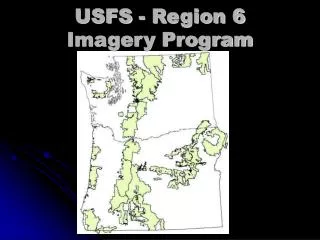
Other USDA Image Acquisition Programs • US Forest Service • “Resource Photography” • Natural Resources and Conservation Service • National Resource Inventory
GIS Implementation 1999 - 2004 USDA Farm Service Agency Digitizing Farm Field Boundaries (Common Land Units)
GIS Implementation 1999 - 2004 USDA Farm Service Agency Digitizing Farm Field Boundaries (Common Land Units) Approx. 50 million polygons
Requirements for ImageryUSDA Farm ProgramsinGIS Environment • Measure acreage • ID Crop Type • Base Map for Farm Records • Coordination • Rectified Digital Image • acquired annually • Color/Color Infrared • >2m. GSD • Updated Ortho Imagery • FGDC, etc.
Current Image Acquisition Two Programs • Worked fine in the past • Worked fine for GIS implementation • Digitizing CLU boundaries from mosaicked DOQs • Not So good for GIS Maintenance • Timeline for ortho update too long • Redundant Photo coverage • Imagery for aerial compliance needs to be rectified
Year 1 Year 2 Year 3 Year 4 Current Image Acquisition/Use Cycle Image Acquisition (NAPP) Reflights Ortho Rectification (NDOP) Mosaic DOQs Digitize Field Boundaries Aerial Compliance Image Acquisition USDA Field Service Center
National Agricultural Imagery Program Single Source of Imagery to Support GIS Maintenance in USDA Field Service Center • Acquired Annually and Delivered for Compliance • Flown during growing season • color/CIR • delivered “geo-referenced” • Source of Imagery for updated ortho-photos • Register 1st generation within 3 meters • Ortho Produced/Delivered within 1 year of acquisition • Based on funding levels • Cost Sharing Crucial
NAIP Vision Statement The National Agricultural Imagery Program (NAIP) consolidates FSA’s aerial photography, digital imagery, and digital orthoimagery requirements into a national strategy that acquires the best value products for USDA agencies while is flexible enough to create win-win partnerships with Federal agencies, State and local governments, and private entities. NAIP will maximize the informational value of acquisitions by minimizing the cycle time from acquisition to fielding while keeping the image content information for the creation of traditional photographic andorthoimagery.
June July Aug Sept Oct Nov Dec Jan Feb Mar April May Annual NAIP Timeline Photo Acquisition NAIP Contracts Geo Rectification Ortho Rectification Aerial Compliance USDA Field Service Center Update GIS Base Data APFO Contracts and Development Ortho Rectification
NAIP Program Goals • Procurement plan based on “Best-Value” contracting practices • Acquire large format aerial photography, 1:40,000 scale, color positive film • Acquire during the peak agricultural growing season (leaf-on) • Deliver digital imagery (one & two meter), in a county format, within one month of acquisition for FSA Compliance Program
NAIP Program Goals • Provide new photography/digital imagery on an annual basis • Update ortho-image base on 1-5 year cycle (depending on USDA Service Center needs) • Aerial film archived at APFO and made available for photographic products • Digital imagery furnished to the “National Map” concept to augment the NAPP/NDOP
NAIP Products and Cost2002 Pilot Project 1m Ortho-Rectified 2m Geo-Rectified • 2 meter GSD • 3.75 quarter quad • horizontal accuracy: not specified • measurements +/- 1% • geo-positioned to facilitate use • 1 meter GSD • 3.75” quarter quad • horizontal accuracy: 3 meter • from reference DOQ $19.00 / Sq. Mile $7.00 / Sq. Mile
FSA NAIP Contracts2002 Aerial Imagery Contracts Contracts Summary • Six States Contracted: KS, NE, ND, SD, MO, and MN • 121 Counties Covered • 82,727 Square Miles • 28,932 Linear Miles of NAPP-Like Aerial Photography (Film archived at APFO) • Summer 2002 Flying Season
FSA Compliance Imagery2 Meter Geo-rectified Imagery Kansas, Nebraska, North & South Dakota, and Missouri • Project Cost: $6.94 per square mile $453,000.00 total • 65,266 Square Miles • 93 Counties Covered • Geo-Rectified Color Digital Imagery • 2.0 Meter pixel Resolution • Geo-Tiff Image Format
FSA Compliance and 1 Meter Ortho Imagery Updates MINNESOTA • Project Cost: $18.99 per square mile, $331,548.70 total • 17,461 Square Miles • 28 Counties Covered • Ortho-Rectified Color Digital Imagery • 1.0 Meter pixel Resolution • Geo-Tiff Image Format
Potential NAIP Coverage for 2003 Compliance Season 847 Counties 791,330 Square Miles
Potential NAIP Coverage for 2004 Compliance Season 1,338 Counties 1,475,756 Square Miles
Types of Partnership Opportunities • New Coverage Beyond FSA Counties • New Coverage Beyond Agricultural Areas of a County • Higher Image Resolution Upgrade • Ortho Rectification Upgrade • State or County Cost Share with FSA
USDA Aerial Photography Field Office 2222 West 2300 South Salt Lake City, Utah 84119-2020 www.apfo.usda.gov Contacts for Partnership Information: Cindy Sessions (801) 975-3500 Ext. 208 Wynn Zundel (801) 975-3500 Ext. 222 APFO is the primary source of aerial imagery for USDA with over 10 million images dating from 1955.