
Plate Tectonics PowerPoint
Delve into the fascinating world of plate tectonics with this detailed PowerPoint presentation by Daniel Luddeke. Explore the history of Pangaea, Alfred Wegener's groundbreaking theory, convergent and divergent boundaries, transform boundaries, and their associated natural disasters like earthquakes and volcanoes. Discover the formation of mountain ranges, trenches, and valleys, as well as the role of plate movements in shaping our planet's surface. Engage with insightful images, diagrams, and real-world connections to deepen your understanding of Earth's geological processes. Join us on a journey through time and space to uncover the mysteries of our ever-changing planet.
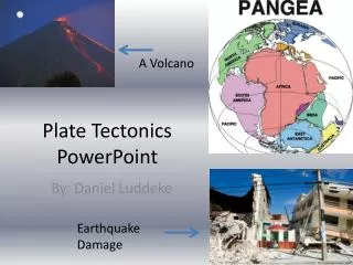

Plate Tectonics PowerPoint
E N D
Presentation Transcript
A Volcano Plate Tectonics PowerPoint By: Daniel Luddeke Earthquake Damage
Section #1 History of Pangaea • The theory of Pangaea was originated by Alfred Wegener who was a German Scientist. He lived from 1880-1930 and was also an a accomplished Astronomer and Meteorologist. During this time he came up with a theory. The theory was called Pangaea or a super continent. Pan” means all and “Gaea” means earth so all together it means “all of the earth”. Pangaea occurred during the Carboniferous period which happened about 3 million years ago. He originally came up with this theory in 1912 but it was not accepted by other scientists. It was not until 1950 (20 years after Wegener died) that they finally began accepting it. His studies of meteorology and astronomy helped with this discovery because they could see if space and gravity could have played a role in the making of Pangaea and also if weather contributed. During this period of time the contraction theory was being discussed. The Contraction theory is where they said that the sun could not be more than 20 million years old. It also said that the suns energy was coming from gravitational contraction. P.M.S. Blackett and S.K. Runcorn assisted in Wegener’s theory. They came from two colleges and provided data that helped Wegener's theory and convinced scientists to accept it.
Section 1 Pictures These are 2 photos of Alfred Wegener. He was the German scientist that came up with the theory of Pangaea or the super continent . He was born in November 1880 and died November 1930. *An important fact to know: Plates mean a giant land mass that is constantly moving around and shifting. This is a diagram of plates moving and splitting apart through the ages
Section 2 Convergent Boundaries • A convergent boundary is a boundary where 2 plates (oceanic or continental or both) collide and cause a series of natural disasters. Some of these disasters that can occur from this are mostly volcanoes and earthquakes (and tsunamis caused by the earthquakes). Mountains and trenches can also occur for because of this. Mudslides/landslides can also happen at this type of boundary. One examples of a convergent boundary is the Eurasian and Indian plates. These 2 plates are convergent and formed the Himalayan mountains. oceanic- continental This is a picture of the Himalayan mountains which formed because of activity along a convergent boundary. continental- continental oceanic- oceanic
Section 2 Pictures This is a photo of a volcano spewing molten rock or magma (technically called lava when it reaches the surface). This is a photo of a landslide that occurred in El Salvador This is a photo of the damage that occurred in the result of an earthquake. This earthquake occurred in Japan in 2004. Japan is dead in the center where the North American, Philippine and Pacific plates meet. This is a diagram of an oceanic trench that formed when 2 convergent plates collided. This is a prime example of a mudslide and what it can do to towns and homes.
Section 3 Divergent Boundaries • This type of Boundary is where 2 plates move away from each other in opposite direction. Ridges and valleys can occur from the spreading of the 2 plates. One major example of this is the Mid Atlantic ridge. The mid Atlantic ridge is the worlds largest mountain range and it stretches from the arctic ocean all the way down to the southern tip of Africa. It separates the North American plate from the Eurasian plate in the North Atlantic Ocean and the African and South American plates in the South Atlantic ocean. This is a diagram of what occurs at a divergent boundary. This is a map of the Mid Atlantic Ridge in the Atlantic Ocean. It played a major role in the breakup of Pangaea.
Section 3 Pictures This is a sonar diagram of the mid ocean ridge. Sonar gives us the opportunity to map under water land features and other features that we can use to better understand earths surface. This is a map of all of the plate boundaries across the world.
Section 4 Transform Boundaries • A transform boundary is a boundary where 2 plates slide past each other and friction occurs. Many earthquakes occur along these boundaries. Earthquakes and Tsunamis are the only 2 occurrences that really occur along these boundaries. An example of a Transform boundary is the San Andreas fault in California. The San Andreas fault runs about 810 miles and marks the boundary between the North American and Pacific plates. This is a diagram of what occurs at transform boundaries. This is an Aerial photo of the San Andreas Fault in California.
Section 4 Pictures This is a diagram of the transform boundary in California. This is the boundary that separates the pacific and North American plate. This is a map showing the most and least earthquake probable areas in California. This picture shows major structural damage that can happen when an earthquake ruptures along the San Andreas fault line.
Section 5 Real World Connections • As Americans, we live on the North American Plate. The North American plate is bordered by the Eurasian, African, South American and Pacific plates. The North American plate is the only plate that contains the United states. The real big threat in the united states in in California and along the pacific plate. There is a danger here because this is where a transform boundary is and earthquakes and other natural disasters can occur here. Landslides and mudslides may rarely occur due to shaking from powerful earthquakes. We may also need to worry about our future. In 1811 one of the strongest earthquakes in history occurred on the New Madrid fault line near Missouri. Scientists may believe this fault line is due to rupture again. Scientists also have a theory that all of the seismic activity from the San Andreas fault could cause large chunks of land to break away from California and slide into the ocean. All of our oil drilling and mining could also in the future rupture new fault lines and cause more and stronger earthquakes. Scientists also have a theory that a “mega” Tsunami could strike Hawaii and wipe out a large portion of it. Also more and stronger volcano eruption and earthquakes could occur in Hawaii and along the pacific ring of fire. This diagram shows the New Madrid seismic area that caused a major earthquake that rang church bells in Boston, Massachusetts in 1811. This diagram shows all of the earthquakes that have occurred around the New Madrid fault line since 1974 but none of these were as major a scientists believe we could experience.
Section 5 Pictures This picture/diagram show what level of shaking is most high and least high in a building. Earthquakes can also cause a great number of structural damage and we need to prepare ourselves better for more and larger earthquakes. This is a great diagram of the North American plate and all of the plates that surround it. Take a look at this map and look at where the pacific plate and North American plates meet. Now Take a look at the map below and look at where all of the major earthquakes have occurred. They have all occurred along this plate boundary area. This map of the united states show the level of seismic hazard throughout the united states. It also show earthquakes that have occurred since 1978 that had a magnitude of 6.5 or higher. Most of them have occurred along the North American and pacific plate boundary. This boundary area is also called the pacific ring of fire.
Cited Sources page for Plate Tectonics project Section 1: http://www.ucmp.berkeley.edu/geology/techist.html http://en.wikipedia.org/wiki/Pangaea Section 2: http://en.wikipedia.org/wiki/Convergent_boundary http://vulcan.wr.usgs.gov/Glossary/PlateTectonics/description_plate_tectonics.html Section 3: http://scign.jpl.nasa.gov/learn/plate2.htm http://en.wikipedia.org/wiki/Divergent_boundary Section 4: http://vulcan.wr.usgs.gov/Glossary/PlateTectonics/description_plate_tectonics.html http://en.wikipedia.org/wiki/Transform_boundary Section 5: http://www.dnr.state.oh.us/Portals/10/pdf/GeoFacts/geof08.pdf http://www.dnr.state.oh.us/OhioGeologicalSurvey/GeologyTopics/GeologicHazards/tabid/7902/Default.aspx http://en.wikipedia.org/wiki/San_Andreas_Fault http://en.wikipedia.org/wiki/New_Madrid_Seismic_Zone


