Download

1 / 25
250 likes | 518 Vues
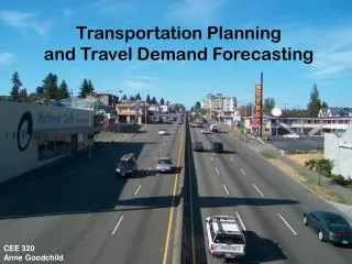
OVERVIEW OF TRAVEL DEMAND FORECASTING. TDF RELATIONSHIPS. Urban Activity. Transit and Highway Networks. Travel Demand Forecasting Process. 1A. AVAILABLE TOOLS. Sketch Tools. discussed in this text. NUMBER OF ALTERNATIVES. Traditional Tools. Micro-Analysis Tools. LEVEL OF DETAIL. 1B.

E N D
TDF RELATIONSHIPS Urban Activity Transit and Highway Networks Travel Demand Forecasting Process 1A
AVAILABLE TOOLS Sketch Tools discussed in this text NUMBER OF ALTERNATIVES Traditional Tools Micro-Analysis Tools LEVEL OF DETAIL 1B
AVAILABLE TOOLS • Sketch tools -- preliminary planning • Traditional tools -- tactical planning • Micro-analysis -- detailed, near-term planning 2A
AVAILABLE TOOLS short-range planning long-range planning SKETCH SKETCH MICRO-ANALYSIS TRADITIONAL 2B
PLANNING PROCESS GOALS PROBLEM STATEMENT CURRENT STATE & FUTURE FORECAST RESOURCES & CONSTRAINTS OBJECTIVES DEFINE ALTERNATIVES ANALYSIS EVALUATION SELECTION IMPLEMENTATION MONITORING 3A
PLANNING PROCESS GOALS PROBLEM STATEMENT CURRENT STATE & FUTURE FORECAST RESOURCES & CONSTRAINTS OBJECTIVES DEFINE ALTERNATIVES ANALYSIS EVALUATION TDF SELECTION IMPLEMENTATION MONITORING 3B
THE 4-STEP APPROACH TRIP GENERATION TRIP DISTRIBUTION MODE CHOICE HIGHWAY ASSIGNMENT TRANSIT ASSIGNMENT 4A
URBAN ACTIVITY Development Policies Transit Policies Land Use Forecasts Regional growth Highway Policies NETWORK Trip Generation Transit & Highway Networks Data Collection Trip Distribution Mode Choice Auto occupancy Auto trips Ped/Bike trips Transit trips Highway Assignment Pedestrian/Bike Assignment Transit Assignment TRAVEL DEMAND FORECASTING PROCESS System evaluation 4B
URBAN ACTIVITIES 2 4 HH = 2500 EMP = 2156 HH = 1500 EMP = 3161 1 LAKE SUBURBS CITY HH = 1000 EMP = 5030 CBD 5 3 HH = 3000 EMP = 1437 HH = 1400 EMP = 2587 SUBURBS CITY 5A
URBAN ACTIVITIES • total population and employment estimates • location behavior of people and businesses • local policies BASIS OF ZONAL FORECASTS 5B
REGRESSION ANALYSIS ZONE AUTOS TRIPS 1 230 1200 2 150 1130 4000 3 250 2700 4 380 3000 3000 5 160 1900 TRIPS 6 60 800 Slope = 1500/250 = 6.0 7 450 2800 2000 8 100 600 9 300 2800 1000 TRIPS = 400 + 6.0*AUTOS Constant = 400 0 100 200 300 400 500 AUTOS From NHI, 1994, p3-8 6B
1 2 3+ 0 1 2 4 1 3 5 8 2+ 4 7 11 CROSS-CLASSIFICATION FAMILY SIZE TRIPS = 2 TRIPS = 10 CAR OWNERSHIP TRIPS = 3 TRIPS = 12 From NHI, 1994, p3-10 7A
TRIP GENERATION 2 4 P = 26,268 A = 17,740 P = 14,498 A = 16,709 1 LAKE SUBURBS CITY P = 8980 A = 23,696 CBD 5 3 P = 33,255 A = 18,190 P = 13,461 A = 19,774 SUBURBS CITY 6A
Attractiveness and accessibility of j Attractiveness and accessibility of all zones GRAVITY MODEL Mathematical Form Trips produced at i Tij = where: Tij = trips from zone i to zone j Pi = trips sent from zone i Ai = trips received from zone i Fij = travel time factor between zone i and zone j Conceptual Form 3A
TRIP DISTRIBUTION 2 4 1600 1730 1 1700 LAKE SUBURBS CITY P=8980 5 3 1850 2100 SUBURBS CITY 6B
MODE CHOICE • characteristics of the trip maker • characteristics of the trip • characteristics of the transportation system FACTORS CONSIDERED 7A
MODE CHOICE 2 4 640 bus 960 car 577 bus 1153 car 1 1133 bus 567 car LAKE SUBURBS CITY P=8980 5 3 462 bus 1388 car 1050 bus 1050 car SUBURBS CITY 7B
4 2 1 5 3 P&R TRIP ASSIGNMENT Zone Boundaries 8A
TRIP ASSIGNMENT 4 2 Increasing levels of congestion 1 Centroid 1 5 3 Centroid connector 8B
Specify Structure of Models and Level of Analysis Input Base Year Travel Data Input Present Transportation System Descriptions Calibrate Forecasting Models Input Base Year Zone and Household Data Validate Models on Existing Data Input New Transportation System Descriptions Input New Zone Data Forecast Travel Evaluate Results 9A
URBAN ACTIVITY Development Policies Transit Policies Land Use Forecasts Regional growth Highway Policies NETWORK Trip Generation Transit & Highway Networks Data Collection Trip Distribution Mode Choice Auto occupancy Auto trips Ped/Bike trips Transit trips Highway Assignment Pedestrian/Bike Assignment Transit Assignment TRAVEL DEMAND FORECASTING PROCESS System evaluation 9B
NEW ISSUES • Emphasis on management and operation • Changing demographics • Changing legal requirements • Computer technology advances 10A
MODEL CHANGES • Analyze operational improvements • Consider non-motorized modes • Consider access • Integrate transportation and land use models • Shift to behavioral models • Quick and reliable responses 10B