Landforms and Weathering
Landforms and Weathering. Grade 5 Goal 2 EOG Tested. Major Unit Goal/Learning Outcomes. Students should be able to: Describe how forces change landforms over time Rate the effects of weathering forces Understand how water movement shapes landforms Describe the characteristics of landforms
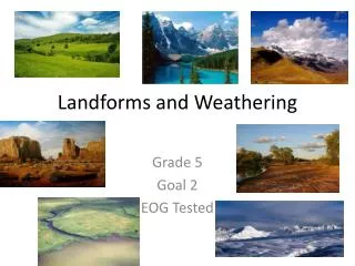

Landforms and Weathering
E N D
Presentation Transcript
Landforms and Weathering Grade 5 Goal 2 EOG Tested
Major Unit Goal/Learning Outcomes • Students should be able to: • Describe how forces change landforms over time • Rate the effects of weathering forces • Understand how water movement shapes landforms • Describe the characteristics of landforms • Discuss how water flow effects erosion • Identify landforms using maps and aerial photographs • Understand the influence of humans on erosion and deposition
Objective 2.01 • Identify and analyze forces that cause change in landforms over time including: • Water and Ice • Wind • Gravity
Objective 2.02 • Investigate and discuss the role of the water cycle and how movement of water over and through the landscape helps shape land forms.
Objective 2.03 • Discuss and consider the wearing away and movement of rock and soil in erosion and its importance in forming: Canyons Valleys Meanders Tributaries
Objective 2.04 • Describe the deposition of eroded material and its importance in establishing landforms including: • Deltas • Flood Plains
Objective 2.05 • Discuss how the flow of water and the slope of the land affect erosion.
Objective 2.06 • Identify and use models, maps and aerial photographs as ways of representing landforms.
Objective 2.07 • Discuss and analyze how humans influence erosion and deposition in local communities, including school grounds, as a result of: • Clearing land • Planting vegetation • Building dams
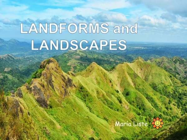
What are Landforms? • Landforms are the natural features of the earth. • Mountains, plateaus, plains and hills are all examples of landforms.
Changes Over TimeWeathering • Landforms constantly develop and change as the forces of weathering and erosion change rocks and break them down. Weathering is the force that causes rocks to fragment, crumble, crack and break down either chemically or physically.
Weathering of Rocks • Rocks weather in different ways and at different rates depending on the mineral composition and location of the rock. The rocks break down into small rock fragments as they are weathered. These fragments are broken down further into particles that comprise soil along with organic material.
Ice Wedging When water is frozen it expands, so when water seeps into cracks in rocks then freezes, the expanded ice can cause the rock to split and crack. This process is known as ice wedging and it can reduce a rock to rubble over time.
Soil/Plant Wedging • Soil can also collect inside of the cracks of rocks. Plants can grow in this soil and eventually the roots grow large enough to cause pressure on the rocks, causing the crack to expand. The rock can split apart from this expansion.
Chemical Weathering • Minerals found in the rocks can change to other minerals due to the reaction with water or air. Reactions such as rusting or acid formation can also cause the rock to break down into smaller fragments.
Changes Over TimeErosion • Erosion carries away the rock debris caused by weathering. The eroded rocks and sediments are deposited by forces such as volcanoes, wind, water, ice and waves to various depositional environments on Earth’s surface.
Water Erosion • A variety of landforms are carved by water. Moving water erodes rocks and transports the small pieces of rock. • Groundwater or underground water can dissolve limestone causing caverns or sinkholes. • Ocean waves shape our coastline. The waves also transport sand and rocks causing extensive erosion.
Wind Erosion • Wind moving at high speeds can transport a large amount of dust and sand. • Erosion of this type shapes deserts by carrying the sand and by sandblasting rock. If soil doesn’t contain plants to hold its place, it can be exposed to vast amounts of erosion. • Loss of soil can cause loss of farmland.
1930 Dust Bowl • During the Dust Bowl in the 1930’s, over cultivation of the farmland removed the native grasses that held the soil in place. • Drought and wind stripped the land of its fertile soil.
Glaciers • Glaciers also help to shape landforms. These huge sheets of ice move slowly over the land in the polar regions of the Earth and in high mountains where vast amounts of snow build up and turn to ice. • The mass of ice moves slowly, only a few inches per day. This movement is caused by layers of ice moving each other or by the layers of ice sliding on a thin layer of water that begins to melt at the bottom of the glaciers.
Glaciers (continued) • As the glaciers moves, it pull out pieces of the bedrock which become embedded into the bottom of the glacier. • As the glacier moves over the land, these pieces of embedded rock grind down on and under the glacier, shaping a variety of landforms. • When glaciers retreat, possible landforms that are created include: canyons, huge boulders, rock piles, hills, valleys and lakes. http://www.youtube.com/watch?v=qbQjukRmLSg
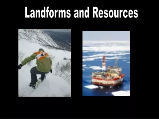
Forces that Build • Plate tectonics is a major force that builds large masses of land. • Faults, volcanoes and mountains are formed as rocks are moved across the surface of the Earth and shape mountains. Watch this 3 minute video. Click on the link below: http://www.youtube.com/watch?v=nfziy_860GU
Deposition • There are smaller building forces that can occur by transporting weathering agents such as water, wind and ice. • These are the same forces that erode the land. • These weathering agents can carry sediment and deposit it somewhere else through a process called deposition. • Deposition of sediment can form beaches, deltas, sand dunes and change • the shape of rivers and • coastlines.
People and the Land • People have a direct affect on weathering, erosion and deposition. • People can speed up erosion by clearing the land for farming, housing developments, building roads, deforestation and strip mining. • People change the course of rivers by channeling them and building dams across them • The shapes of mountains are changed by building roads and highways. • Coastlines are changing by building roads and houses that may alter the natural changes of the coastline.
Examples of Landforms:Valleys • Valleys are depressions on the surface of the Earth that are borders by hills or mountains. • The naturally formed troughs are made by water and/or ice (glacier) erosion. • As rivers and streams flow through valleys, they carry sediments and other materials of land. • Fertile soil is found at the bottom or floor of the valley. The valley floor slopes downstream.
V-Shaped Valleys Valleys formed by rivers have more v-shape.
U-Shaped Valleys U-shaped valleys are formed by glaciers.
Plateaus • Plateaus are formed in different ways: • Some are formed as a result of lava flows covering a large area and building up the surface. • They can also formed by the forces of upward folding, followed by the erosion of surrounding land. These forces leave large areas of fairly level highlands that are separated from land by steep slopes. • Plateaus can be surrounded by mountains or can be higher than the land around them.
Mountains • Mountains are created by huge forces in the Earth over a long period of time. • They are formed by the movements of the Earth’s plates (plate tectonics). • The forces of heat and pressure underneath the Earth’s crust cause movements in the Earth’s plates. • These movements are what most scientists believe form most of the mountains.
Plate Tectonics • The lithosphere of the Earth is divided into sections called plates. • Through plate tectonics these plates move and collide, separate, and slide past each other. • When some plates collide, one moves under the other and causes the eruption of volcanoes. • Other plates compress causing folding and wrinkling of the crust. (Appalachian Mts.)
Plains • Plains are wide stretches of land that do not have significant changes in elevation. • Some plains (Great Plains) are found inland while others found along the coast. • Plains contain fertile soil so these areas are often well populated. • Roads, towns and cities are also easily built in these areas. • Coastal Plains are stretches of lowland along the seacoast that slope towards the ocean.
Fall Line • Along the NC coast, the coastal plain is flooded by the ocean and the edge of the North American continent is actually submerged beneath the ocean. In some areas the plains is part of an elevated ocean floor. • Sediments and other solid materials are carried by rivers and waves where they are deposited along the coastline extending the coastline seaward. • The sharp upward slope of land along the plain’s inward is called the fall line.
Lakes • Lakes are bodies of water that are different from marine environments. • They are small, fairly closed systems, and have less pronounced tides. • When sediment flows into lakes, the coarser sand and gravel are deposited in the shallow areas of the lakes, especially during the summer. • The finer silt and clay are deposited in the deeper areas of the lakes, especially during the winter.
Varves • Alternating thin layers of light-colored and dark colored finer grained sediment are called varves, this is one type of deposit and forms in all types of lakes (glacier and nonglacial). • While most sediment deposits in lakes come from rivers, some deposits are from wind, ice-rafting and volcanic rock erosion.
Volcanoes • Volcanoes create different types of rocks because of the various mineral compositions that compose magma. • Depending on the amount of gas found in the magma and the thickness of magma, the volatility of volcanic eruptions and the landforms that are made differ.
Lava • Lava in mountain building environments is the most thickness and has higher gas content. • The eruptions from these volcanoes are more explosive and form an extrusive, solid volcanic material called tephra. • Rich fertile soil is formed from ash and is used for growing crops. • In the USA most volcanoes are found in Hawaii, Washington and Oregon.
Volcanic landforms • As a results of volcanic activity, there are three different types of landforms that are created. 1. Lava Plains and Lava Plateaus are volcanic landforms that are created when a large volume of fluid lava flows over a wide surface area. The result is topography with extremely flat surfaces that aggrades with each successive lava flow.
Volcanic composite cones • Composite cones are very distinctive in appearance. • They have layers of interbedded, blocky tephra that is composed mainly of ash and cinder. • The peaks can rise several thousands of meters with narrow circular bases. • Mount Rainer in Washington is an example of a composite volcano.
3. Calderas • These are created by volcanoes that have erupted then have later collapsed inward. • Composite cone volcanoes are much more likely to form calderas due to the tephra sheets that they contain. • Crater Lake in Oregon and Yellowstone Plateau in Wyoming are calderas.
Grand Canyon • Not all landforms are created by deposition. • The Grand Canyon is a landform that was created by the erosive forces of water and wind that cuts and etched the land over millions of years. • The Colorado River cut deep gorges into less resistant rock and created the canyon while the more resistant, less weathered rock remained.
Other Types of Landforms:Alluvial Deposits • Alluvial deposits are rock debris and sediments such as silt and clay that are carried down by mountain streams or rivers to the valley floor. • Alluvium is soil or sediments deposited by a river or other running water. • Alluvium is typically made up of a variety of materials: fine particles of silt or clay, larger particles of sand and gravel.
River Flows • A river constantly picks up and drops sediment throughout its length. • Where the river flows quickly, more particles are picked up than dropped. • Where the river flows slowly, more particles are dropped than picked up • Areas where more particles are dropped are called alluvial or flood plains, and the dropped particles are called alluvium.
Alluvium Fans • Alluvium often contains valuable ores such as gold and platinum as well as a wide variety of gemstones. • Such concentrations of valuable ores are termed a placer deposit. • Stream flows that occurs in humid climates are distributed into fan shaped landforms called alluvial fans.
Alluvial Soils • Alluvial soils are finely layered and deep. • The alluvial sands found close to river banks and on natural levees are sandier, but can be more clayey or peaty when close to swampy areas. • Some alluvial deposits have rich top soil and are very fertile allowing for the area to be a crop-growing region.
Colluvial Deposits • Colluvial deposits are materials that are moved down slope by gravity and/or erosion and collect at the base of mountains or foothills with little or no sorting. (Soils from colluvial deposition are deep and hard, clay soils are more common).
Eolian Desert • Eolian desert deposits are found in arid regions around the world. • Dry air masses create wind systems that transport then deposit sediment. • Silt particles, called loess, are carried by the wind and collect around the fringes of the deserts. • Large areas of the desert environment that have more than 125 square kilometers of eoloan sands are called sand seas or ergs.
Eolian Desert • Smaller areas are called dune fields • Variable wind directions and wind force transport and deposit sand creating different types of dunes. • Some dunes are shaped by the wind into ridges, strings, domes, stars, or half-moon shaped dunes. • Desert consist mainly of wind-deposited sand that originated from sandstone that has eroded over time.
Glacial Deposits • Glacial deposits can move huge amounts pf soil and bedrock. • Over 10,000 years ago glaciers extended into lower latitudes and elevations than in the present. • The climate became warmer and these glaciers began to melt and wear away the bedrock below the glaciers.
Rate of Glacier Melts • Different rates of ice melt caused the eroded sediment to fall out of the retreating glaciers. • This glacier till formed deposits called moraines and drumlins. • The melt-waters flowing in around the margins of the glacier accumulated deposits known as outwash plains and depressions (kettles), small mound shaped accumulation of sand or gravel called kames, and eskers (narrow ridges of sediment).
Loess Deposits • Loess deposits are commonly located in or near glacial regions but can also be found in the desert regions of the world. • These deposits are composed mainly of silt grains, with less significant amounts of clay and sand. • Mineral quartz is dominant in loess with feldspar, carbonates and clay minerals in smaller amounts. • Depending on the type of region where the loess is found, there will be varying types of minerals, rocks and sediments.