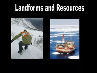
Landforms and Resources
Landforms and Resources. By: Dania Perez Rafael Mayo Naji Said Prem Kafley. Peninsulas and Islands. Mainland of southeast asia lies on two peninsulas. Between indochinese and the malay peninsulas. Atleast 700 miles long Most of the islands found in archipelagoes.

Landforms and Resources
E N D
Presentation Transcript
Landforms and Resources By: Dania Perez Rafael Mayo Naji Said PremKafley
Peninsulas and Islands • Mainland of southeast asia lies on two peninsulas. • Between indochinese and the malay peninsulas. • Atleast 700 miles long • Most of the islands found in archipelagoes.
Mountains and Volcanoes • Mainland has several mountains ranges such as the annamese cordillera • Roughly run through north and south. • Mountains are of volcanic origin • South asia is part of the pacific ring of fire.
Rivers and Coastlines • Mainlands has severe large rivers that run from north through the valley. • Near the coast rivers tend to spread out a fertile delta. • Rivers begins in china and crosses several southeast asian nations. Mekong River, Vietnam
Resources • Fertile soil • Volcanic activity and flooding rivers both add nutrients back to the soil. • Southeast asians have access to large numbers of fish in the rivers nearby.
Oceania’s Many Islands • Erosion causes some islands to vanish while other force’s create new islands. • Most pacific islands fall into 2 categories : high islands & low islands • Most islands are small • They don’t have a lot of resources • The general scarcity of resources made it difficult to develop industries.
Majestic New Zealand • 2 main islands, north and south • Running down the south island is a 300-mile-long mountain range • it has 16 peaks over 10,000 feet high. • Several rivers • North island • Less mountains • More fertile farm land • New Zealand has few mineral resources.
Flat Australia • The land mass known as australia is the smallest continent on earth • Near the eastern coast, running roughly parallel to it is a chain of highlands called the great dividing • The great barrier reef is often called the worlds largest reef although it is really a 1250-miles chain of more than 25,000 reefs
Icy Antarctica • An tarctica is the fifth largest continent. • It is centered on the south pole. • It’s topography is hidden by a thick ice sheet but under the ice lies a varied landscape. • East Antarctica is a group separate Islands linked only by the ice that covers them. • Antarctica’s ice sheet is the largest supply of fresh water in the world.