Gerrymandering and Electoral Geography: A Deep Dive into Voting Patterns
170 likes | 247 Vues
Explore the influence of gerrymandering on political geography, voting districts, and elections. Learn about the impact of redistricting, reapportionment, and historical voting behaviors, such as the 1860 Presidential Vote. Discover how electoral manipulation can sway election outcomes and shape democracy.

Gerrymandering and Electoral Geography: A Deep Dive into Voting Patterns
E N D
Presentation Transcript
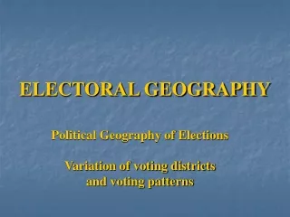
ELECTORAL GEOGRAPHY Political Geography of Elections Variation of voting districts and voting patterns
“Gerrymandering” Redistricting for partisan purposes
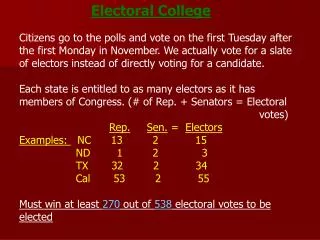
U.S. congressional delegation redistricting Reapportionment : allocating seats to a geographic area (normally done after every census)
1860 Presidential Vote Led to Southern secession, Civil War
205 229 1 I
If Party A is in control of redistricting… • Wasted votes: Party B is a minority in every district • Excess votes: almost all of Party B supporters are in one district • Stacked votes: Party A controls the majority of districts, yet Party B controls more than 1 – can result in very strange shaped districts