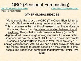
QBO (Seasonal Forecasting)
230 likes | 408 Vues
QBO (Seasonal Forecasting). QBO 30 mb Zonal Wind Index (Index Primarily Used). QBO 50 mb Zonal Wind Index.

QBO (Seasonal Forecasting)
E N D
Presentation Transcript
QBO (Seasonal Forecasting) QBO 30 mb Zonal Wind Index (Index Primarily Used) QBO 50 mb Zonal Wind Index OTHER GLOBAL INDECES“Many people like to use the QBO (The Quasi-Biennial zonal wind Oscillation) to make long range forecasts. I don't use it. This is because in the months of research that I have done on the index, I have found no clear correlation between it and anything. Things that would correlate in theory (to the 3rd degree) don't have enough analogs to verify it. For example... someone will say that a west-QBO Nino in a solar max would produce a good winter in the east. Well, there are only 1-2 analog years to work with, so you can neither prove or disprove the theory. Making forecasts based on it may work for some people, but I don't trust something that unproven.” (Misc. Pro Met)
QBO (DT on the Quasi-Biennial Oscillation) “The quasi-biennial oscillation (QBO) is a band of high level zonal winds found over the Equatorial at very high altitudes (even above the Jet Stream). It is a very well known periodic oscillation in atmosphere. The has been a lot of research done over the last10 years that shows the QBO has significant impact of overall climate patterns ...as well as winter weather patterns as well as the Hurricane season. The period of the QBO "oscillation" is about (a little over) two years. The QBO has two "phases" which occur within the 1 Oscillation cycle-- the Easterly or NEGATIVE phase and the WESTERLY or Positive phase…
QBO (Quasi-Biennial Oscillation) “…Within the meteorological community the QBO is used heavily by SOME as a key ingredient to figuring out what the winter pattern across North America might be...while other forecasters don’t think its all that relevant…” (DT) http://www.atmos.ucla.edu/~cwhung/qbo.html http://strat-www.met.fu-berlin.de/products/cdrom/html/section5.html http://ugamp.nerc.ac.uk/hot/ajh/qbo.htm
Negative QBO and Blocking A negative (easterly) QBO helps create a blocking high over Greenland which can divert cold air south into the United States
QBO (DT) “…In my opinion However much of the discussion is mis-directed towards How and why the QBO is important. For example it has been asserted that during the Winter season....the Eastern half of the US is often cold and snowier than Normal when the QBO is in Westerly or Positive phase while others have asserted that the Easterly or Negative Phase is better for colder and snowier Eastern US winters…”
QBO (DT) “…This LINK has the QBO data going back to 1948. It is my position that the QBO index is NOT an indices that directly relates to the overall pattern per se ...be it Winter...Spring...Summer or Autumn. The reason why I think the QBO is important is that it tell us what the Pacific Jet is going to be doing over the central and eastern Pacific. Good weather forecasters should be willing to tell you that if you get the West coast of North America wrong...you get EVERYTHING else-- the Rockies to the Plains to the Midwest to the Deep South and East coast wrong as well. Perhaps this explains why there are often so many snow and cold forecasts for the eastern US out there that are so often wrong or over hyped….”
QBO (DT) “…It is My contention that a East or Negative Phase of the QBO as we go into the Winter months correlates to a more active and stronger Pacific Jet stream...which means more rains and storminess for the Pacific NW and West coast and a Ridge over the SE or East coast. The KEY point to consider is that IF the current QBO Phase stays strongly positive into the winter, significant cold air outbreaks or a colder than normal overall pattern would be significantly reduced. If on the other hand the QBO phase drops towards neutral then the overall pattern becomes much more promising for significant winter weather over much of the nation as well as the chances for more significant cold air outbreaks…”
QBO (DT) …If you scan all the QBO data and you look for QBO events which were strongly negative... reached NEUTRAL ... then PEAKED ... and dropped back to NEUTRAL ... you can plot how long it takes for the positive phase of the QBO to run its course. That cycle takes anywhere from 10 to 16 months…”
Other Factors: EPO and QBO “…This is a repeat in some ways of what went on last winter. I am sure I don't have to remind you that the consensus forecast from a lot of well-known private forecast services was for a cold and stormy winter 2005-06 over the eastern US. There is very low emphasis outside of my self from any other forecaster that I know about the power of the Pacific Jet last winter enhanced by a persistently positive EPO and the very negative QBO. IMO this is why most of the winter forecasts for a cold and /or stormy eastern US busted so badly in 2005-2006.” DT (November 2006)
QBO and El Nino “Least but also First the QBO dropped DRAMATICALLY in DEC 2006 to well under +10 to a value of +6.10... this combined with a weakening El Nino tells me the 2nd of the winter will be impressively cold and stormy for much of the US as it has been warm and dry. The combination of weakening moderate El Nino and near neutral QBO winters are a LOCK -- as much as one can have such thing in seasonal forecasting for a Good if not GREAT 2nd half of winter and a delayed spring.” -DT-
2006 QBO (Dr. Hurm Research-Jan 2007 Post) 2006 January -18.84 February -11.25 Rising March -0.39 Rising April 5.00 Rising May 10.36 Rising June 11.47 Neutral (Stall) July 10.75 Neutral (Stall) August 9.10 Neutral (Stall) September 10.20 Neutral (Stall) October 10.86 Neutral (Stall) November 10.10 Neutral (Stall) December 6.20 Falling January (2007) 2.61 Falling ...we shall see February 2.43 Neutral (Stall) March 1.24 Falling April -5.18 Falling As seen in the following slides, one must note that our major snowstorms have usually come during a “stall” period, referred to as neutral, or near a transitional period RATHER than in the middle of a rising or falling period. As we enter 2007, we are in a transitional period from neutral (6months) to falling. February/March is looking favorable for a snowstorm when evaluating the QBO data. We shall see. May 2005 to January 2007
QBO Trend Map and Plot for 2001-2006 -Note the “stalling” so to speak when rising or falling- -Note the occurrence of a snowstorm before or after a transition (falling-rising-neutral) or during a “neutral stall”- Making Monthly QBO Plots Note: Arrows Indicate Time Periods in Which Philadelphia Received a Major Snowstorm. BOLDED ARROWS indicate the most significant storms. It is common for these snowstorms to occur at or near a transitional period of the QBO as well as within a neutral period referred to as a “stall.” FNF FNR
QBO Map Plotting and Plot for 1995-2000 Falling, Neutral, Falling Falling, Neutral (“Stall”), Falling
QBO Map Plotting and Plot for 1971-1976 No Biggies Here! But There Were Favorable Times. See Ovals. Major Snowstorm N and W of PHL Southern Snowstorm: 15-25 inches in GA and SC Check for other NE snowstorms or moderate snowstorms.
QBO Map Plotting and Plot for 1965-1970 Falling-Neutral-Falling Falling-Rising Transition Period from Falling to Rising!
QBO Map Plotting and Plot for 1959-1964 Falling-Neutral-Falling Falling-Neutral Stall-Falling
QBO Map Plotting and Plot for 1953-1958 Falling-Neutral Stall-Falling Falling-Neutral Stall-Falling Falling-Neutral Stall-Falling
QBO and Major Snowstorms in the Delaware Valley (Dr. Hurm) • Major snowstorms tend to occur during a “stall” or neutral trend and/or before/after a “transitional” period: Falling-Neutral-Falling = 32 Rising-Neutral-Falling = 13 Rising-Neutral-Rising = 3 Rising = 2 Falling-Rising = 2 Rising-Falling = 1 -Not during times of rapid rising or rapid falling. This is very, very rare- 2. Also, during times of QBO between -10.0 and + 10.0