Download
1 / 17
170 likes | 191 Vues
Explore the role of Earth Observation/GMES Working Group in promoting regional interests and identifying 25 uses of GMES in NEREUS regions.

E N D
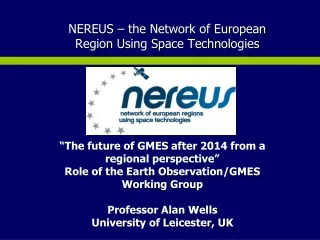
NEREUS – the Network of European Region Using Space Technologies “The future of GMES after 2014 from a regional perspective” Role of the Earth Observation/GMES Working Group Professor Alan Wells University of Leicester, UK
NEREUS Strategic Objectives • The Voice of European Regions for the Application of Space Technology • A key source of information on space matters in Europe for its members • An advocate for the regions in matters of space policy • A network focussed on USING space technologies
Working Groups Earth Observation/GMES Global Satellite navigation Telecom Regional Policy NEREUS-WG- Education, Training, COM
Earth Observation/GMES Working Group • A network focussed on Earth observation and GMES applications and opportunities among regional participants, (industry, regional authorities, academic and research institutes. • An forum for knowledge exchange and information sharing • A voice for explaining and promotingregional interests in GMES.
25 Uses of GMES inin theNEREUS Regions A regionally based consultation undertaken by the NEREUS EO/GMES Working Group
Intended purpose “25 Uses” Provide reference to a representative sample of the GMES market in the regions. Promote GMES to regional end users. Inform “policy shakers and movers” about GMES markets applications and opportunities.
Case Studies of current uses of GMES in the Regions. 25 case studies offered from 17 regions. Strong motivation from the Working group members to identify their regional involvements in GMES. Wide diversity of applications have been presented.
Three Different Motivations Have Emerged Operational projects in support of regional priorities. -Fire and Flood Risk, -Coast, Land and Water Management Projects driven by EU directives and programmes Mapping-CORINE and GMES Urban Atlas NATURA-biodiversity Maritime Security Civil Protection Applications driven by research priorities. Climate Change-regional impacts. Urban Air Quality – Citizens’ Health.
Mapping with GMES Urban Atlas, Agricultural Land Use, Coastlines. Monitoring Forest Clearance. Molise Coastline Monitoring Aquitaine GMES Urban Atlas. x10 Corine Resolution. Veneto
GMES for Maritime Security and Marine Economy TerraSAR Ship Detection Mecklenburg Vorpommern Daily Estimation of Oil Slicks around the Azores Islands Daily sea ice maps derived from EO data. Bremen.
Civil Protection Measures Fires, Floods, Landslip. . Forest Fires Early detection .. Basilicata region Geological landslip detections with SAR. Lombardia. Mapping of flooding from satellite images. Bavaria.
Urban Quality of Life Air Quality and Urban Heat Islands. Traffic induced NOx pollution superimposed on imported emissions from adjacent territories. East Midlands, UK. Urban Heat Island effects with EO thermal imaging. Madrid
Water and Land Management Fertiliser management by EO in crop growth cycle. Midi Pyrenees Snow cover monitoring for water reserve forecasting. Midi Pyrenees
Provisional findings. GMES systems and services from service providers are not always meeting the needs of regional and local administrations and potential end-users. Regional/local administrations and commercial enterprises, as potential end users, may be unfamiliar with existing EO/GMES data systems and services and their potential for use outside the space sector. Indicates need for more focussed communications, wider-based dialogue and better training facilities.
Emerging Roles for Regional Consortia Consortia are being constructed around industry (esp. SME’s), academic and regional authority partnerships. Different models Different funding arrangements Policy role: consortia members as advisers to regional authorities on uses of EO/GMES capabilities to deliver regional development strategies. Consortia delivering pre-operational demonstration projects. Regional technology demonstrators are key steps towards the wider market.
Regional Roles in GMES Operational Implementation Phase “25 Uses” offers evidence that the regional connection offers a significant delivery mechanisms for enhancing exploitation of EO/GMES across Europe. The regions are closely connected to a wide and diverse range of potential end users. NEREUS is ready to contribute to widening the scope of GMES in its forthcoming Operational Implementation Phase. Target for 2012. “NEREUS identifies 50 operational uses of GMES in the Regions”