Download
1 / 10
100 likes | 246 Vues
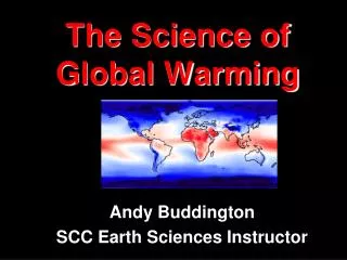
Land cover mapping at global scale: some lessons learnt from the GLC 2000 project. E. Bartholomé JRC-Ispra. Some observations on the following issues. Properties of input data Pre-processing Classification procedures and cover type identification The way forward. Input data.

E N D
Land cover mapping at global scale: some lessons learnt from the GLC 2000 project E. Bartholomé JRC-Ispra
Some observations on the following issues • Properties of input data • Pre-processing • Classification procedures and cover type identification • The way forward
Input data • Number of channels (more channels would be better: cloud mask, LC discrimination) • Radiometry (OK) • Atmospheric correction (Cloud mask, aerosols) • Geometry (Sub-pixel accuracy: the real difference) • Data format (Global coverage in one single image)
Pre-processing • How to build syntheses • 3rd min albedo (Cabral & al) • Average (Vancutsem & al) • BRDF correction (Champeaux & al) • Cloud mask (Viaux & al., Cherlet & al.) • How to clean temporal profiles • Low vegetation coverage (Defourny & al.) • Removal of atmospheric noise (Bartholomé & al) • Good strategic choice not to wait for improved methods, but to directly start map production (last data received March 2001, this workshop March 2003) • But results obtained through labour intensive techniques difficulty to repeat regularly
Classification • Most people have used from-the-shelf classification software • Classical approach: 1) divide space according to spectral properties, 2) label each area with reference information • Ideally, the structural properties of each land cover class should have to be identified form space capacity to measure a number of parameters: • Vegetation height for each strata • Vegetation cover for each strata (forest cover ¹ fcover) • Vegetation type (woody/grassy/…, broadleaf / needle leaf) • seasonality
Classification • At least two cases of ad hoc classification algorithm • Small water bodies (VGT only, semi arid regions only) • Urban areas (VGT + DMSP)
Next steps – medium term • Combination of existing LC map with new data to identify possible changes • Multi-sensor database to complete the spectrum of measurements • Intensification on priority land cover classes to respond to specific needs (i.a. forest, agriculture, protected areas,…) – use of medium resolution
Next steps – medium term • We should consider LC mapping & monitoring at global scale as a component of environmental monitoring: • Technical commonality between several applications (e. g.Forest change & FCCC/KP, Agriculture & food security, protected areas & CBD, wetlands & Ramsar conv.) • Incorporate indicators of disturbances possibly leading to land cover conversion / degradation (e. g. fire, burn scars, drought index, surface water, etc…)
Next steps – long run • Need to incorporate specifications related to land cover monitoring into future space missions • Choice of instruments / wavebands / repeat cycle, etc. • Quality of output data (e. g. geometry) • Need for research to develop new approaches to retrieve significant LC-related parameters (e. g. BRDF parameters as indicators of vegetation structure)