Download
1 / 38
380 likes | 420 Vues
The Skagit County Shoreline Master Program (SMP) aims to update policies and regulations for shoreline use to achieve a balance between environmental protection, public access, and water-oriented activities. The process includes public participation, inventory analysis, and setting up guidelines for future development.

E N D
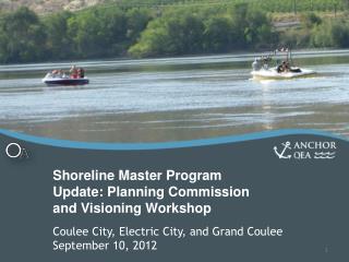
Skagit County Shoreline Master Program Update Visioning Workshops Concrete - June 7, 2011 Lyman – June 8, 2011 Mount Vernon – June 15, 2011
Agenda Key SMP Principles SMP Process SMP Development and Key Issues Public Participation Inventory and Characterization Next Steps
SMA adopted in 1972 • Mutually adopted program between State and Local
Why Update the SMP Now? County’s last major update 1995 New State SMP rules adopted in 2003 All local governments must update Due in Skagit County by 2013 State grant is funding the process
What is an SMP? A comprehensive shoreline land-use plan that includes policies and regulations for the use and development of the shoreline
What an SMP is not The SMP will apply to future development. It will not retroactively apply to past actions. It will not require modifications to existing land uses or developments.
Balance • environmental protection • public access • water-oriented uses • private vs public interest • Still required to protect Critical Areas • No Net Loss of Ecological Function • Preferred Uses
Lakes and reservoirs greater than 20 acres
Rivers and streams with mean annual flow over 20 cubic feet per second
Lands extending landward 200 feet from the ordinary high water mark, floodways and floodplain areas 200 feet landward of the floodway
Required Steps WE ARE HERE SMP - Environment Designations - Goals - Policies - Regulations Local Adoption Inventory & Analysis Cumulative Impacts Analysis Determine Jurisdiction Restoration Plan 2010 | 2011 | 2012 | 2013 Public Participation Ecology Review and Adoption
New or Revised Elements WE ARE HERE SMP - Environment Designations - Goals - Policies - Regulations Local Adoption Inventory & Analysis Cumulative Impacts Analysis Determine Jurisdiction Community Visioning No Net Loss Standard Restoration Plan 2010 | 2011 | 2012 | 2013 Public Participation Ecology Review and Adoption
Degraded Improved SMP elements SMP Updates: Achieving No Net Loss of Ecological Function • SMP Update • Framework to achieve NNL • Inventory & Characterization • Environment Designation • Development Policies & Standards • Recommended Actions outside SMA authority • Compliance Strategy • Cumulative Impacts Analysis • Restoration Plan SMP Restoration Plan Voluntary restoration opportunities Higher No Net Loss – Current Baseline Ecological Function On-going degradation from existing development • Off-site mitigation opportunities • Offsetting mitigation Unavoidable impacts from new development Avoid and MitigateImpacts Lower Shoreline violations Key:
Shoreline Master Program Includes Goals Policies Environment designations Regulations
Public Access Shoreline Uses and Modifications Vegetation Conservation In-water Activities Upland Activities Regulatory Content
Environment Designations Based On: • Criteria in the Guidelines • Ecological condition per Inventory/Analysis • Existing and planned land use
Development of the SMP • Builds upon: • Community Visioning • SMP Guidelines & Consistency Analysis • Inventory/Analysis Report • Shoreline Advisory Committee to provide assistance with SMP development • Policies and Regulations developed in collaboration with Planning Commission • Eventual recommendation to BOCC
Key SMP Issues • Non-conforming Uses/Structures • Overwater Structures (piers/docks) • Shoreline Armoring • Buffers and Setbacks • Vegetation Conservation
Public Involvement • Open House Events • Visioning in summer 2011 • Review of Draft SMP mid 2012 • Shoreline Advisory Committee • Community Outreach – fliers, fairs, etc. • Information Sessions for Planning Commission • County meetings with planning commissions and elected officials
Ways of Reaching Out • SMP Webpage • FAQs • Public involvement timeline • Document postings • Meetings with community groups • Posters, fliers, booths, etc. • Post card to all landowners
Draft Shoreline Inventory and Characterization
Inventory Elements CARA Geologic Hazards Floodplains and Wetlands Land Cover Habitats and Species Drift Cells Shoreline Modifications Water Quality Environmental Cleanup Sites Current Land Use Land Ownership Marine Public Access Septic Systems Surface Water System Impervious Surfaces Geologic Units Marine Shoreforms Soils
Management Units Samish Bay Samish Island, Padilla Bay, and East Swinomish Channel Swinomish Tribal Reservation Fidalgo Island and Other Islands Skagit Bay/Delta Lower Skagit River- Diking Districts Samish River Middle Skagit River Upper Skagit River Nooksack Watershed (WRIA 1) Stillaguamish Watershed (WRIA 5)
Shoreline Analysis • Develops current baseline condition from which future impacts will be measured • Analyzes existing shoreline ecological functions • Analyzes current land use and identifies likely future changes • Identifies potential restoration opportunities
Next Steps • Draft Shoreline Analysis – under review • Community Visioning (Open House) - June 2011 • Begin Drafting of SMP - Fall 2011 • Public roll out – Summer 2012
Contact Information Betsy Stevenson Skagit County (360) 336-9410 betsyds@co.skagit.wa.us Website www.skagitcounty.net/smp