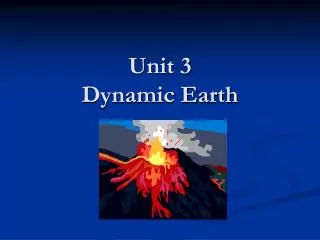
Unit 3 Dynamic Earth
Unit 3 Dynamic Earth. The Earth is divided into 4 layers. 1. Crust (Lithosphere) 2. Mantle (Magma) 3. Outer Core 4. Inner Core. Layers of the Earth (List the 4 layers of the earth, choose a color for each layer and color diagram the appropriate color). Why does the Earth have layers?.

Unit 3 Dynamic Earth
E N D
Presentation Transcript
The Earth is divided into 4 layers • 1. Crust (Lithosphere) • 2. Mantle (Magma) • 3. Outer Core • 4. Inner Core
Layers of the Earth (List the 4 layers of the earth, choose a color for each layer and color diagram the appropriate color)
Why does the Earth have layers? • The layers formed because of their different densities. • The less dense material is found in the crust. • The more dense compounds sank to the center of Earth.
Crust • Outermost layer • Thinnest layer (5-100 km thick) • Two types: Continental and Oceanic • Click here to see the 2 types of crust
Mantle • Just beneath crust • Contains most of Earth’s mass (67%) • Thickest layer (2900 km thick) • Hot, gooey layer made of magma (liquid rock – molten rock)
Outer Core • Hot liquid Iron • 2,200 km thick
Inner Core • Solid Iron/Nickel (metal) • 1250 km thick
Earth’s Layers • The crust is also known as the lithosphere. • The broken sections of the crust are referred to as plates (tectonic). • These plates fit together along Earth’s surface like a puzzle. • The plates move along the surface very slowly. • The upper part of the mantle acts like a plastic and is called the asthenosphere. It allows the plates to move.
Tectonic Plates • Plate tectonics is the theory that the lithosphere is divided up into plates that move along the asthenosphere. (upper part of the mantle)
Three types of Plate Boundaries • 1. Convergent – where two plates are colliding • 2. Divergent – where two plates are separating • 3. Transform – where two plates slide against each other
Wegener’s Hypothesis of Continental Drift • Continental Drift – is the hypothesis that the continents once formed a single continent called Pangaea. This continent broke up and the pieces have moved to their present locations.
Evidence that helps support Continental Drift Similar findings on opposite sides of the Atlantic include: • Fossils • Plants • Mountain Ranges • Matching Rock Types
Movement of Tectonic Plates • What causes the tectonic plates to move? Convection Currents • Convection – the movement of thermal energy through a fluid. Hottest magma rises Cooler magma sinks
Deformation of the Earth’s Crust • Deformation – Shape of rock changes (folds). • Compression – Stress that occurs when forces act to squeeze an object. • Tension – Stress that occurs when forces act to stretch an object.
Types of stress that deform rock: • Folding – the bending of rock layers
Faulting – the surface along which rocks break and slide past each other.
EARTHQUAKES • An earthquake is the shaking of the Earth’s crust. • The study of earthquakes is called Seismology • The instrument used to measure an earthquakes magnitude (strength) is a seismometer and seismograph
EARTHQUAKES • Earthquakes occur along PLATE BOUNDARIES (edges of the crustal plates) • The most active earthquake zone is along the pacific ocean, also known as THE RING OF FIRE.
Three Types of Plate Boundaries • Convergent • Divergent • Transform This motion creates: Volcanoes Seafloor spreading Ridges Mountains Earthquakes
Seismic Waves • When an earthquake occurs it produces vibrations, also known as seismic waves. • Seismic waves are the reason we know the interior of the Earth.
Seismic Waves • Speed: FAST Speed: SLOW
Shadow Zones • The solid core of the Earth blocks and bends the vibrations from an earthquake from reaching the other side of the Earth. • P-waves can travel through the interior of the earth • S-waves can not pass through the liquid portions of the earth.
Measuring Earthquakes • Richter Scale – measures the magnitude (strength) of the earthquake from 1 to 10. • Mercalli Scale – measures the amount of damage done from an earthquake from I-XII.
Earthquake Safety Before the shaking: • 1. Prepare emergency kit • Water • First Aid Kit • Radio / Batteries • Canned food / Can opener • 2. Prepare escape route • 3. Home Safety Plan • Remove objects from high shelves
Earthquake Safety During the shaking: • Get under a table • Get in a doorway • Stay away from objects that may fall on you
Earthquake Safety After the shaking: • Get away from danger • Go to your previously appointed emergency location • Do not go back indoors until advised