Download
1 / 13
130 likes | 354 Vues
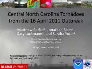
Central North Carolina Tornadoes from the 16 April 2011 Outbreak. Matthew Parker 1 , Jonathan Blaes 2 , Gary Lackmann 1 , and Sandra Yuter 1 1 North Carolina State University 2 NOAA/National Weather Service Raleigh, North Carolina, USA.

E N D
Central North Carolina Tornadoes from the 16 April 2011 Outbreak Matthew Parker1, Jonathan Blaes2, Gary Lackmann1, and Sandra Yuter1 1North Carolina State University 2NOAA/National Weather Service Raleigh, North Carolina, USA Acknowledgments: NSF grant ATM-0758509, too many collaborators to list at NC State and the Raleigh WFO
Raleigh CWA A B Raleigh (metro pop 1.1M) Fayetteville (metro pop 366K) • Majority of tornadoes (by number) occurred east of the Raleigh CWA, however the longest track tornadoes (and a majority of the significant tornadoes) occurred in central NC • Record for summed path length in NC (196 miles in RAH CWA alone) • Tornadoes A & B had paths > 55 miles: 2 of only 4 since 1980 in NC • Two central NC tornadoes tracked through major urban areas (A & B) • Tornado A passed within 1.7 miles of the RAH NWS office (NWS-Blacksburg backed up RAH for 7 minutes as staff took shelter) • Est. damage in RAH CWA >$328M (tor. A≈$172M, tor. B≈$116M)
Surface observations, manual surface analysis, and radar reflectivity 1200-2000 UTC, 4/16/2011
R F R=Raleigh Convective ingredients 1200-2000 UTC, 4/16/2011 F=Fayetteville
RUC Analysis sounding: Raleigh, NC (RDU) 1800 UTC 4/16/11 Observed sounding: Greensboro, NC (GSO) 1500 UTC 4/16/11 (modified with observed cell motion) (modified with observed sfc T, sfc Td, cell motion) CAPE: 668 J/kg CIN: -10 J/kg 0-6 km shear: 28 m/s 0-3 km SRH: 807 m2/s2 LCL height: 264 m AGL CAPE: 1043 J/kg CIN: 0 J/kg 0-6 km shear: 30 m/s 0-3 km SRH: 804 m2/s2 LCL height: 763 m AGL
Base scan radar reflectivity and eventual primary tornado tracks 1630-1900 UTC, 4/16/2011 “Raleigh” “Fayetteville” • The initial convective mode appeared to be linear, but the squall line evolved into discrete supercells over central and southern NC • A number of cells appeared to have been initiated ahead of the primary squall line, but all of these pre-line cells dissipated • The “Raleigh” and “Fayetteville” supercells can actually be tracked backward to origins in SC around 1600-1700 UTC
Surface observations, radar reflectivity, and eventual primary tornado tracks 1800 UTC, 4/16/2011 1. Outflow temperature deficits were generally small (~5-6 C) - high ABL rel. humidity - no trailing strat. precip. Raleigh Fayetteville 2. Low-level shear vectors were largely parallel to the squall line 3. Strongly curved clockwise hodographs favor dynamic lifting on the right flanks of supercells
Idealized simulation with initial linear trigger Simulated reflectivity Homogeneous environment: 1800 UTC RUC analysis Sounding from RDU Evolution appears to have been strongly controlled by the environment • Simulated cold pool temperature deficit never exceeds 6 K • Simulated squall line breaks up despite homogeneous environment • Simulated supercells emerge after roughly 3 hours
Base scan radar reflectivity and tornado tracks (RAH CWA only) 1900-2030 UTC, 4/16/2011 • The three supercells highlighted above produced 10 total tornadoes (pink tracks), including two significant (EF2 or greater) tornadoes each • The Raleigh supercell appeared to be quasi-steady during its lifetime, whereas the Fayetteville supercell appeared to be somewhat cyclic, with periods of multiple circulation centers
“Raleigh tornado” Sanford, NC 1908 UTC (308 PM EDT), 4/16/2011 (early in lifetime) Raleigh, NC 1950 UTC (350 PM EDT) 04/16/2011 (late in lifetime) tornado parent meso tornado parent meso
“Fayetteville supercell” Smithfield, NC 2049 UTC (449 PM EDT), 4/16/2011 (end of tornado 1, beginning of tornado 2) tornado 2 tornado 1
This slide to do: Add visual interest • Preliminary conclusions • The longest-track tornadoes on 4/16/2011 were centered in the Raleigh CWA. • Wind profiles were impressive , with slight enhancement during the day. • Non-zero CAPE wasn’t present until 2-3 hours prior to the tornadoes. • The observed squall line-to-supercell evolution is somewhat unusual. • Squall line moved off of the cold front, and the outflow behind the squall line was not especially cold; the linear forcing is hypothesized to have been weak. • Large vertical wind shear, strongly curved hodographs, and minimal low-level line-normal shear appear to strongly favor discrete supercells. • The 4/16/2011 outbreak was a record-setter for central NC. We have ongoing interest in trying to understand what was unique about the environment. • Anecdotally: long, strongly-curved low-level hodographs are somewhat unusual within the warm sector in central NC. • Anecdotally: low-level flow from off of the Atlantic tends to yield greater low-level stability. Such stability may permit larger low-level vertical wind shear to persist in the afternoon boundary layer, but the interplay between this process and the development of CAPE seems complex. questions/comments: mdparker@ncsu.edu