Download
1 / 20
200 likes | 301 Vues
This report outlines the water use priorities and conflict management within Brooten, focusing on agricultural irrigation, domestic water supply, and the implications of high-capacity well use. Key procedures defined in Minnesota Rules regulate well interference and water usage thresholds to balance competing demands among users. Two-tiered threshold elevations are established to ensure sustainable aquifer levels, protecting both the water supply and the structural integrity of the aquifer. Important calculations of available head and thresholds are detailed for effective groundwater management.

E N D
Brooten Area Water Use June 19, 2008
Brooten – Initial Conflict Study Area
A A’ Brooten – Geologic Cross-Section
Brooten – Extent of Lower Buried Aquifer
Brooten – General Extent of Buried Aquifers
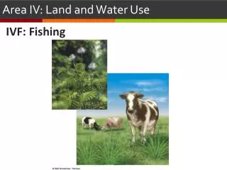
2. 3. 1. 4. 5. 6. Water Use Priorities Agricultural irrigation & processing of agric. products Consumptive less than 10,000 gallons/day Domestic water supply Power production Consumptive uses in excess of 10,000 gallons/day Non-essential uses
Well Interference Well interference is when a high capacity well impacts a domestic or public water supply well by reducing water levels beyond the reach of those wells. Procedures defined in Minnesota Rules 6115.0730 Water Use Conflict Water use conflict occurs where the available supply of waters of the state in a given area is limited to the extent that there are competing demands among existing and proposed users which exceed the reasonably available waters. Procedures defined in Minnesota Rules 6115.0740
Thresholds Two types have been applied at high volume water user sites: Aquifer protection Resource protection Thresholds are not developed to prevent well interference.
Two tiered threshold • The two-tiered threshold allows appropriation from the aquifer but also provides a buffer to protect the structural integrity of the aquifer itself. • Under this method, two threshold elevations are set, the first, at 50% of the pre-pumping available head is meant to act as a warning light to the appropriator(s). In general, this 50% level should not be breached until the well has been pumped for some time. • If the 50% level is achieved, the appropriator should be increasing the frequency of water level monitoring, actively investigating alternate water supplies, implementing more aggressive water conservation measures and planning to cut back their appropriation rates
1) Determine the SWL (static water level) below the land surface. SWL=68 feet 2) Determine the depth to top of the aquifer below the land surface. Top of aquifer=180 feet 3) Calculate available head above the top of the aquifer; top of aquifer minus SWL. Available head=180-68=112 feet 4) Calculate 50% of available head. Available head divided by 2. Available head/2=112/2=56 feet 5) Calculate threshold by subtracting 50% of available head from the depth to the top of the aquifer. Threshold=180-56=124 feet
The second threshold elevation is set at an elevation equivalent to 25% of the pre-pumping available head. If the 25% threshold is reached, appropriation from the aquifer should cease altogether or pumping minimized to such a degree that water levels stop declining or start recovering.
1) Determine the SWL (static water level) below the land surface. SWL=68 feet 2) Determine the depth to top of the aquifer below the land surface. Top of aquifer=180 feet 3) Calculate available head above the top of the aquifer; top of aquifer minus SWL. Available head=180-68=112 feet 4) Calculate 50% of available head. Available head divided by 2. Available head/4=112/4=28 feet 5) Calculate threshold by subtracting 50% of available head from the depth to the top of the aquifer. Threshold=180-28=156 feet