Download
1 / 29
330 likes | 672 Vues
The United States of America Land of the Beautiful. FUN FACTS of the NORTHEAST REGION. Its economy consists of shipbuilding, fishing, and trading. It is a land of many immigrants and religions. Boston, Massachusetts is the richest part of the region. Education is a strong part of the region.

E N D
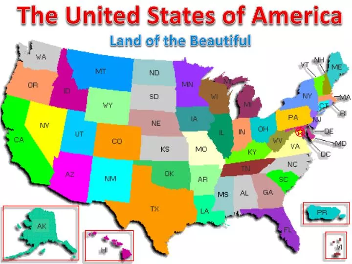
The United States of America Land of the Beautiful
FUN FACTS of the NORTHEAST REGION • Its economy consists of shipbuilding, fishing, and trading. • It is a land of many immigrants and religions. • Boston, Massachusetts is the richest part of the region. • Education is a strong part of the region. • Universities include: Harvard, Yale, Brown, Dartmouth, Wellesley, Smith, Mt. Holyoke, Williams, Amherst, and Wesleyan. • Philadelphia, Pennsylvania was home to the Continental Congress that organized the American Revolution and the birthplace of the Declaration of Independence in 1776 and the U.S. Constitution in 1787. • Rivers such as the Hudson and Delaware helped to develop cities located along them because of shipping. • New York City, New York is the nation’s largest city and its financial and cultural center.
Group One: TRIVIA • Everyone else: Cut out flash cards. • 1. QUIETLY get a pair of scissors. You may have to share. • 2. Cut along the solid lines on the last page of your packet to make your flashcards. • 3. When you are finished, quietly flip through them to learn their shapes and names.
TOURIST ATTRACTIONS Place Which Northeast state is famous for skyscrapers, theater, the Empire State Building, and the Statue of Liberty? If you wanted to see Times Square, what state would you visit? What large bridge is located in New York?
Look for the following landforms • Lake Erie and Lake Ontario • Atlantic Ocean • Appalcian Mountains • Poconos Mountains • Coasts and Harbors • Connecticut, Delaware, Hudson, and Potomac Rivers
Group Two: TRIVIA • Everyone else: Use flash cards. • 1. ON YOUR OWN, flip through your flashcards to learn the shapes and names of the states. • 2. Then use the “table of contents” page in your packets to write in pencil the state and abbreviation on the back of each state flashcard.
LAND • Place and Human-Environment Interaction • What activity could you take part in if you visited the Poconos in Pennsylvania during the winter? • What is the name of a large park in New York where you could have a lovely picnic?
Group Three: TRIVIA • Everyone else: Use flash cards. • 1. With ONE Partner, take turns flipping through your flashcards to learn the state abbreviations and capitals. • 2. Study well. You will need to know these for the activity at the end.
PEOPLE Place and Movement What is one way you might see people getting around in New York City? What might you get to do at the FAO Schwarz toy store? What large type of home or building might you find in Rhode Island?
STUDY TIME • Group Four: See me, please. • Everyone else: REMAIN QUIET and...
The United States of America Land of the Beautiful
FUN FACTS about the SOUTHEAST REGION • The only diamond mine in North America is in Arkansas. • Georgia is where Eli Whitney invented the cotton gin in 1793. • The first train to haul passengers ran between Augusta, Georgia and Charleston, South Carolina. • Memphis, Tennessee is home to the first civil rights museum and was where Martin Luther King, Jr. was killed. • Virginia has been called “Mother of the Presidents” because eight U.S. presidents were born there. • Cape Hatteras Lighthouse in North Carolina is the tallest lighthouse in the U.S.
Group One: TRIVIA • Everyone else: Cut out flash cards. • 1. QUIETLY get a pair of scissors. You may have to share. • 2. Cut along the solid lines on the last page of your packet to make your flashcards. • 3. When you are finished, quietly flip through them to learn their shapes and names.
PEOPLE Place and Movement Who is a famous person from Tennessee? What is the capital city of Tennessee famous for? What large place would you likely arrive at if you traveled to Tennessee’s capital?
Look for the following landforms • The Everglades • The Great Smoky Mountains • The Appalachian Mountains • Piedmont Plateau • The Gulf and Atlantic Coastal Plains • Chesapeake Bay • Gulf of Mexico • Rivers
Group Two: TRIVIA • Everyone else: Use flash cards. • 1. ON YOUR OWN, flip through your flashcards to learn the shapes and names of the states. • 2. Then use the “table of contents” page in your packets to write in pencil the state and abbreviation on the back of each state flashcard.
TOURIST ATTRACTIONS Place Whose home do people like to see when they visit Graceland, TN? What is one place in Florida that people come from around the country to visit?
Group Three: TRIVIA • Everyone else: Use flash cards. • 1. With ONE Partner, take turns flipping through your flashcards to learn the state abbreviations and capitals. • 2. Study well. You will need to know these for the activity at the end.
LAND Place and Human-Environment Interaction What activity could you do in a channel in Key West Florida? What could you do if you visited a beach at Key West?
STUDY TIME • Group Four: See me, please. • Everyone else: REMAIN QUIET and...
State Abbreviations Maps from: Targeted Regional United States Zones. (n.d.). American Banner Exchange. Retrieved March 31, 2011, from http://www.americanbannerexchange.com/usa-zones.htm • Native America Map from: • Regions unit 2 article. (n.d.). Scott Foresman Social Studies. Retrieved March 31, • 2011, from http://www.sfsocialstudies.com/g4/na/u2/article.html States and Capitals Northeast Map from: Griebel, C. (2002, March 3). Northeast Region. Regions of United States WebQuest. Retrieved March 31, 2011, from http://cg043.k12.sd.us/regions%20of%20the%20US% 20webquest/northeast_region.htm States and Capitals Southeast Map from: Griebel, C. (2002, March 3). Southeast Region. Regions of United States WebQuest. Retrieved March 31, 2011, from http://cg043.k12.sd.us/regions%20of%20the%20US% 20webquest/southeast_region.htm