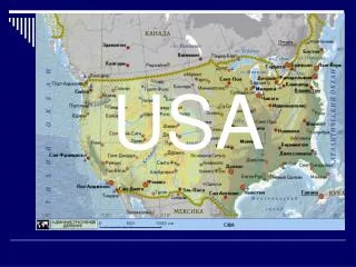
USA Weather Map
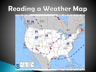
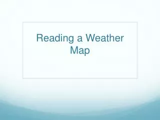
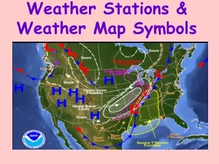
USA Weather Map. By Your Name Period #. Let’s view a live weather-cast…. Go to http :// www.weather.com/maps/maptype/currentweatherusnational/uscurrentweather_large.html This will show you a weather map of today!!!. Sample U.S. Weather Map, similar to the one you'll make!. L. L. H.

USA Weather Map
E N D
Presentation Transcript
USA Weather Map By Your Name Period #
Let’s view a live weather-cast… • Go to http://www.weather.com/maps/maptype/currentweatherusnational/uscurrentweather_large.html • This will show you a weather map of today!!!
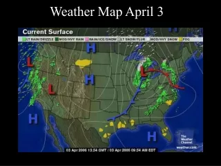
Sample U.S. Weather Map, similar to the one you'll make! L L H http://www.epa.gov/OGWDW/dwinfo.htm
You may choose this map, or... http://www.epa.gov/OGWDW/dwinfo.htm
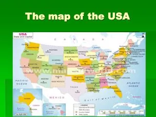
You may choose this map, or... : http://media.maps101.com/SUB/SATELLITES/SATGIF/united_states.gif
Learn how to read a weather map: • http://www.edheads.org/activities/weather/ Click on the words Click here to START, and then go through the tutorial. • Learn how to read wind barbs: http://ww2010.atmos.uiuc.edu/(Gh)/guides/maps/sfcobs/wnd.rxml and/or http://www.rap.ucar.edu/weather/info/about_windbarb.html
Help Pages To find the latest weather information: • http://www.weather.com/maps/maptype/currentweatherusnational/index_large.html • http://www.weather.com • http://www.weather.gov/ or http://www.nws.noaa.gov/ • http://weather.cnn.com/weather/forecast.jsp • http://www.ghcc.msfc.nasa.gov/GOES/goeseastconusir.html(Click on “Animate image above” For wind speeds with proper symbols: • http://www.ral.ucar.edu/weather/surface/java_metars/ • http://www.weather.gov/outlook_tab.php IMPORTANT ONE! ONLY IF YOU HAVE EXTRA TIME SHOULD YOU GO HERE: http://www.intellicast.com
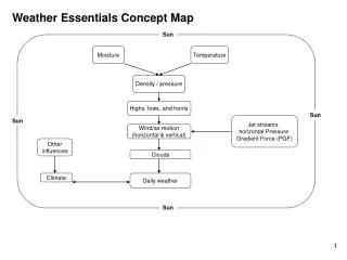
When we add pressures of air masses to our maps,we’ll use WordArt (see ) like this: Typical Weather-map symbols used to show barometric pressure of air masses:
Typical Weather-map symbols used to show barometric pressure of air masses: We will use Draw/AutoShape/Line tools to draw these symbols, like this:
Typical Weather-map symbols used to show wind speed and direction… We will use Draw tools to draw these wind barbs, like this: Long line = 10 knots, Short = 5 knots
Typical Weather Map Symbols for cloud cover and storms may be clip art. • To find your own animated clip art: • In menu, click on Insert/Picture/ClipArtor click on red-headed Fred • When the Clip Art window appears at right, click on Clip art on Office Online • When the new window appears, enter one word in the Search box to name what you want. • When you see a graphic that you want, click in the that is underneath it. • Click on Download/Download Now, copy/paste or drag the pic into your map.
Assignment • Save as this file using the proper format for Mr. Robinson’s (Example: Last Name First name Weather map) • Choose one of the three US maps and then delete the slides with the other two maps. • On the map that you chose, use proper symbols to show everything listed on the next slide……………………… • BEFORE YOU LEAVE FOR THE DAY, fast-save one more time (Ctrl+S), and then DELETE ALL SLIDES EXCEPT YOUR U.S. MAP and SLIDES THAT HAVE YELLOW STARS ON THEM. REMEMBER: DO NOT DELETE THE SLIDES WITH YELLOW STARS ON THEM. DO NOT DELETE YOUR U.S. MAP!
Make a map of “current “ weather conditions in the United States. 1. Label N, S, E, W on each side of the continental United States. Use WordArt. 2. There is a cold front moving in from Montana and North Dakota ( MT, ND). It is traveling south. Use Draw/AutoShapes/Line tools. 3. Behind the front is a high pressure system. Use WordArt. 4. There is a cold front moving from Ohio through Alabama (OH, AL). It is moving to the west. Use Draw/AutoShapes/Line tools. 5. In front of the cold front it is raining. Use clip art. 6. From Arizona to Texas, there is a warm front moving to the northeast. Use Draw… 7. Behind the warm front there is a low pressure system. Use WordArt. 8. There is a stationary front up the Pacific Coast from California to Washington (CA, WA). 9. All along the stationary front it is raining. Use clip art. 10. It is sunny in Colorado (CO) and the temperature is 55 degrees F. 11. In Michigan, it is snowing and the temperature is 25 degrees F and the winds are blowing to the south at 15 knots. 12. Florida is partly cloudy with a temperature of 76 degrees F. Winds are blowing at 6 knots to the west. Insert a new slide (See menu bar), copy/paste these questions onto the slide, and then answer them: 1. When the warm air and cold air masses come together, which will rise to the top? Why? 2. Which causes heavier showers, a cold front over-riding a warm front or a a warm-front over-riding a cold front? 3. My barometer went from 1020 to 980. What is going to happen with the weather?
If you have more time… • Go to http://www.explorelearning.com/, type humidity in the Search box, and then complete the gizmo and quiz for an extra credit daily quiz grade! (Turn in the quiz only if you make a high grade.)