Download
1 / 13
130 likes | 290 Vues
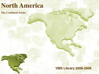
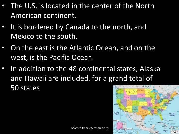
The U.S. is located in the center of the North American continent. It is bordered by Canada to the north, and Mexico to the south. On the east is the Atlantic Ocean, and on the west, is the Pacific Ocean.

E N D
The U.S. is located in the center of the North American continent. It is bordered by Canada to the north, and Mexico to the south. On the east is the Atlantic Ocean, and on the west, is the Pacific Ocean. In addition to the 48 continental states, Alaska and Hawaii are included, for a grand total of 50 states Adapted from regentsprep.org
The U.S. occupies just less than half (almost 45%) of continent! The U.S. is the third-largest country on earth (by size), right behind Russia and Canada. Adapted from regentsprep.org
Most of the United States has a temperate climate, but Hawaii and Florida are tropical, Alaska is polar/arctic, the Great Plains region is semiarid (dry, almost desert-like), and the Great Basin of the southwest is an arid (desert-like) climate. Adapted from regentsprep.org
The U.S. can be divided into many different regions (areas that share some common characteristics). The United States is divided into five geographic regions: The Western Mountains & Basins, the Great Plains, the Central Lowlands, the Appalachian Mountains, and the Atlantic Coastal Plain. This is only one way to classify the very diverse areas of America. Adapted from regentsprep.org
Not only does it have very different geographic regions, but the U.S. has a huge array of natural resources such as timber, coal, petroleum, and natural gas. In addition, it has large metal deposits of copper, lead, uranium, gold, iron, nickel, silver and zinc. As you can imagine, the mining industry in the U.S. is extensive. From the non-agricultural, arid land in the southwest, to the fertile central lowlands and coastal plains, there is an extremely variable array of landforms and land usage in the United States. The map to the right highlights two dozen different vegetation zones in the U.S. and North America. Adapted from regentsprep.org
From the non-agricultural, arid land in the southwest, to the fertile central lowlands and coastal plains, there is an extremely variable array of landforms and land usage in the United States. The map to the right highlights two dozen different vegetation zones in the U.S. and North America. Adapted from regentsprep.org
One of the greatest obstacles for early settlers intent upon moving westward, were the Appalachian Mountains. They extend, in an almost unbroken chain, from Maine to Alabama, with very few places to pass through. Early settlers quickly found the Cumberland Gap (at the junction of modern-day Kentucky, Tennessee and Virginia) to be one of the easiest ways westward (and inland) from the colonies. Adapted from regentsprep.org
Four hundred miles west of the Cumberland Gap, settlers would encounter the largest river in North America, At that point, the 2,552 mile long Mississippi River was nearly one mile wide, and over 100 feet deep. Travelers had to go miles upstream to find a ford (a place to cross the river). Adapted from regentsprep.org
Once across the Mississippi River, the Great Plains made for fairly easy travel. It was not until settlers saw the Rocky Mountains, that westward expansion slowed. Most people were diverted either far to the south, or chanced high passes through the mountains, sometimes getting stranded in unpredictable winter snowstorms. Adapted from regentsprep.org