Download
1 / 19
210 likes | 787 Vues
Human Characteristics of United States Unit 2 Lesson 3. Content Expectations 4 - G1.0.2: Use cardinal and intermediate directions to describe the relative location of significant places in the United States.

E N D
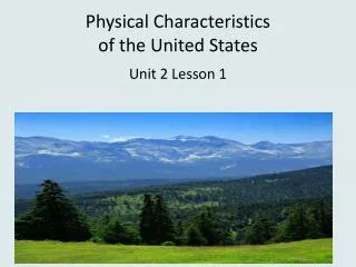
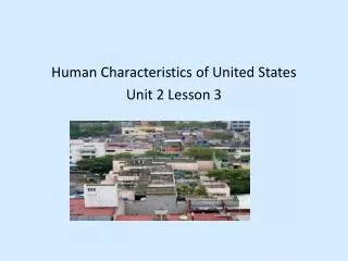
Human Characteristics of United States Unit 2 Lesson 3
Content Expectations 4 - G1.0.2: Use cardinal and intermediate directions to describe the relative location of significant places in the United States. 4 - G1.0.3: Identify and describe the characteristics and purposes (e.g., measure distance, determine relative location, classify a region) of a variety of geographic tools and technologies (e.g., globe, map, satellite image). 4 - G1.0.4: Use geographic tools and technologies, stories, songs, and pictures to answer geographic questions about the United States.
Graphic Organizer Connections between human characteristics and physical characteristics Special Purpose Maps Transportation Networks Human Characteristics of the United States Example: Interstate Highway System Specific Places Examples: ·Cities map ·Highway map ·Tourist map Cities Examples: ·Size of cities ·Reasons for location Examples: ·Buildings ·Monuments ·Tourist Sites
Make inferences about this map. (Think about what you notice.)
• Tourist areas often are built near unique physical characteristics like the Grand Canyon. • These areas include places to shop, stay, eat and view the physical feature. • A transportation system into the area is created. This can include roads, railways and trails.
Word Cards • Word Cards from previous lessons needed for this lesson: • Fundamental Themes of Geography – Word Card #1 from Lesson 1 • Place – Word Card #1 from Lesson 2
Connecting Physical and Human Characteristics – Sample Answers
City Search Directions: Use the map at the following website to help you answer these questions: http://www.mrnussbaum.com/usaflash3.htm 1. According to the map how many U.S. cities have over 1,000,000 people? 2. What are these cities? 3. What are four states that have no major cities according to this map? 4. Why do you think this is true? 5. Directions: Click on a variety of cities and find 4 examples of a physical characteristic that influenced the location and/or growth of the city.
City Search – Sample Answers Directions: Use the map at the following website to help you answer these questions: http://www.mrnussbaum.com/usaflash3.htm 1. According to the map how many U.S. cities have over 1,000,000 people? 9 2. What are these cities? Los AngelesSan Diego Phoenix DallasHouston San Antonio New York Philadelphia Chicago 3. What are four states that have no major cities according to this map? Maine, Montana, North Dakota, South Dakota, New Mexico, Vermont, New Hampshire 4. Why do you think this is true? Answers will vary. 5. Directions: Click on a variety of cities and find 4 examples of a physical characteristic that influenced its founding and/or growth of the city.
• Many interstate highways run north/south or east/west. • There are more interstate highways in the eastern part of the United States than in the western part. • Often the interstate highways do not run along coastal areas. An exception is Highway 95 in Florida. • Interstate 80 goes across most of the United States. • Interstate 75 goes from Michigan to southern Florida. • No Interstate highway connects Alaska with the rest of the states.
References Disney World. 7 October 2008 <http://disneyworld.disney.go.com/wdw/?bhcp=1>. The Gateway Arch. 7 October 2008 <http://www.gatewayarch.com/Arch/>. Golden Gate Bridge. 7 October 2008 <http://www.goldengatebridge.org/>. Mount Rushmore. 7 October 2008 <http://www.mtrushmore.net/>. Trans Alaska Pipeline. 7 October 2008 <http://www.alyeska-pipe.com/pipelinefacts.html>. U.S. Cities Interactive Map. 7 October 2008 <http://www.mrnussbaum.com/usaflash3.htm>. Teacher Resource Egbo, Carol. Supplemental Materials (Unit 2, Lesson 3).Teacher-made material. Michigan Citizenship Collaborative, 2008. Grand Canyon South Rim Village Map. 7 October 2008 <http://gocalifornia.about.com/library/weekly/n_az_gc_map_vlg.htm>. United States Interstate Highways Map. 7 October 2008 <http://www.onlineatlas.us/interstate-highways.htm>.