Download
1 / 30
300 likes | 411 Vues
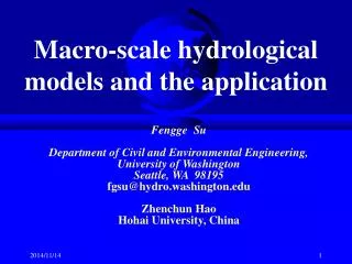
This study by Fengge Su and Zhenchun Hao focuses on advancing macro-scale hydrological models, specifically the Atmosphere-Vegetation Interaction Model (AVIM). The research presents improvements to runoff parameterization, addressing its simplistic treatment of hydrological processes. Using the Huaihe and Xilinhe River Basins as case studies, the authors demonstrate the effectiveness of enhanced modeling techniques, allowing for more accurate streamflow simulations. This work contributes significantly to understanding runoff generation in arid climates and improving water resource management in China.

E N D
Macro-scale hydrological models and the application Fengge Su Department of Civil and Environmental Engineering, University of Washington Seattle, WA 98195 fgsu@hydro.washington.edu Zhenchun Hao Hohai University, China
Contents • Macro-scale hydrological model • Runoff improvement in the land surface model AVIM (Atmosphere Vegetation Interaction Model) • Streamflow simulations for major river basins in China by the use of VIC model
1. Macro-scale Hydrological Model • the Xin’anjiang Model is used as the basic model to develop a grid-based distributed hydrological model. • The Huaihe River Basin with the area of 270,000 km2 is selected as the research area. A 30km×30km squared-grid is adopted There are totally 307 grid cells.
17 sub-areas with 307 grid cells 沭 河 沂河 周口 亳县 固镇+宿县 平原区 漯河 洪泽湖 阜阳 班台 蚌埠 鲁台子 明光 王家坝 息县 蒋集 横排头
2. Improvement of runoff parameterization in AVIM • Brief description to the land surface scheme AVIM(Atmosphere-Vegetation Interaction model) • Improvement of runoff parameterization in AVIM • Hydrological simulations over Xilinhe drainage basin
Runoff plays an important role in land surface water budgets. • The treatment of hydrological processes in AVIM is too rough, and runoff is simply an excess of precipitation over evapotranspiration. • The purpose of this study is to improve the parameterization of runoff generation in AVIM.
Brief description to AVIM • Canopy in AVIM is considered as a uniform • layer covering the soil with a shielding factor. • The soil column is divided into three layers: • upper layer(d1=0.1m); lower layer(d2=0.9m); • deep layer(d3=d2).
Evapotranspiration in land surface scheme AVIM Wet canopy evaporation Evapotranspiration Dry canopy transpiration Bare soil surface evaporation
The soil model • Diffusion type multi-layer scheme
Runoff • The parameterization of runoff in AVIM is very • simple. It is assumed that the rainfall Pginfiltrates • the upper layer of soil. As soil gets saturated, the • surface runoff (rof) will occur and is equal to the • excess of rainfall over evaporation.
The treatment of the heterogeneity in the Xinanjiang model
Sensible heat Latent heat Pg Land surface scheme AVIM Runoff generation model Routing model Discharge Q w1, w2 Rof Improvement of runoff parameterization in AVIM Rof
Wm W Pg rof A WM W0 0 f/F 1 Runoff generation model
The calculation of runoff may then be expressed in the form: Then W0 and WM can be expressed as:
Hydrological simulations over Xilinhe drainage basin • Basin description • Data • Experimental design
Basin description • The Xilinhe drainage basin is located in the east of Inner Mongolia plateau of China, and belongs to arid and semi-arid climate. • Mean annual precipitation is about 350mm; mean annual runoff depth is only5.7mm; runoff coefficient is 0.016. • Most of the runoff is generated in spring by snowmelt, and 66.5% of the runoff occurs in Apr. and May.
Data • The hydrological simulations area is upstream of Xilinhaote station, which is located at 116°10′E , 48°49′N, with the drainage area of 3852 square kilometers. • The data for calibration and validation comprises daily streamflow from Xilinhaote gauging station and daily atmospheric forcing data from the year 1991 to 1994, including observed radiation, precipitation, air temperature, humidity, wind, and cloud cover. • The improved AVIM model is run at an hourly time step.
Experimental design Model is run in the three situations: • Running the original version of the AVIM model; • Running the improved AVIM model, using the energy-balance snow model; • Running the improved AVIM model, using a degree-day snow accumulation and ablation model.
The original AVIM model results indicate that all the calculated runoff is zero. That is because, under the assumption of neglecting horizontal heterogeneities, the runoff will not occur until the entire upper layer is saturated, but the saturation is rarely reached in Xilinhe basin with the even precipitation of 350mm/y.
Daily observed and simulated streamflow at gauging station Xilinhaote for the period 1991-1994 (by the improved AVIM model with the energy-balance snow model)
Daily observed and simulated streamflow at gauging station Xilinhaote for the period 1991-1994 (by the improved AVIM model with the day-degree snow model)
The Xilinhe drainage basin is located in arid and semi-arid zone. Annual runoff depth is only 5.7mm,and runoff coefficient is about 0.016. It is a challenge to select the basin to simulate the hydrologic processes. • The simulated rainfall-runoff processes are acceptable and encouraging. It indicates that the modification of runoff generation scheme in AVIM is reasonable and effective.
The difference of calculated upper soil water content(mm) between the original AVIM (no runoff) and the improved AVIM model (having runoff)
The difference of calculated latent heat(w/m2) between the original AVIM (no runoff) and the improved AVIM model (having runoff)
The difference of calculated sensible heat(w/m2) between the original AVIM (no runoff) and the improved AVIM model (having runoff)
Conclusion and discussion • The runoff generation scheme in the original AVIM was improved. • The model was used to simulate daily hydrographs for the Xilinhe drainage basin, and there was an acceptable agreement between the observed and simulated streamflow in rainfall-runoff processes at the Xilinhaote station. • Though, streamflow simulation is not the main task in land surface scheme, it can act as a diagnostic tool for verification of water balance model in the scheme.