
CORRECTABLE BC-ERRORS WITHIN MESO-MET MODELS
E N D
Presentation Transcript
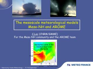
CORRECTABLE BC-ERRORS WITHIN MESO-MET MODELS R. Bornstein San Jose State University San Jose, CA pblmodel@hotmail.com Presented at 86th AMS Annual Meeting, Atlanta, GA 30 January 2006
Acknowledgements • H. Taha, Altostratus & SJSU • D. Hitchock & P. Smith, State of Texas • D. Byun, U. of Houston • J. Ching & S. Dupont, US EPA • S. Stetson, SWS Inc. • S. Burian, U. of Utah • D. Nowak, USFS • Funded by:NSF, USAID, DHS, LBL, LMMS, NASA • MY M.S.(ex)STUDENTS: J. Cheng, C. Lozej, F. Freedman, T. Ghidey, K. Craig, S. Kasakseh, R. Balmori
OUTLINE • INTRODUCTION • SYNOPTIC FORCING • POORLY (AT BEST) KNOWN INPUT DATA • DEEP SOIL TEMP IC/C • SOIL MOISTURE IC • SST IC/BC • SFC/PBL FORCING • NON-URBAN • URBAN • CONCLUSION
Theme of Talk:MESO-MET ATM-MODELS MUST CAPTURE B.C. FORCINGS IN CORRECT ORDER (1 of 2) e.g., AN O3 EPISODES OCCURS ON A GIVEN DAY: • NOT FROM CHANGING: TOPOGRAPHY & EMISSIONS • BUTDUE TO CHANGING (UPPER-LEVEL &/OR SFC) GC/SYNOPTIC PRESSURE-PATTERNS, WHICH • ENTER OUR MESO-SOLUTIONS FROM EITHER CORRECT OR IMPRECISE LARGER-SCALE MODEL-VALUES & WHICH • THUS ALLOW SCF MESO THERMAL-FORCINGS (i.e., UP/DOWN SLOPE, LAND/SEA, URBAN, CLOUDS/FOG) TO DEVELOP CORRECTLY OR INCORRECTLY
CORRECT ORDER (2 of 2) MUST THUS CORRECTLY REPRODUCE: • UPPER-LEVEL Syn/GC FORCING FIRST pressure (the GC/Syn driver), which produces Syn/GC winds • TOPOGRAPHY NEXT grid spacing flow-channeling • MESO SFC-CONDITIONS LAST temp (the meso-driver) & sfc roughness Meso-winds
Correct GC/Synoptic forcing • Methodology: • Check large-scale forcing before simulations: • NWS charts vs. large-scale model input-fields • If correct use analysis-nudging FDDA correct synoptic-trends • Case studies: • SFBA Winter synoptic-storm (Lozej 1996) • Atlanta urban-thunderstorm (Craig 2000) • Ozone-episodes • LA (Boucouvala et al. 2003) • SFBA (Ghidey 2005)
1996 SFBA Winter-Storm (Lozej) • Obs storm went over SFBA • Wrong input large-scale IC/BC caused storm to • move too zonally and thus too fast • pass (and precipitate) too far north • Note: IC/BC more important for synoptic storms than for meso-systems (they are driven by surface-conditions) • Obs and MM5: next 3 slides
SFBA SFBA GOES IR & SFC NWS 12 March, 12 UTC: Storm over SFBA
11 March L 12 March L • NCEP(2.50)/MM5 (27 km) (solid blue) & ETA (dash pink) • 500 mb heights (dam) at 12 UTC • Left:slight IC/BC errors in NCEP • ETA: digs deepervs • NCEP/MM5: more zonal • Right: storm goes too far N of SFBA & moves too quickly
MM5 (upper) 3 hr precip max is thus N of observed precip (lower) max (at 50-km S of SFBA) SFBA
Atlanta Summer Thunderstorm (Craig) • Obs: weak-cold front N of Atlanta • Large-scale IC/BC: front S of city • MM5 UHI-induced thunderstorm: 5-km deep, wmax 6-m/s, 8-cm precip • Should be: 9-km, 12-m/s, 14-cm • Source of problem: MM5-storm formed in stable-flow from N & not in unstable-flowfrom S • Data & MM5 results: next slide
ATLANTA UHI-INITIATED STORM:OBS SAT & PRECIP (UPPER) & MM5 W & PRECIP (LOWER)
LA Summer O3-episode (Boucouvula) • Obs of large scale IC/BC: Shift of meso-700 hPa high upper-level flow from N NW-moving sea-breeze & max-O3 • was blocked by sfc-flow from N • stayed in San Fernando Valley • MM5: analysis nudging got front and O3right (next slide)
Lower: no analysis nudging MM5 sea-breeze front & O3-max not blocked from pass-ing to North b/t 2 Mts, as N-S opposing large-scale flow is weak Mt Mt Upper: analysis nudging MM5 sea-breeze front (blue line) & O3-max blocked from passing to-N b/t 2 Mts by strong opposing N-S large-scale flow (as in obs) Mt Mt
SFBA Summer O3-episode (Ghidey) • Obs: daily max- O3 sequentially moved from Livermore to Sacramento to SJV • Large scale IC/BC: Shifting meos-700 hPa high shifting meos-sfc low changing sfc-flow max-O3 changed location • MM5 (next 2 slides): good analysis-nudging good sfc-wind
SAC episode day: D-1 700 hPa Syn H moved to Utah with coastal “bulge” & L in S-Cal correct SW flow from SFBA to Sac H H L
SJV episode day: D-3 700 hPa Fresno eddy moved N & H moves inland flow around eddy blocks SFBA flow to SAC, but forces it S into SJV L H
Topographic-Channeling (J. Cheng) • Horiz grid-spacing too-large • Mt-passes not resolved flow-direction is wrong • Mt-passes are too wide speeds underestimated • Solution: decrease-spacing until wmax is unchanged • Case study (not shown): SFBA Richmond toxic-spill
MM5 Non-urban Sfc-IC/BC Issues • Deep-soil temp: BC • Controls min-T • Values unknown & MM5-estimation is flawed • Soil-moisture: IC • Controls max-T • Values unknown & MM5-table values too specific • SST: IC/BC • Horiz coastal T-grad controls sea-breeze flow • We usually focus only on land-sfctemp • IC/BC SST values from large-scale model too coarse & not f(t)
Summary for MM5:deep soil temp • Calculated as average large-scale model inputsurface-T during simulation-period • This assumes a zero time-lag b/t sfc and lower-level (about 1 m) soil-temps • But obs show • 2-3 month time-lag b/t these 2 temps • Larger-lag in low-conductivity dry-soils • Thus MM5 min-temps will always be too-high in summerand too-low in winter • We need to develop tech (beyond current trial and error) to account for lag: next 2 slides
Mid-east Obs vs. MM5: 2 m temp(Kasakech ’06 AMS) First 2 days show GC/Syn trend not in MM5, as MM5-runs had no analysisnudging Obs Run 1 Run 4: Reduced Seep-soil T July 29 August 1 August 2 obs MM5:Run 4 July 31 Aug 1 Aug2 Standard-MM5 summer night-time min-T, But lower input deep-soil temp better 2-m T results better winds better O3
SCOS96 LA Temps (Boucouvual et al.) • RUN 1: has • No GC warming trend • Wrong max and min T RUN 5: corrected, as it used > Analysis nudging > Reduced deep-soil T 3-Aug 4-Aug 5-Aug 6-Aug
MM5 input-table values:z0 problems • Water z0 = 0.01 cm • Only IC updated internally by eq = f(MM5 u*) • But Eq only valid for open-sea smooth-swell conditions • Observed values for rough-sea coastal-areas ~ 1 cm MM5 coastal-winds are over-estimated • Urban z0 = 80 cm • too low for tall cities: obs up to 3-4 m • Urban-winds: too fast • Must adjust input value or input GIS/RS f(x,y) • See next 2 slides
25-MM5 category (USGS) vegetation categories and physical parameters
S. Stetson: Houston GIS/RS zo input Values up 3 m
Importance of:detailed SST as f(x,y,t) • Theory Along-shore winds off-shore Ekman ocean-transport cold-water upwelling atm & ocean cold-core Lows altered atm pollutant-transport • *Need: detailed satellite SST-input • Case studies:see next 4 slides • Houston (Balmori, 2006 AMS) • NYC (Pullen et al., 2006 AMS)
MM5 2-m cold-core L (in 3 domains)along-shore coastal-V Houston ozone-episode L D-1 D-2 L D-3
Satellite SST Over Gulf of Mx:lots of detailshttp://www7333.nrlssc.navy.mil/
Model-Urbanization Techniques • Urbanize momentum, thermoynamic , & TKE • surface & SBL: diagnostic eqs • PBL: prognostic eqs • From veg-canopy model (Yamada 1982) • Veg-param replacedwith GIS/RS urban-param/data • Brown and Williams (1998) • Masson (2000) • Martilli et al. (2001) in TVM/URBMET • Dupont, Ching, et al. (2003) in EPA/MM5 • Taha et al. (2005), Balmori et al. (2006b) in uMM5 • Detailed input urban-parameters as f(x,y) • Next: 2 slides
Urbanized meso-met model TKE (z) hc =building top max urban effect _________________
1 km uMM5 Houston UHI: 8 PM, 21 Aug • Upper, L:MM5UHI (2.0 K) • Upper,R: uMM5 UHI (3.5 K) • Lower L: (uMM5-MM5) UHI LU/LC error
Summary of how to obtaingood meso-met model results • 1st capture trends in large-scale forcing via • validated large-scale model input • analysis nudging • Then simulate correct meso sfc-T via correct • IC/BC deep soil-T (for min-T) • IC soil-moisture (for max-T) • Get good SSTs (from obs or ocean-models) for good sea-breeze flows • Use good urbanizations (scheme & inputs) for good temps, turbulence, & winds
Overall Lessons • Models can’t be assumed to be • perfect • black boxes • If obs not available, it is OK to make reasonable educated estimates, e.g., for • Deep-soil temp • Soil moisture • Need datafor comparisons with simulated fields • Need good urbanization, e.g., uMM5 • Need to develop better PBLparameterizations