I/O-Efficient Pfafstetter Watershed Decomposition Algorithm for Terrain Analysis
10 likes | 120 Vues
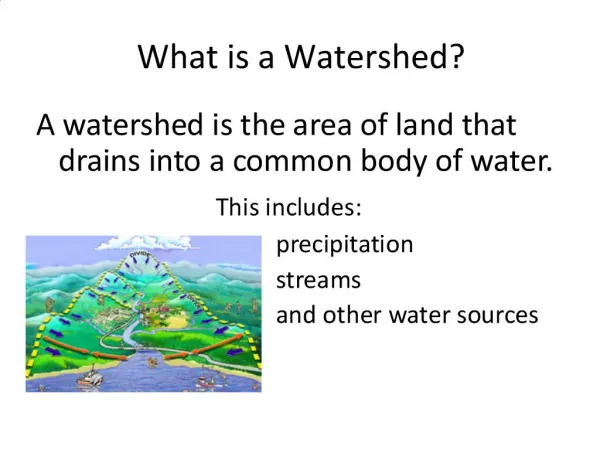
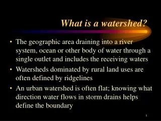
This study presents an I/O-efficient algorithm for watershed decomposition, utilizing the Pfafstetter labeling system to analyze vast terrain datasets. By efficiently identifying and labeling watersheds and their tributaries, such as rivers and interbasins, we can gain valuable insights into local and coastal watersheds. The algorithm is designed to match manually constructed decompositions, ensuring accuracy while handling modern, massive terrain data. Our approach enables better watershed queries and retrievals for user-specific locations, enhancing the potential for future applications in hydrology and environmental studies.

I/O-Efficient Pfafstetter Watershed Decomposition Algorithm for Terrain Analysis
E N D
Presentation Transcript
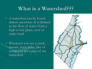
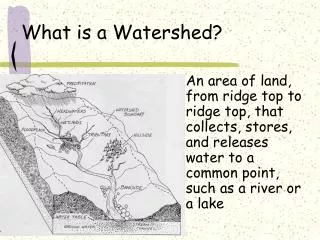
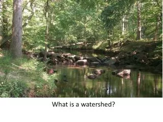
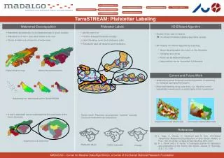
8 72 9 7 7 75 4 71 5 74 73 3 6 25 1 24 21 2 2 27 26 22 23 Watershed decomposition Digital elevation map Pfafstetter labels USGS (manually) Overlay • TerraSTREAM: Pfafstetter Labeling I/O-Efficient Algorithm Watershed Decomposition Pfafstetter Labels • Watershed decomposition is a fundamental task in terrain analysis • Watershed of a river = area which drains to the river • Terrain dividable into (hierarchy) of watersheds • A river’s watershed can be subdivided into the watersheds of the river‘s tributaries • Identify main river • Find the 4 largest tributaries (orange) • Label tributaries (even) and interbasins (odd) • Recursively label all tributaries and interbasins • “Sanity check”: Pfafstetter decomposition “matches” manually • constructed watershed decompositions • Modern terrain data is massive I/O-efficient Pfafstetter labeling algorithms needed • We develop I/O-efficient algorithm by exploiting • Terrain decomposable into rivers, i.e. into tributaries • Tributaries form a tree • Rivers can be labeled individually • Label prefixes can be “forwarded” to tributaries Current and Future Work • Watershed queries: Retrieval (and decomposition) of watershed for individual user-specified location • Meaningful labeling along coast lines, e.g., label the coastal watersheds independently or as tributaries of the “coastal river” Subdividing into Watersheds within TerraSTREAM + = Independent costal watersheds Connected coastal watersheds References References [1] L. Arge, A. Danner, H. Haverkortand N. Zeh. I/O-Efficient Hierarchical Watershed Decomposition of Grid Terrain Models. In Proc. 12th Intl. Symp. on Spatial Data Handling, SDH, 2007. [2] K. L. Verdin and J. P. Verdin. A topological system for delineation and codification of the Earth's river basins. Journal of Hydrology, 218, 1-12, 1999. Subdivision of a watershed MADALGO – Center for Massive Data Algorithmics, a Center of the Danish National Research Foundation