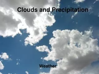
Clouds and Radiation
This overview examines the complex relationship between clouds and radiation, highlighting substantial uncertainties in decadal trends regarding cloudiness. The IPCC notes an increase in clouds and precipitation over land, excluding tropical regions. Key aspects include how clouds affect atmospheric heating and cooling, the role of different cloud types in radiative forcing, and the measurements used to assess cloud properties. The interplay between cloud composition, height, and surface temperature is essential for understanding climate dynamics.
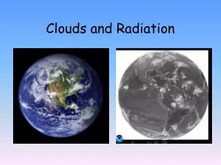

Clouds and Radiation
E N D
Presentation Transcript
Clouds and Radiation “..there are substantial uncertainties in decadal trends in all data sets and at present there is no clear consensus on changes in total cloudiness over decadal time scales.” IPCC-The Scientific Basis-Chapter 3, p. 277 An increase in both clouds and precipitation has occurred over many parts of the land surface (Dai et al., 1999, 2004a, 2006), although not in the tropics and subtropics (which dominate the global land mean; Section 3.3.2.2). IPCC-The Scientific Basis-Chapter 3, p. 279
IPCC WG1 AR4 Report Variability caused by model representations of clouds
How do Clouds Alter the State of the Atmospheric Column? Diabatic Heating Profiles • Latent Heating • Net column latent heating = Precipitation mass * L, where L = latent heat • Radiative Heating • Net column radiative heating= net incoming minus net outgoing • Profiles of diabatic heating impact atmospheric dynamic and thermodynamic structure
a cloud-free column SHORTWAVE λ=1-4 μm includes visible band S S ) S ) S
LONGWAVE λ > 4 μm /Cooling
Radiative Flux Divergence Primer • Radiative Flux Divergence = • net radiation into column - net radiation out of column • positive values imply heating • negative values imply cooling neg pos NET
SHORTWAVE • cirrus (ice clouds) • thin • wispy • semi-transparent • optically thin
SHORTWAVE • cumulus convection • and other optically thick • clouds • (liquid/mixed/ice) • base near surface • > 30% coverage • vertical development • layer clouds
Cirrus and Cumulus from the Space Shuttle Courtesy NASA CERES
LONGWAVE • cumulus convection • and other optically thick • clouds • (liquid/mixed/ice)
LONGWAVE • cirrus (ice clouds) • cold cloud tops
What Cloud Properties Change the Radiative Heating Rate Profile? • Hemispheric cloud coverage cloud • Optical thickness of individual clouds and layers • Height in the atmosphere • Layer coherence (or overlap) • Composition • Contain ice crystals, liquid water, or both? • Particle sizes? • Particle concentrations?
How Does the Location of Cloud Impact the Surface Temperature? High Clouds ~10-km Low Clouds ~2-km COOLING WARMING
What types of remote sensors do we use to make cloud measurements? • Vertically-Pointing Lasers (LIDARs) • measure the height of the lowest cloud base • below cloud concentrations of aerosol and water vapor • beam quickly disperses inside cloud • Cloud Radars • cloud location and microphysical composition • in-cloud updrafts, downdrafts, and turbulence • Microwave Radiometers • measure the total amount of liquid water in atmosphere • can’t determine location of liquid • no measure of ice water content
LidarData from Southern Great Plains 20-km No Signal 10-km Low Clouds Ice Clouds Surface time 7:00 pm 7:00 am 24 Hours 7:00 pm Negligible Return Cloud and Aerosol Particles Cloud droplets
Niamey, Niger, Africa • 20 Cloud Droplets • 15 Cloud and/or Aerosol Height (km) • 10 • LIQUID CLOUDS • 5 • Biomass Burning • Dust Negligible Return • 0 • 1200 • 0000 • 0000 Time (UTC)
3.2 mm cloud radars 8 mm UHF 10 cm VHF
Cloud Radar Wavelengths 8.0 mm 35 GHz 3.2 mm 95 GHz Maximum Propagation Distance 20-30 km 10-15 km
Cloud Radar Data from Southern Great Plains 20-km Black Dots: Laser Measurements Of Cloud Base Height 10-km Surface time 7:00 pm 7:00 am 7:00 pm Small Cloud Particles Typical Cloud Particles Very Light Precipitation
Evolution of Cloud Radar Science • Cloud Structure and Processes • Cloud Statistics • Cloud Composition diurnal variation in cloud fractional coverage and surface precipitation for June 2006 over Lamont, Oklahoma (Courtesy: Lynne DiPretore)
GFS cloud initialization data • mandatory radiosonde data • satellite retrievals of temperature • satellite-derived cloud motion vector • aircraft • cloud fraction parameterization: Xu and Randall (1996) • August • GFS 10-15 km cloud fraction larger than AMF • AMF 0-10 km cloud fraction larger than GFS Height (km) Cloud Fraction (%) Kollias, P, M.A. Miller, K.Johnson, M. Jensen, D. Troyan, 2008
Multiple remote sensors required to measure non- and weakly precipitating clouds Top Radar Echo Low Radar Sensitivity 10-km Base Radar Echo Top Base 2-km Emission Radar Echo Surface Microwave Radiometer Laser Radar
Liquid Cloud Particle Median Radius 6 4 Height (km) 2 0 time 7:00 pm 7:00 am 7:00 pm 25 17 1 4 10 Micrometers Miller and Johnson, 2003
June 12, 2006 Oklahoma CPL backscatter profiles and MAS comparison Matt McGill/NASA Goddard +37 km 0 -37 6 4 altitude (km) 2 0 19:53 time (UTC) 19:30 275 distance (km) 0
A-TRAIN CONSTELLATION The Afternoon or "A-Train" satellite constellation presently consists of 5 satellites Two additional satellites, OCO and Glory, were supposed to join the constellation OCO was lost during a launch failure on 2/24/2009. Glory is scheduled to launch (02/23/11) Approx equator crossing times
Aqua CALIPSO Aura Glory OCO-2? CloudSat PARASOL OMI - Cloud heights OMI & HIRLDS – Aerosols MLS& TES - H2O & temp profiles MLS & HIRDLS – Cirrus clouds CALIPSO- Aerosol and cloud heights Cloudsat - cloud droplets PARASOL - aerosol and cloud polarization Glory-aerosol size and chemistry MODIS/ CERES IR Properties of Clouds AIRS Temperature and H2O Sounding (Source: M. Schoeberl) Afternoon Constellation Coincidental Observations
Radar/Lidar Combined Product Development • Formation flying is a key design element in cloudsat • CloudSat has demonstrated formation flying as a practical observing strategy for EO. • Overlap of the CloudSat footprint and the CALIPSO footprint, within 15 seconds, is achieved >90% of the time.
A-Train Cloud Ice Microwave Limb Sounder ECMWF CloudSat
Visual Images of the Sky • cloud coverage (versus cloud fraction) • simple! digitize images and … • daytime only • integrated quantity
Lidar/Radar combined ice microphysics - new A-Train ice cloud microphysics Zhien Wang University of Wyoming