Download
1 / 47
680 likes | 1.16k Vues
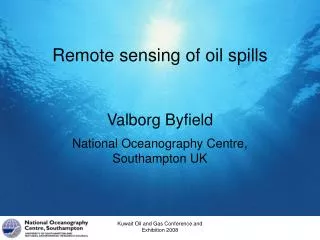
Remote sensing of oil spills. Valborg Byfield National Oceanography Centre, Southampton UK. Overview. Imaging mechanisms Sensors used and why / how they work Issues related to data interpretation. Summary of information requirements. Spill Response

E N D
Remote sensing of oil spills Valborg Byfield National Oceanography Centre, Southampton UK Kuwait Oil and Gas Conference and Exhibition 2008
Overview • Imaging mechanisms • Sensors used and why / how they work • Issues related to data interpretation Kuwait Oil and Gas Conference and Exhibition 2008
Summary of information requirements • Spill Response • Location, extent, thickness and type of surface oil • Location, extent and concentration of dispersed oil • Environmental information for trajectory models • Available in near-realtime (<4 hours) at least daily • Routine Monitoring • Positive identification • Location, extent and likely source • Available in near-realtime, as often as possible • Environmental Impact Assessment • Location, extent, volumes and ultimate fate • More accurate information, but not in real-time Kuwait Oil and Gas Conference and Exhibition 2008
Imaging mechanisms • What properties of oil allow us do distinguish spilt oil from clean water? • How do these properties affect the appearance of oil spills in data from different remote sensing instruments Kuwait Oil and Gas Conference and Exhibition 2008
Main radiative properties of oil • Higher refractive index at optical • Greater surface reflection; interference colours • Higher absorption coefficient • Absorption of light entering and leaving the water; absorbed solar energy heats the oil • Fluorescence induced by UV and blue light • Lower infrared emissiviity than water • Appears cooler at thermal wavelengths Kuwait Oil and Gas Conference and Exhibition 2008
Other key properties of oil • Higher viscosity than water • Damping of surface waves • Hydrophobic (does not mix easily with water) • Forms surface films or emulsions • Dispersed oil forms micelles that scatter light • Thermal isolation from underlying water means surface oil is relatively warmer after periods of solar heating. Kuwait Oil and Gas Conference and Exhibition 2008
Sensors used for oil detection • Active sensors - emit radiation (radar, lidar) • Synthetic aperture radar (SAR) • Laser fluorosensors (lidar) • Passive sensors • Sunlight main source of radiation • Ultra violet sensors • Optical (visible - near infrared sensors • Temperature dependent IR radiation main source • Thermal sensors measure infrared radiation emitted by the oil and surrounding water Kuwait Oil and Gas Conference and Exhibition 2008
Synthetic Aperture Radar (SAR) • Active microwae sensor • Can “see” through cloud • Very high resolution • < 25m in image mode, 75m in wide swath mode • Sensitive to ripples (10-30cm wavelength) • Smooth areas reflect less of the signal and appear dark in SAR images • Oil dampens surface ripples Kuwait Oil and Gas Conference and Exhibition 2008
The Microwave Spectrum Frequency (GHz) 0.3 1.0 3.0 10.0 30.0 100.0 100 30 10 3 1 0.3 BAND P L S C X K Q V W 0.39 1.55 3.9 5.75 10.9 36 46 56 Wavelength (cm) Kuwait Oil and Gas Conference and Exhibition 2008 NOC-LSO 10
Imaging geometry, coordinates Satellite orbital path Radar antenna Satellite ground track Azimuth direction Ground range direction Swath Kuwait Oil and Gas Conference and Exhibition 2008
Radar images of surface roughness Oblique oblique- viewing regular swell waves rough rough smooth smooth rough Bright represents strong backscatter, dark represents weak backscatter
The slick of the recent oil spill from the tanker Prestige off Galicia Envisat ASAR wide-swath mode 17 Nov, 2002 Kuwait Oil and Gas Conference and Exhibition 2008
Caught in the act ! ERS-117 Oct 1993 North of Sicily Kuwait Oil and Gas Conference and Exhibition 2008
Oil Seeps S.E. of Sicily in the Mediterranean ERS-1 image 26 May 1994 Kuwait Oil and Gas Conference and Exhibition 2008
An obvious dumping event Note the ABL signature of warm Kuroshio current ERS-1, 20th May 1994 Off the East coast of Taiwan Identifying this ship would need rapid airborne intervention Kuwait Oil and Gas Conference and Exhibition 2008
Another case of dumping or leaking N.E. of Sri Lanka Note the way the wind has blown the slick, spreading it to the N.E. from the ship track. N.B. the heavier oil is pushed ahead by the wind but the lighter fractions trail behind wind Kuwait Oil and Gas Conference and Exhibition 2008
Wind speed dependent detection • Ideally 3-7 m/s to detect oil • Low wind - no ripples to dampen • High wind - sea surface roughness sufficient to overcome wave-damping by oil Kuwait Oil and Gas Conference and Exhibition 2008
Visual observations • Thin surface oil (<400 nm) appear as silvery sheens Kuwait Oil and Gas Conference and Exhibition 2008
Interference fringes • Interference between light reflected from air-oil and oil-water interfaces • Colour varies with thickness in range 300-1000nm • Detectable by eye and high-resolution photos • Rarely seen in optical RS data due to pixel size and integration time Kuwait Oil and Gas Conference and Exhibition 2008
Visual observations (3) • Thick crude oil is brown or black due to selective absorption of blue-green light Kuwait Oil and Gas Conference and Exhibition 2008
Visible / Near Infrared Sensors • Measure upwelling radiance in a number of wave bands to give a colour spectrum • Airborne (e.g. CASI) • Resolution determined by altitude and aircraft speed (typically 2-10m pixels) • Satellite sensors • MODIS - daily overpasses • 2 bands at 250m resolution (red and NIR) • 5 bands at 500m resolution (blue-red) • MERIS - every 3 days, • Full resolution: 300 m at 15 waelengths • Cannot ‘see’ through cloud Kuwait Oil and Gas Conference and Exhibition 2008
Passive visible - NIR sensors Contributions to measured radiance Three main mechanisms behind oil-water optical contrast • Greater oil refractive index increased specular reflection • High oil absorption coefficient decreasing exponentially with wavelength • Solar induced fluorescence - extending into red and NIR for heavy crudes Kuwait Oil and Gas Conference and Exhibition 2008
Downwelling irradiance Ed : direct sunlight + sky radiance water-leaving radiance Lw backscattering bb absorption a fluorescence Kuwait Oil and Gas Conference and Exhibition 2008 scattering b Courtesy of S. Bernard, UCT
≈ Reflectance of pure water • Water-leaving radiance and reflectance depend on scattering and absorption Water absorbs strongly in the red Reflectance of pure water is strongest in the blue Water backscatters strongly in the blue Kuwait Oil and Gas Conference and Exhibition 2008
Additive absorption Kuwait Oil and Gas Conference and Exhibition 2008
Chl absorption max ~ 440nm blue green yellow red min ~ 550nm 400 500 600 700 Wavelength (nm) Phytoplankton Chlorophyll • Absorption: • characteristic • maximum and • minimum. • Reflectance • changes with increasing chlorophyll concentrations Kuwait Oil and Gas Conference and Exhibition 2008
Water radiance clear With YS l (nm) 400 500 600 700 blue green yellow red Yellow Substance YS absorption l (nm) • Dissolved organic matter - no extra scattering • YS absorption: maximum in the blue • Overall effect is to damp down radiance in the blue (so the water looks yellowish/brownish) 400 500 600 700 Kuwait Oil and Gas Conference and Exhibition 2008
Water reflectance turbid clear l (nm) 500 600 700 blue green yellow red Suspended Sediments (inorganic) • Sediment backscattering - varies approximately as 1/l: • Sediment absorption: approx. as an exponential • Overall effect is to increase radiance (thus water looks brighter) and shift radiance maximum away from blue 400 Kuwait Oil and Gas Conference and Exhibition 2008
Oil absorption coefficients Kuwait Oil and Gas Conference and Exhibition 2008
Thickness of surface oil Tank experiments with light crude oil show a clear relationship between spectral signature and oil thickness in the range ~2-500m, mainly due to absorption in the region of the water reflectance peak. Kuwait Oil and Gas Conference and Exhibition 2008
Effects of oil spectral absorption • Absorption within the oil layer reduces both downwelling radiance into the water and water-leaving radiance • Absorption is strongest in the blue, and weaker in the NIR - making oil look red in false colour composites that map NIR to red • In bands where water-leaving radiance is high water-leaving radiance is negatively correlated with film thickness • Absorption and scattering contribute to changes in water reflectance where dispersed oil is present Kuwait Oil and Gas Conference and Exhibition 2008
Refractive index Oil-water difference in surface reflection • Oil refractive index ranges from 1.47 (light crude) to 1.55 (HFO), higher than water at ~ 1.33 • Surface reflection of sky radiance makes oil brighter than water in bands with negligible water-leaving radiance. • CASI NIR bands good for detecting surface oil ~2m +. Kuwait Oil and Gas Conference and Exhibition 2008
Wave damping effects • Wave-damping also important in Vis/NIR images • Rougher surface increases effective viewing angle, , and increases sky and sun-glint • Surface films give smoother surface, lower effective , less glint, and thus appear darker • Best film-water contrast near swath edges and in sun-glint region Surface films in a rip current region Courtesy of J. daSilva, University of Lisbon Kuwait Oil and Gas Conference and Exhibition 2008
Oil fluorescence • Oil fluorescence is excited by strong light at UV and blue wavelengths • Different oils have different emission spectra • Reabsorption of emitted light creates a red-shift for thicker films and high concentrations of dispersed oil. • Mechanism behind oil spill monitoring using lidar • Solar induced fluorescence contributes to oil-water contrast for passive Vis/NIR sensors Kuwait Oil and Gas Conference and Exhibition 2008
Detecting dispersed oil • Only possible using optical sensors, as water is opaque to UV, IR and MW • Suspended sediment may give similar high backscatter to oil micelles • Spectral absorption by CDOM may resemble oil • Knowledge of background conditions essential • Resuspension of sediment by tidal currents and wave action • River plumes with high SPM • Seasonal plankton blooms Kuwait Oil and Gas Conference and Exhibition 2008
Passive optical sensors - summary • Optical detection mechanisms • High oil absorption coefficient selectively removes blue and green light from water-leaving radiance • Higher oil refractive index increases surface reflection relative to water • Solar induced fluorescence increases signal near fluorescence emission peak • Wave-damping • Different signal contribution from sun-glint • Different sky-glint contribution (spectral and intensity) Kuwait Oil and Gas Conference and Exhibition 2008
Ultraviolet video / line scanners • Thin oil brighter than surrounding water due to higher refractive index • Thicker oil increasingly bright due to oil fluorescence • UV radiation absorbed by the atmosphere > only suitable for airborne remote sensing Kuwait Oil and Gas Conference and Exhibition 2008
Laser fluorosensors / lidar • Active remote sensing from aircraft only • UV or blue laser induces oil fluorescence • Emission from oil measured at a number of wavelengths to give an emission spectrum • Can determine broad oil types and relative thickness of surface oil • Some ability to detect dispersed oil Kuwait Oil and Gas Conference and Exhibition 2008
Thermal infrared sensors • Measures thermal radiation from oil and surrounding water • Radiation a function of temperature and emissivity • Oil has lower emissivity than water • Appears cooler when the temperature is the same • Thick oil absorbs sunlight • Heats up to become warmer than surrounding water • Thicker oil absorbs more light and retains heat better than thin oil • Brighter when temperature sufficient to overcome effect of lower emissivity Kuwait Oil and Gas Conference and Exhibition 2008
Thermal infrared sensors (2) • Spatial resolution • 2-10 m pixel size for detection and thickness estimates • Greater resolution averages across thick and thin films, reducing detectability • Airborne sensors in common use • Thermal video and line scanners • Thermal band with optical sensors • Satellite remote sensing • AVHRR, AATSR, MODIS • 1k resolution insufficient for oil detection and thickness estimates • SST useful as tracer for currents/fronts • Aid interpretation of airborne data Kuwait Oil and Gas Conference and Exhibition 2008
Summary of sensors used in oil spill monitoring 1) Extent can be determined easily for scanners where pixels are geo-referenced, less easily for video. 2) Approximate thickness range depends on oil type, degree of emulsification and environmental parameters. Kuwait Oil and Gas Conference and Exhibition 2008
Platform choice: aircraft or satellite? • Requirements of the application • Characteristics of the location • Spatial resolution / overview • Temporal resolution / duration • Flexibility in space / time • Post acquisition processing • Speed of data delivery • Constraints • Cost and availability • Of satellite data • Of aircraft and suitable instruments • Geographical constraints (distance) • Weather constraints (cloud, wind, rain) • What combination of airborne and satellite data would be optimal given your requirements and constraints? Kuwait Oil and Gas Conference and Exhibition 2008
MW Opt. TIR Atmospheric absorption • Radiance lost between sea and sensor • Radiation absorbed by • atmospheric gases: O2, CO2, H2O, CH4, NO2 • Aerosols: water droplets, dust • RS bands chosen in ‘atmospheric windows’ Wavelengths with low absorption (high transmittance) Kuwait Oil and Gas Conference and Exhibition 2008
Spatial resolution v overview? • Satellite data give spatial overview • Best suited for studies of pheno-mena with a spatial scale of 10km + • Aircraft spatial resolution ranges from 1m pixels to 10km swath width (20 000 feet altitude) • Suitable for studies where a resolution (pixel size) of 20m or better is necessary Kuwait Oil and Gas Conference and Exhibition 2008
Temporal resolution v duration • Satellite data give temporal overview and long time series • Orbit repeat times and cloud cover may limit temporal resolution • Best suited for studies of temporal scales of weeks to years • Aircraft can fly over an area many times in an hour • Suitable for studying phenomena that evolve over hours Kuwait Oil and Gas Conference and Exhibition 2008
Combination of both RS types Aircraft: • Study of small-scale rapidly evolving processes of short duration, e.g. estuarine and coastal processes, rivers and lakes Satellite: • Study of larger scale processes of longer duration e.g. shelf-seas to basin-scale. Combined aircraft and satellite • Provides spatial and temporal overview and resolution • Use satellite data to provide background and context for analysis of airborne data Kuwait Oil and Gas Conference and Exhibition 2008
Aircraft Availability of aircraft only if campaigns booked in advance High cost of airborne campaigns Locations limited to regions within aircraft range Overflights can be planned for optimal viewing configurations Strong winds or fog may prevent flights, turbulence problematic for geo-referencing Flights underneath cloud if conditions require this Satellite Multisensor data available on-line for scientific studies Cost low for scientific use Covers most areas of the globe during orbtial cycle Fixed orbits and overpass times limit flexibility Satellite coverage is independent of weather, (subject to cloud cover) IR and optical sensors limited by clouds Flexibility, availability, constraints Kuwait Oil and Gas Conference and Exhibition 2008