Download
1 / 24
270 likes | 867 Vues
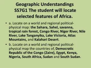
Geographic Understandings SS7G1 The student will locate selected features of Africa. .

E N D
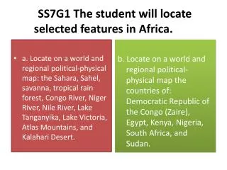
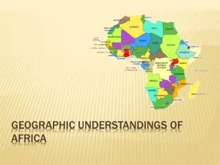
Geographic Understandings SS7G1 The student will locate selected features of Africa. • a. Locate on a world and regional political-physical map: the Sahara, Sahel, savanna, tropical rain forest, Congo River, Niger River, Nile River, Lake Tanganyika, Lake Victoria, Atlas Mountains, and Kalahari Desert. • b. Locate on a world and regional political-physical map the countries of, Democratic Republic of the Congo (Zaire), Egypt, Kenya, Nigeria, South Africa, Sudan and South Sudan.
the Sahara, Sahel, savanna, tropical rain forest, Congo River, Niger River, Nile River, Lake Tanganyika, Lake Victoria, Atlas Mountains, and Kalahari Desert ^^^Atlas ^^^Mountains ^^^^^^ Sahara Sahel Savanna Tropical Rain Forest Savanna Tropical Rain Forest Lake Victoria Desert Semi desert Savanna Savanna grassland Forest Tropical Rain Forest Montage forest East Africa Coastal Forest Mediterranean Mountain Grassland Savanna Kalahari Desert
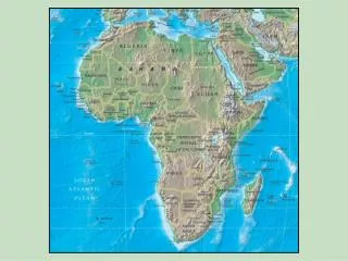
Sahara: “Great Desert” or world largest hot desert, which covers Africa from the Mediterranean to Sahel region of Africa and from the Atlantic to Red Sea. It is larger than the USA or China.
The Kalahari Desert is a large Desert in South Africa, Botswana and Namibia. Like the Sahara little grows there.
The Atlas Mountains are a large Mountain Range in North Africa. These Mountains divide the Mediterranean Sea from the Sahara.
The Nile River starts in the Savannas of East Africa and runs North through Sudan and Egypt and the Sahara Desert to reach the Mediterranean Sea. It is the longest river in the world and a life source for people in this area.
The “Green Line” is referred to as a line in the Sahara desert where the desert ends and farm land begins. This is an image from space that shows the Nile “Green Line.”
Sahel: the “shore” or beltway is a semi-tropical region of semi-arid land that boarders the Sahara from the Red Sea to the Atlantic Ocean.
Deforestation, or loss of trees and plants, is one of the major causes of Desertification in the Sahel. Desertification, or when land that was once productive (farmland, grassland, shrub) becomes Desert is a major issue in the Sahel Zone.
Cause of Environmental Decline in Africa • Results in • Desertification in • Savanna • Sahel • Rain Forest Overpopulation Climatic Change = Natural plants can survive variation in rainfall better than imported crops Over cultivation = too much farming or planting the wrong plants Deforestation = removal of trees. Cause erosion and drought. Overgrazing= too much herding. Main livelihood in Sahel and Savanna
Droughts, or long periods of little or no rainfall are more and more common in the Sahel. • Droughts lead to Desertification and Deforestation. • Droughts can also cause Famine, or periods of starvation, for the people in Africa.
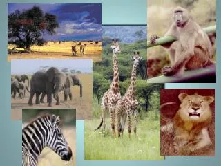
Savanna: is an area of vast grassland. 65% of Africa! Many of the famous African animals, giraffe, lions, zebra, elephants, etc., are found in the Savannas of Africa. The savanna’s are south of the Sahara and Sahel.
Lake Tanganyika, in East Africa, is the largest lake in Africa by volume and the second largest in the world. It is extremely deep and drains into the Congo River. Lake Victoria, also in East Africa, is the largest lake in Africa by surface area. Both provide an important life source for the people of the area.
Lake Victoria Lake Tanganyika
Tropical Rainforests, normally along the equator, are found in Central Africa. These are hot and humid climates, with lot’s of rainfall. Trees are hundreds of feet tall and millions of animals and plants co-exist.
African Rivers Nile River: Ethiopia, Sudan, Egypt • Longest river in the world • Used for transportation and irrigation • Most Egyptians live along its banks Niger River: Sahel, Nigeria • Transportation route • “Oil Delta” rich in petroleum • Silt enriches soil for farming Congo River: Democratic Republic of the Congo • Irrigation & fishing • Transportation to interior of Africa • Timber from rainforest • People use to search for work Niger River Nile River Congo River
Nile River Niger River Congo River
Water Maters Limited water in many parts of Africa • Growing population • Little clean water Pollution • Factories • Built to improve economy • Factory wastes flushed into streams and rivers • Human waste • Animal waste • Bacterial pollution • Hot climate makes it easy for bacteria and parasites to survive
the Sahara, Sahel, savanna, tropical rain forest, Congo River, Niger River, Nile River, Lake Tanganyika, Lake Victoria, Atlas Mountains, and Kalahari Desert ^^^Atlas ^^^Mountains ^^^^^^ Sahara Sahel Savanna Tropical Rain Forest Savanna Tropical Rain Forest Lake Victoria Desert Semi desert Savanna Savanna grassland Forest Tropical Rain Forest Montage forest East Africa Coastal Forest Mediterranean Mountain Grassland Savanna-with trees Savanna Kalahari Desert