Download
1 / 25
280 likes | 1.04k Vues
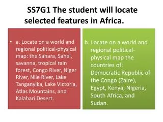
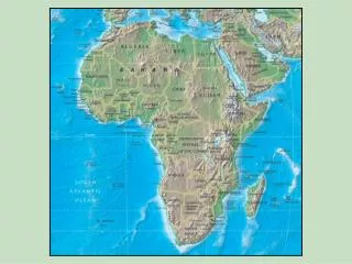
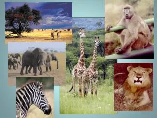
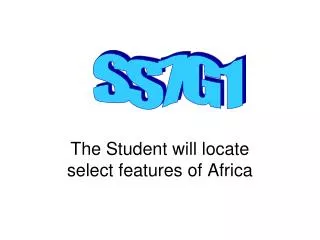
SS7G1. The Student will locate select features of Africa. Locate the following physical features on your maps: Sahara Desert Sahel Savanna Atlas Mountains Congo River Niger River Nile River Lake Victoria Kalahari Desert Lake Tanganyika Cape of Good Hope.

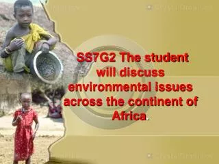
E N D
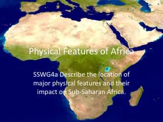
SS7G1 The Student will locate select features of Africa
Locate the following physical features on your maps: Sahara Desert Sahel Savanna Atlas Mountains Congo River Niger River Nile River Lake Victoria Kalahari Desert Lake Tanganyika Cape of Good Hope Savanna Niger River Savanna Savanna Lake Tanganyika
Sahara Desert It covers almost one-third of the continent and stretches from the Atlantic Ocean to the Red Sea. World’s Largest Desert It divides the continent into two regions: Arab North Africa and Black African Sub-Saharan Africa
Kalahari Desert The kalahari covers over 100,000 square miles of southwestern Africa. It gets around 10 inches of rain a year and has very hot summers. Grass, shrubs, and a number of wild animals are able to survive in the Kalahari because of an underground supply of water.
Savannas A savanna is a rolling grassland scattered with shrubs and isolated trees. Not enough rain falls on a savanna to support forests. Savannas are also known as tropical grasslands. They are found in a wide band on either side of the equator on the edges of tropical rainforests. Serengeti Although the soil in the savanna is very rich, there is no farming because of disease carrying insects like the tsetse fly and black fly.
The Sahel is a belt of dry grassland that borders the southern edge of the Sahara Desert. This semi-arid region is sparsely vegetated area and receives an average of four to eight inches of rainfall per year during its July to September monsoon season Desertification – the process of once fertile farm land turning into desert. In the 1970’s, drought caused mass starvation. More than 1,000,000 people died. Many farmers moved to cities. The desert gradually took over abandoned farms. Termite mound in the Sahel during the dry season
Rainforests The Congo Basin holds the world’s second largest rainforest and represents 70% of the African continent's plant cover. A tropical rainforest is a forest close to the equator, averaging over 70 inches of rain a year, with dense vegetation. The Congo is one of the world's most threatened ecosystems. Commercial logging, clearing for subsistence agriculture, and warfare has devastated the forest, displaced people, and resulted in the expansion of the "bushmeat" trade. Since the 1980s, Africa has had the highest deforestation rates of any region on the globe.
Lake Victoria is the largest lake in Africa and the second largest freshwater lake in the world (Lake Superior is larger). Lake Victoria The longest river in the world (The Nile River) originates from Lake Victoria as the White Nile.
Lake Tanganyika Lake Tanganyika is an African Great Lake. It is estimated to be the second largest freshwater lake in the world by volume, and the second deepest, after Lake Baikal in Siberia. The water flows into the Congo River system and ultimately into the Atlantic Ocean.
Nile River At over 4,000 miles in length, the Nile is the longest river in the world. go Most of Africa’s fertile farm lands lie along the Nile. It has been a source of fresh water for people, animals and crops, and an important trade route for thousands of years.
Congo River The second longest river in Africa (after the Nile). The Congo (also known as the Zaire River) is the most powerful river in Africa. People use the river for fishing and travel. Zaire Hydroelectric power obtained from the river powers most of Central Africa.
Niger River The Niger is the third-longest river in Africa, exceeded only by the Nile and the Congo River (also known as the Zaire River). The river floods during the annual rainy season creating freshwater marshlands, where people grow rice and fish. The Niger Delta contains rich supplies of oil, providing Nigeria with most of its annual income.
Atlas Mountains Located on the northwest corner of the continent, the Atlas Mountains run through Morocco, Algeria, and Tunisia. This range separates the Mediterranean and Atlantic coast lines from the Sahara.
Locate and label on your political map, the following countries: South Africa Egypt Kenya Sudan Nigeria Democratic Republic of Congo (Zaire)
Currency = Rand (ZAR) South Africa Dutch traders landed at the southern tip of modern day South Africa in 1652 and established a stopover point on the spice route between the Netherlands and the East, founding the city of Cape Town. South Africa has three capitals – Pretoria (executive), Bloemfontein (judicial), and Cape Town (legislative) and eleven official languages. The largest city is Johannesburg.
Egypt Currency = Egyptian pound (EGP) The capital of Egypt is Cairo. The official language is Arabic. Egypt is one of the most populous countries in Africa and the Middle East. The majority live near the banks of the Nile River. The first kingdom was founded around 3150 BC by King Menses, giving rise to a series of dynasties that ruled Egypt for the next three thousand years.
Kenya Currency = Kenyan Shilling (KES) The Capital of Kenya is Nairobi. They have two official languages, English and Swahili. In 1984 a skeleton was discovered at Lake Turkana of a boy belonging to Homo erectus from 1.6 million years ago.
Sudan Currency = Pound The capital of Sudan is Khartoum. They have two official languages, Arabic and English. It is the largest country in Africa and in the Arab World. It is ranked as the second most politically unstable country in the world. Sudan's modern history has been plagued by civil wars stemming from ethnic, religious, and economic conflict between the Muslim Northern Sudanese, and the Christian of Southern Sudan. Refugees waiting for water – Darfur, Sudan
Nigeria Currency = Nigerian naira (₦) (NGN) The capital of Nigeria is Abuja. The largest city is Lagos. Nigeria has 4 official languages, English, Hausa, Igbo, and Yoruba. Nigeria is the most populated country in Africa. Students in Nigeria
Democratic Republic of Congo (Zaire) Currency - Congolese franc (CDF) The capital of DRC is Kinshasa. The official language is French. An unstable nation, local fighting has killed more than 4 million people. Their economy depends on the diamond industry. Many laborers only make a dollar a day. The Congo rainforest is home to the mountain gorilla.
Lets take a Quiz! • http://staff.harrisonburg.k12.va.us/~cwalton/mapquizafrica.htm
The End Created by Debra Harrington Yeager Middle School 2009
References • http://www.swindsor.k12.ct.us/Schools/tems/teachers/swierczynski/sahara_files/SAHARAmap.gif • http://www.worldatlas.com/webimage/countrys/afnewlnd.gif • http://www.naturalhistoryonthenet.com/Continents/images/africaregions.jpg • http://staff.harrisonburg.k12.va.us/~cwalton/mapquizafrica.htm • http://grabstein.co.za/Graphics/kalahari.jpg • http://www.esrl.noaa.gov/news/2005/sahel/sahel_map.gif • http://static.howstuffworks.com/gif/nile-river-2.jpg • http://www.blueplanetbiomes.org/savanna.htm • http://www.geography-site.co.uk/pages/countries/atlas/maps/congo_dr.gif • http://www.rhinocarhire.com/getfile/67dd0251-003f-4aca-8a67-bfa219b77d30/South-Africa.aspx • https://www.cia.gov/library/publications/the-world-factbook/geos/SF.html • http://keithaharmon.files.wordpress.com/2009/05/pyramids.jpg • http://images.google.com/imgres?imgurl=http://muller.lbl.gov/travel_photos/africawildlifefolder/AfricaWildlifeFolder-Images/14.jpg&imgrefurl=http://muller.lbl.gov/travel_photos/africawildlifefolder/africawildlifefolder-pages/Image14.html&usg=__IFdFLRW_UpDaS4eke9_sTIsybZg=&h=600&w=800&sz=436&hl=en&start=18&um=1&tbnid=UQafjMpFERYU2M:&tbnh=107&tbnw=143&prev=/images%3Fq%3Dmountan%2Bgorilla%26hl%3Den%26um%3D1 • http://www.trekhireuk.com/assets/morocco-toubkal/toubkal-lunch.jpg