Download

1 / 65
650 likes | 1.69k Vues
Incorporating Google Maps and Google Earth into your Remote Sensing Applications J. Freemantle OARS Technical Meeting, Dec 11, 2006 Outline Overview of Google Earth Simple examples using keyhole markup language (kml) Using the Google Maps/Earth API Some community examples Questions?

E N D
Incorporating Google Maps and Google Earth into your Remote Sensing Applications J. Freemantle OARS Technical Meeting, Dec 11, 2006
Outline • Overview of Google Earth • Simple examples using keyhole markup language (kml) • Using the Google Maps/Earth API • Some community examples • Questions?
Google Earth • Client/Server Application • Free for basic version • Works on Windows (2000/XP), Mac OS 10.3.9, Linux
Google Earth Overview • Satellite and Airborne Imagery 1-3 years old • Spatial resolution in countryside < 15 m. Major US cities less than 1-2 feet (20-40 cm). • Parts of Manhattan (Fulton Co.) 10 cm!
Why Google? • Its free!!! • Generally up to date • Large user community • Developer/programmer friendly • Easy to learn • Platform independent • Its cool!
Assumptions/Caveats • Check the fine print of End User License (EUL) for your situation. • Google Earth 4.0 (Beta), free version. • Public/Private data? (choose wisely).
Simple Examples using KML • Point • Pictures • Tracks • Overlays • Links to external data
Keyhole Markup Language (kml) • Xml grammar and file format for describing geographic features in google earth/maps • Points • Lines • Polygons • Models • links
Keyhole Markup Language (KML) • KML files can be shared. • KMZ files are a compressed version of KML files. • Google Earth processes kml files like web browsers process html files.
Kml example: Simple point <?xml version="1.0" encoding="UTF-8"?> <kml xmlns="http://earth.google.com/kml/2.0"> <Placemark> <name>OARS Meeting</name> <description><![CDATA[Incorporating Google Maps and Google Earth into your Remote Sensing Applications <br> Presented by Jim Freemantle <br>Dec 11, 2006 7:00 pm <br> Room 129 Chemistry Building, York University, Toronto. <br>]]></description> <Point id="khPoint616"> <coordinates>-79.508,43.773225,0</coordinates> </Point> </Placemark> </kml>
Simple point, with link <?xml version="1.0" encoding="UTF-8"?> <kml xmlns="http://earth.google.com/kml/2.0"> <Placemark> <name>OARS Meeting</name> <description><![CDATA[Incorporating Google Maps and Google Earth into your Remote Sensing Applications <br> <a href=“http://www.oars.on.ca/meetings.php”> details </a> <br>]]></description> <Point id="khPoint616"> <coordinates>-79.508,43.773225,0</coordinates> </Point> </Placemark> </kml>
Simple point, with image <?xml version="1.0" encoding="UTF-8"?> <kml xmlns="http://earth.google.com/kml/2.0"> <Placemark> <name>OARS Meeting</name> <description><![CDATA[Incorporating Google Maps and Google Earth into your Remote Sensing Applications <br> <a href=“http://www.oars.on.ca/meetings.php”> details </a> <br> <img src="c:/documents and settings/user/my documents/my pictures/jim_pic.jpg"/>]]></description> <Point id="khPoint616"> <coordinates>-79.508,43.773225,0</coordinates> </Point> </Placemark> </kml>
Track <?xml version="1.0" encoding="UTF-8"?> <kml xmlns="http://earth.google.com/kml/2.0"> <Document> <name>t0490f13</name> <Placemark> <name>t0490f13</name> <description><![CDATA[Flight Line 13 tape 490 CASI 2001 <br>]]></description> <LineString> <coordinates>-68.8911,48.79734,2470.74 -68.8947,48.79449,2471.35 </coordinates> <coordinates> -68.9127, 48.78028,2466.96,-68.9164,48.77747,2469.82 </coordinates> </LineString> </Placemark> </Document> </kml>
GeoTagging • Requirements • GPS device • Camera with EXIF format jpg files and internal clock • Software to sync gps track with time of photo • Software to create google earth file (.kml)
GeoTagging • GPS Devices Used Garmin Forerunner 201 Runners GPS ($159.00) Sony GPS-SC1 ($129.00)
GeoTagging • Software Used • GPSBabel (NMEA to GPX) • GPS Image Tracker (Sony) (Not required) • iTag
Overlays • Getting your georeferenced data into Google Earth • Need georeferenced data • Manually imported, as a jpg image, and matched to Google Earth
Links • Images • External websites via url • Databases
Track with link <?xml version="1.0" encoding="UTF-8"?> <kml xmlns="http://earth.google.com/kml/2.0"> <Document> <name>t0489f06</name> <Placemark> <name>t0489f06</name> <description><![CDATA[Flight Line 06 tape 489 CASI 2001 <br> <a href="http://www.aerocan.net/tapedb.xml#489"> Link to Flight Log </a> <br>]]></description> <LineString> <coordinates>-68.8911,48.79734,2470.74 -68.8947,48.79449,2471.35 </coordinates> <coordinates> -68.9127, 48.78028,2466.96,-68.9164,48.77747,2469.82 </coordinates> </LineString> </Placemark> </Document> </kml>
Point with link <?xml version="1.0" encoding="UTF-8"?> <kml xmlns="http://earth.google.com/kml/2.0"> <Placemark> <name>Waskesiu</name> <description><![CDATA[Aeronet Sites Worldwide <br><a href="http://aeronet.gsfc.nasa.gov/cgi-bin/ type_one_station_opera_v2_new?site=Waskesiu&nachal=2&aero_water=0&level=1 &if_day=0&year_or_month=0">Link to Waskesiu data</a><br>]]></description> <Point id="khPoint616"> <coordinates>-106.083,53.916698,550</coordinates> </Point> </Placemark> </kml>
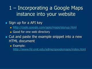
Google Earth/Map Application Programmer Interface (API) • Sign up for your key • Can be used only on requested web accessible directory eg. http://www.example.com/gmaps • Receive example script and put it in that directory • Build Google Map applications from there
<!DOCTYPE html PUBLIC "-//W3C//DTD XHTML 1.0 Strict//EN" "http://www.w3.org/TR/xhtml1/DTD/xhtml1-strict.dtd"> <html xmlns="http://www.w3.org/1999/xhtml"> <head> <meta http-equiv="content-type" content="text/html; charset=utf-8"/> <title>Jim's Google Maps JavaScript API Example from M. Brown</title> <script src="http://maps.google.com/maps?file=api&v=2&key=xxx" type="text/javascript"></script> <script type="text/javascript"> //<![CDATA[ var largemapcontrol = new GLargeMapControl(); function load() { if (GBrowserIsCompatible()) { var map = new GMap(document.getElementById("map")); GEvent.addListener(map,'click',function(overlay,point) { var latLngStr = '(' + point.x + ', '+ point.y + ')<br/>'; var message = document.getElementById("message"); message.innerHTML = latLngStr; }); map.centerAndZoom(new GPoint(-79.505, 43.77382), 4); map.addControl(largemapcontrol); } } //]]> </script> </head> <body onload="load()" onunload="GUnload()"> <div id="map" style="width: 500px; height: 300px"></div> <div id="message"></div> </body> </html>
Google Earth API • Link to dynamically generated kml • No API key required • See http://earth.google.com/kml/kml_tut.html#tracking_point
Google Earth Example <?php // get the time $timesnap = date("H:i:s"); $BOX=$_GET[BBOX]; // split the client's BBOX return by commas and spaces to obtain an array of coordinates $coords = preg_split('/,|\s/', $BOX); // for clarity, place each coordinate into a clearly marked bottom_left or top_right variable $bl_lon = $coords[0]; $bl_lat = $coords[1]; $tr_lon = $coords[2]; $tr_lat = $coords[3]; // calculate the approx center of the view -- note that this is innaccurate if the user is not looking straight down $userlon = (($coords[2] - $coords[0])/2) + $coords[0]; $userlat = (($coords[3] - $coords[1])/2) + $coords[1]; $response = '<?xml version="1.0" encoding="UTF-8"?>'; $response .= '<kml xmlns="http://earth.google.com/kml/2.0">'; $response .= '<Placemark>'; $response .= '<name>'.$timesnap.'</name>'; $response .= '<Point>'; $response .= "<coordinates>$userlon,$userlat,0</coordinates>"; $response .= '</Point>'; $response .= '</Placemark>'; $response .= '</kml>'; echo $response; ?>