Mid-Latitude Cyclones: Vertical Structure
Mid-Latitude Cyclones: Vertical Structure. Lecture 13 CASE STUDY DUE NEXT WEEK!. Review. Extratropical cyclones generally first develop along an intersection of two airmasses (like a stationary front)

Mid-Latitude Cyclones: Vertical Structure
E N D
Presentation Transcript
Mid-Latitude Cyclones: Vertical Structure Lecture 13 CASE STUDY DUE NEXT WEEK!
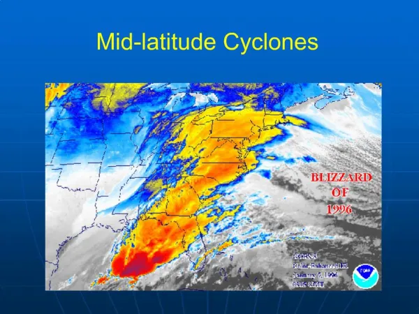
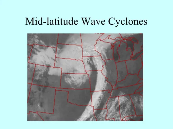
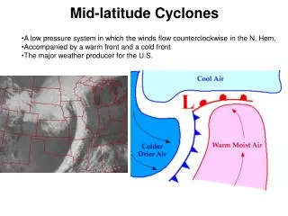
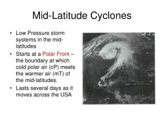
Review • Extratropical cyclones generally first develop along an intersection of two airmasses (like a stationary front) • As the cyclone develops, warm and cold fronts form, and the cold front slowly approaches the warm front • Once an occluded from forms, the cyclone is normally at its most intense, and will begin to weaken afterward • This is because it is no longer near a region of a horizontal temperature gradient (which is why it developed in the first place)
Review Continued • Finding fronts on weather maps is very useful • It is often useful to first find the area of lowest pressure, since fronts typically originate from it • In the case of most fronts (except occluded fronts), there should be a large temperature change across them • All fronts should also have a fairly sharp wind shift from one side to another • Other factors, like precipitation, cloud cover, and moisture gradients can indicate a front
Review Continued • Last week, we discussed the surface structure of mid-latitude cyclones which are crucial in maintaining a temperature equilibrium on our planet. • We know that the winds move counter-clockwise and converge around a surface low low pressure center (this is because of thefrictional forceat the surface) • This Convergence/Divergence suggests that there must be movement of air in the vertical (continuity of mass) • Also, the flow in the upper troposphere is generally ingeostrophic balance, so there is no friction forcing convergence/divergence.
Upper Levels Ridge Trough Ridge
Vorticity Vorticity is simply a measure of how much the air rotates on a horizontal surface Positive vorticity is a counterclockwise (i.e. cyclonic) rotation Negative vorticity is a clockwise (i.e. anticyclonic) rotation Therefore, troughs contain positive vorticity, and ridges contain negative vorticity Trough Ridge
Let’s Revisit … Vorticity < 0 Vorticity < 0 Vorticity > 0
Negative vorticity advection Positive vorticity advection
Vorticity Advection and Vertical Motion * Positive vorticity advection (PVA) results indivergenceat the level of advection * Negative vorticity advection (NVA) results inconvergenceat the level of advection
Vorticity Advection and Vertical Motion Remember thatconvergenceat upper levels is associated with downward vertical motion (subsidence), anddivergenceat upper levels is associated with upward vertical motion (ascent). Then, we can make the important argument that . . .
Upper Tropospheric Flow and Convergence/Divergence • Downstream of an upper tropospheric ridge, there is convergence, resulting in subsidence (downward motion). • Likewise, downstream of an upper tropospheric trough, there is divergence, resulting in ascent (upward motion).
Upper Tropospheric Flow and Convergence/Divergence • Downstream of an upper tropospheric ridge axis is a favored location for asurface high pressure, and of course, downstream of an upper tropospheric trough axis is a favored location for asurface low pressurecenter.
Upper Tropospheric Flow and Convergence/Divergence • Surface cyclones also move in the direction of the upper tropospheric flow! • The surface low pressure center in the diagram above will track to the northeast along the upper level flow
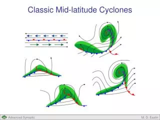
Vertical Structure of Cyclones • What else do these diagrams tell us? • Because the surface cyclone is downstream from the upper tropospheric (~500 mb) trough axis, mid-latitude cyclones generally tilt westward with height!
Vertical Structure of Cyclones To the right is another depiction illustrating the same point: 500 mb positive vorticity advection results in divergence and ascent, inducing a surface cyclone.
Cyclone Growth And Decay • Based on what we’ve learned, the position of the surface cyclone in relation to the upper level structure is key to development • A cyclone will grow if it is below an area of PVA, and weaken if below an area of NVA • Commonly, a cyclone will intensify until it becomes situated in an unfavorable location in relation to the upper levels
An Example:Time 1 Above: Upper Level Height and Wind Speed Right: Surface Pressure
An Example:Time 1 Above: Upper Level Height and Wind Speed Right: Surface Pressure
Time 2 Above: Upper Level Height and Wind Speed Right: Surface Pressure
Time 2 Above: Upper Level Height and Wind Speed Right: Surface Pressure
Time 3 Above: Upper Level Height and Wind Speed Right: Surface Pressure
Time 3 Above: Upper Level Height and Wind Speed Right: Surface Pressure
Summary of Event • At time 1, the upper levels and lower levels are perfectly set up for the surface cyclone to intensify • At time 2, the upper trough is almost above the surface cyclone, so the intensification slows • By time 3, the upper trough is exactly over the surface cyclone, so the intensification has halted
Cyclone Decay • Recall that due to friction, air blows across isobars near the surface • This means that the air is always converging at the center of low pressure areas • Therefore, unless there is at least enough divergence at upper levels to counteract the convergence at low levels, the surface cyclone will weaken because more mass will be added to the air column • This will force the surface pressure to rise
Cyclone Intensification/Weakening • How do we know if the surface cyclone will intensify or weaken? • Ifupper tropospheric divergence>surface convergence, the cyclone will intensify (the low pressure will become lower) • Ifsurface convergence>upper tropospheric divergence, the cyclone will weaken, or “fill.” • Think of an intensifying cyclone as exporting mass, and a weakening cyclone as importing mass.