Download
1 / 18
180 likes | 469 Vues
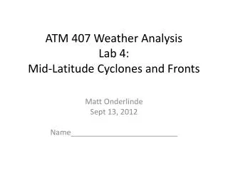
ATM 407 Weather Analysis Lab 4: Mid-Latitude Cyclones and Fronts. Matt Onderlinde Sept 13, 2012 Name_________________________. Key Concepts of Lab 4.

E N D
ATM 407 Weather AnalysisLab 4:Mid-Latitude Cyclones and Fronts Matt Onderlinde Sept 13, 2012 Name_________________________
Key Concepts of Lab 4 1) The mid and upper level (~500 - 250 mb) flow plays a critical role in the development of surface cyclones. - The surface cyclone can then feedback and influence the upper flow. - Upper divergence typically precedes surface cyclogenesis. - Low level temperature advection affects the upper level height pattern by altering the thickness of the atmospheric column. - The vertical alignment of the surface low and the upper trough impacts the deepening (or weakening) of the surface low. Vertical phase lines of low pressure tilt westward for intensify systems..
Key Concepts of Lab 4 2) Positive vorticity advection above the level of non-divergence leads to upward vertical motion, i.e., negative omega (more on the dynamics behind this in MSC 406 - Dynamics II). 3) Parcels conserve potential temperature (theta) as they move around provided no water vapor in the parcel condenses. - We can track parcels by plotting the winds on constant theta surfaces.
Key Concepts of Lab 4 4) We can identify fronts in sounding data. Temperature inversions and abrupt shifts in wind direction in the vertical are typical signs of a front.
Question 1 (20 pts) • Start IDV and open the bundle from the Desktop folder “Lab Files – Lab4_cyclones_fronts – cyclones_fronts_part1.xidv” (or on Blackboard under Lab 4) • Notice the strong cyclone in south central Canada. • What can you say about the vertical alignment of the cyclone at the surface and the cyclone aloft? Do you think this storm will deepen, weaken, neither? Why? Answer Here :
Question 1b • On the surface pressure map on the next slide, draw (using Powerpoint’s shapes) any surface fronts that are associated with the surface low denoted by the red “L”. Note: To insert a curve shape in Powerpoint, click the Insert tab, select Shapes, under “Lines” select the “Curve” option : Now, on the surface pressure map, click where you think a front begins… and click every so often along the front so that the curve follows the shape of the front. Ask me if you have any questions about this. Finally, make cold fronts blue, warm fronts red, occluded fronts (if necessary!) purple. Make the line thickness equal to 8.
Question 2 (20 pts) • Copy and paste this link into a browser : http://www.twisterdata.com/index.php?prog=forecast&model=GFS&grid=3&model_yyyy=2012&model_mm=09&model_dd=11&model_init_hh=12&fhour=12¶meter=TMPF&level=2&unit=M_ABOVE_GROUND&maximize=n&mode=singlemap&sounding=n&output=image&view=large&archive=false • A) On the 850 map on the next slide, highlight some regions that are experiencing Cold and Warm air advection. (Use red and blue shapes) • B) On the website, switch to 300 mb Wind/Height : • Go through some of the times after the 12 hour forecast and see how the 300 mb trough in Canada evolves. Does the temperature advection at 850 mb amplify the trough at 300 mb? How much (or little)? Hint: It helps to look at a specific contour (like 924 dm) and see if it moves southward or northward.
Question 2b • Answer Part B here :
Question 3 (20 pts) • In IDV, open the bundle from the Desktop folder “Lab Files – Lab4_cyclones_fronts – cyclones_fronts.xidv” (it might take a minute, be patient, let it load completely). (Or open it from Blackboard under Lab 4). • A) The solid black lines represent wind streamlines on the 310K Potential Temperature surface. The color filled contours are surface pressure (MSLP) as before. How are parcels on the 310K Ѳ surface tracking with respect to the surface low? Where is air in the center of the low on the 310K Ѳ surface coming from? • B) Switch to the “View from the West”option. Turn on the THTA_PRES_Isosurfacedisplay. You’ll notice the surface slopes upward from south to north. Given the streamlines in the plane view… what can yousay about parcels that are moving north in the system’s warm sector? Do you think the GFS isrepresenting this properly?Why or why not? Hint : take a look at this satellite image : http://www.weathernerds.org/mjonder/TA/MSC407/sat.jpg
Question 3 • Answer here :
Question 4 (15 pts) • Switch back to the plane view. Turn the THTA_PRES_ISOSURFACE back off. Now turn on the Theta _Cross_Section. You’ll see a magenta line show up that represents the cross section. Move this cross section and show if this low is cold core or warm core. The actual cross section image shows up in the Dashboard window (You may need to select Theta_Cross_Sectionin the “View 1” panel on the left to see it). When you move the cross section around on the map this cross section will change. Is the low cold or warm core? How can you tell? Paste a screen shot of your cross section on the next slide. Remember you’re looking at Potential Temperature!
Question 4 • Answer here : (also paste your cross section here)
Question 5 (25 pts) • Let’s go back to the Twisterdata website from question 2 and make some soundings. If you click on the map on that website, it will generate a sounding for that location. Like we showed in class Tuesday, make 3 soundings… one in the warm sector, one north of the warm front, and one behind the cold front. For each sounding, give AT LEAST one good reason you know this sounding belongs where it does (something unique about the temperature or wind profile). Preferably you can give at least two reasons. Paste a copy of your soundings and your explanations on the next 3 slides. When you paste your sounding in, please include a screenshot of the google map that comes along with the sounding on Twisterdata.