Download
1 / 18
180 likes | 309 Vues
Validation of radiometric models and simulated KaRIn/SWOT data based on ground and airborne acquisitions. Roger Fjørtoft, Jean-Claude Lalaurie, Nadine Pourthie, Christine Lion, Jean-Marc Gaudin, Alain Mallet ( CNES, Toulouse, France ),

E N D
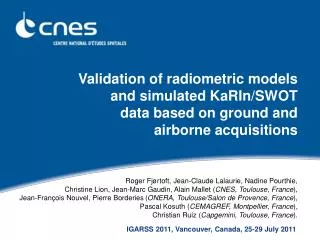
Validation of radiometric models and simulated KaRIn/SWOT data based on ground and airborne acquisitions • Roger Fjørtoft, Jean-Claude Lalaurie, Nadine Pourthie, Christine Lion, Jean-Marc Gaudin, Alain Mallet (CNES, Toulouse, France), • Jean-François Nouvel, Pierre Borderies(ONERA, Toulouse/Salon de Provence, France), • Pascal Kosuth (CEMAGREF, Montpellier, France), • Christian Ruiz (Capgemini, Toulouse, France). IGARSS 2011, Vancouver, Canada, 25-29 July 2011
Outline • Introduction • Context, objectives • Specificities of KaRIn/SWOT interferometric SAR data • Modeling and simulation • Backscattering from various surfaces • Simulation of raw and SLC radar images • Airborne acquisitions • First interferometric Ka-band acquisitions including the KaRIn incidence range (1-4°) • Near-field Ka-band measurements • Water backscattering as a function ofwind speed and surface roughness IGARSS 2011, Vancouver, Canada, 25-29 July 2011
Introduction • Context • Original InSAR configuration of KaRIn/SWOT: Ka-band, near-nadir (1-4°) • Very limited bibliography on backscattering from natural surfaces • Modeling of Ka-band backscattering (0) • As a function of surface type, surface conditions, incidence angle, … • Simulation of raw (L0) and SLC (L1) KaRIn/SWOT interferometric data • Radiometry and geometry • Objective: Realize airborne and near-field Ka-band acquisitions • Compare models and simulations with real data (validate, improve) • Need for ground truth • Study important phenomena w.r.t. feasibility and performance • Coherence, land/water contrast, layover, … • Enable more realistic input data for algorithm development and testing • Airborne data and improved simulated images IGARSS 2011, Vancouver, Canada, 25-29 July 2011
BUSARD/DRIVE airborne acquisitions (1/2) • BUSARD is a Stemme motor-glider operated by ONERA • DRIVE Ka-band radar integrated in POD • Interferometry with short (18 cm) or long (4.7 m) baseline • 2.5 W amplifier • Near-nadir acquisitions (0-14°) with 18 cm baseline in 2011 • Altitude: 3000 m (9500 ft) • Swath: 700 m • Acquisition length: 5 km (2 min) • PRF: 1250 Hz • Integration time: 0.2 s IGARSS 2011, Vancouver, Canada, 25-29 July 2011
BUSARD/DRIVE airborne acquisitions (2/2) • Simultaneous ground truth: • Wind speed • Water surface roughness • Water surface height and slope • Wave height (buoys) • Soil humidity • Same day/week/month: • Soil roughness • Vegetation characteristics • Landcover • Available static data: • Digital maps • DEM IGARSS 2011, Vancouver, Canada, 25-29 July 2011
Acquisition sites in the Camargue area (2011) Rhône Vaccarès Espiguette (buoy) Piemanson IGARSS 2011, Vancouver, Canada, 25-29 July 2011
voie a DRIVE/BUSARD acquisition 24/02/2011 (Rhône) 0° 0° ~1° ~4° Artifacts due to wide antenna lobe (right/ left contamination) ~700 m ~10° Trihedrals ~2,6 km 13° Amplitude IGARSS 2011, Vancouver, Canada, 25-29 July 2011
DRIVE/BUSARD acquisition 24/02/2011 (Rhône) Phase (interferogram) IGARSS 2011, Vancouver, Canada, 25-29 July 2011
DRIVE/BUSARD acquisition 24/02/2011 (Rhône) ~0.3 >0.9 ~0.7 Coherence IGARSS 2011, Vancouver, Canada, 25-29 July 2011
DRIVE/BUSARD acquisition 14/04/2011 (Vaccarès) Amplitude IGARSS 2011, Vancouver, Canada, 25-29 July 2011
DRIVE/BUSARD acquisition 14/04/2011 (Vaccarès) Coherence Amplitude 1 Phase Amplitude 2 IGARSS 2011, Vancouver, Canada, 25-29 July 2011
DRIVE/BUSARD acquisition 14/04/2011 (Espiguette) Amplitude IGARSS 2011, Vancouver, Canada, 25-29 July 2011
DRIVE/BUSARD acquisition 14/04/2011 (Espiguette) Coherence Amplitude 1 Phase Amplitude 2 IGARSS 2011, Vancouver, Canada, 25-29 July 2011
DRIVE/BUSARD acquisition 25/05/2011 (Rhône) Amplitude IGARSS 2011, Vancouver, Canada, 25-29 July 2011
Near-field measurements in Ka-band (1/2) • Near-field Ka-band measurements of 0 of water with a network analyzer and an automatically steerable (0-10°) parabolic antenna (ONERA) • Simultaneous measurement of water surface roughness (using immerged pressure sensors) and wind speed (CEMAGREF) • Rapidly varying wind conditions make the interpretation of the first results complicated. IGARSS 2011, Vancouver, Canada, 25-29 July 2011
Near-field measurements in Ka-band (2/2) • Acquisitions in the Large Air-Sea Interaction Facility (LASIF) at IRPHE (Luminy): 40 m wind tunnel + 40 m water tank • Possibility to study wind-generated water roughness (waves) in stable conditions (as well as to add mechanically generated waves) • Additional equipment for optical roughness characterization (IRPHE) • Comparison of 0 profiles with radiometric models (CapGemini) IGARSS 2011, Vancouver, Canada, 25-29 July 2011
Wind perpendicular to incidence direction 0 (dB) Incidence (°/100) Water 0 as a function of wind speed Wind parallel to incidence direction 0 (dB) Incidence (°/100) IGARSS 2011, Vancouver, Canada, 25-29 July 2011
Conclusion • Airborne acquisitions with DRIVE/BUSARD • First interferometric Ka-band acquisitions including the near-nadir incidence range of KaRIn/SWOT (1-4°) • Confirmation of main feasibility and measurement physics assumptions • Will allow to refine models and simulators • Experience gained w.r.t. InSAR processing and ground truth collection • Hydrology, coastal and ocean test sites covered; possible extension to other surface types: forest, snow/ice, … • Near field measurements of water surfaces • 0 as a function of incidence and wind speed / surface roughness • Interesting phenomena observed; comparison with models ongoing • Wind-generated roughness only; possibility of adding waves mechanically • Complementary in situ and wind/water tank measurements IGARSS 2011, Vancouver, Canada, 25-29 July 2011