IGARSS 2011
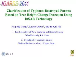
IGARSS 2011. Classification of Typhoon-Destroyed Forests Based on Tree Height Change Detection Using InSAR Technology. Haipeng Wang 1 , Kazuo Ouchi 2 , and Ya-Qiu Jin 1 1. Key Laboratory of Wave Scattering and Remote Sensing Fudan University, P.R. China.

IGARSS 2011
E N D
Presentation Transcript
IGARSS 2011 Classification of Typhoon-Destroyed Forests Based on Tree Height Change Detection Using InSAR Technology Haipeng Wang 1, Kazuo Ouchi 2, and Ya-Qiu Jin1 1. Key Laboratory of Wave Scattering and Remote Sensing Fudan University, P.R. China. 2. Department of Computer Science National Defense Academy of Japan, Japan.
Purpose of This Study • The final goal is to establish methodology to estimate the parameters of • forests from high-resolution SAR data. • This first study we carried out is to quantify the relation between • high-resolution polarimetric SAR data and tree biomass of forests. • This second one is to extract the information of typhoon-damaged forests. • The methodology is to utilize thetexture information, polarimetric analysis • and interferometric technique. • The test site is the Tomakomai forests in Hokkaido, Japan. • The SAR data were collected using the airbornePi-SAR.
Spruce Todo Fir Red Pine Larch Shikotsu Lake Tomakomai National Forests
X-band main antenna X-band sub-antenna L-band antenna Pi-SAR (Polarimetric interferometric - SAR) is an airborne SAR developed jointly by NICT (National Institute of Information and Communications Technology) and JAXA (Japan Aerospace Exploration Agency). It is equipped with two X-band antennas (frequency 9.55 GHz, wavelength 3.14 cm) and a L-band antenna operating at frequency 1.27 GHz (wavelength 23.6 cm). The nominal resolution is 1.5 x 1.5 m at X-band, and 3 x 3 m at L-band for 4-look azimuth multilooking. Pi-SAR
L-band colour composite polarimetric Pi-SAR image Shikotsu Lake study area Pi-SAR Data Tomakomai City range Tarumae Mt. azimuth JAXA/NICT Data acquired:7th, November, 2002 range azimuth study area Data acquired:3rd, November, 2004
Ground-Truth Biomass Data Collection Field measurements were made in 2002, 2003, 2005, and in 2006. Tree species, height, DBH (Diameter at Breast Height), basal area, soil moisture were measured within a 20 x 20 m sample area in each stands, and converted to above-ground biomass using the conversion formula provided by Project department (Stand volume table -East Japan-, Japan Forestry Investigation Committee. Tokyo: Forestry Agency, Oct. 1998)
Typhoon Songda (Japanese No.18) Duration:August 28 – September 8 Typhoon Songda killed 20 people and injured 700 others in Japan. In addition, 15 crew members of a vessel were reported missing. Damages from the storm amounted to $7.17 billion (2004 USD) Time arrived at Tomakomai: September 7th, 2004 Typhoon Songda
Amplitude Analysis Whole image Test sites
Amplitude Analysis Results Accuracy:64.1%
Scattering Mechanisms From Forests X/C-bands multiple reflection between ground and tree trunks/branches L/P-bands scattering from crown parts multiple/volume scattering from branches surface scattering from ground
Three-Component Decomposition Analysis A. Freeman and S. L. Durden, “A three-component scattering model for polarimetric SAR data,” IEEE Trans. Geosci. Remote Sens., vol. 36, no. 3, pp. 936–973, May 1998.
Scattering Mechanism Analysis Result Accuracy:77.7%
X-band main antenna Pi-SAR X-band sub-antenna L-band antenna Pi-SAR on Gulf Stream II X-band and L-band radomes Partial Pol-InSAR by X-band main radome (Sub-antenna data not acquired this time) Two antennas within X-band main radome
X-band VM Pi-SAR image Pi-SAR Data for Interferometric Analysis Data acquired:3rd, August, 2004 Data acquired:3rd, November, 2004
Complex Interferogram Complex Degree of Coherence M, N —— Moving window size S —— Data
X7904 X8104 Courtesy of Dr. Moriyama Removal of Orbital Fringes
Conclusions and Future Work Research was carried out to extract information of typhoo-damaged forests. The accuracies of 64.1% and 77.7% were obtained for amplitude and decomposition data respectively. InSAR processing resutls show it’s potential, but there is no quantitative results yet. Phase unwrapping: other approaches rather than the branch cut. Difficult to see the difference of typhoon-damaged information from the coherence data before and after the typhoon. Next step is to exam the coherence before and after the typhoon Fusion of optical data and SAR data: QuickBird, IKONOS, Geoeye multispectrum optical data, Pi-SAR I&II data.