Download
1 / 55
580 likes | 842 Vues
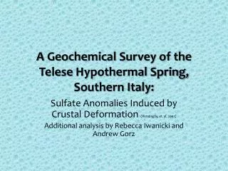
The National Geochemical Survey of Australia. Patrice de Caritat Geoscience Australia

E N D
The National Geochemical Survey of Australia Patrice de Caritat Geoscience Australia A collaborative project under National Geoscience Agreements withNew South Wales Department of Primary Industries, Mineral Resources Tasmania, GeoScience Victoria, Primary Industries and Resources South Australia, Geological Survey of Western Australia, Northern Territory Geological Survey, Geological Survey of Queensland
Outline of Presentation • Why geochemical surveys? • Review of pilot projects • Aims of NGSA • Strategy of NGSA • Results and preliminary interpretations • Total element concentrations • Weak digestion concentrations • Visible near-infrared spectroscopy • Conclusions
Geochemical Surveys 101 Gd+Sm Neutron Spectrometry Data Elphic et al. (1998, 2000) Ti What are geochemical surveys? • GS are the documentation of the chemical composition of the Earth’s surface: concentration values & patterns • Fundamental dataset • Nature of end-product depends on a number of strategic decisions: • Purpose (minex, environmental, land-use, etc.) • Size of area to cover (strategic v tactical) • Sampling medium • Sampling density • Constraints: time, resources, history, etc
Geochemical Surveys 101 • Initially developed for mineral exploration (“geochemical prospecting”) • Reconnaissance geochemical surveys started in the 1960’s (Nichol et al., 1966) • Gained widespread popularity in many parts of the world over ensuing decades • Variety of applications: mineral exploration, environmental baseline, geohealth (e.g., drinking water!), land rehabilitation, risk assessment, etc.
Selected Results from Pilot Projects • Curnamona: • Broken Hill region; base metal, Cu-Au • Riverina: • Agriculture, Murray Basin; Au, base metal • Gawler: • Arid, flat, aeolian influence; Olympic Dam Fe-oxide-Cu-Au-U, Au • Thomson: • Eromanga/GAB Basin cover; borders on Curnamona and Cobar (base metal, Cu, Au) districts
Selected Results from Pilot Projects Riverina: Th channel airborne radiometrics vs Th (ppm) in <180 um TOS Caritat et al., GEEA, 2008
Selected Results from Pilot Projects Zn Fe Profile 111 Fe Zn Profile 133 Riverina: Depth profiles Shallow (<10 cm) and deep (>50 cm) levels are geochemically distinct Caritat et al., GEEA, 2008
Gawler: Zn (ppm) in <180 um TOS I A (TOS) Caritat et al., GEEA, 2008
Selected Results from Pilot Projects Grouped by size fraction: Frequency (%) Cu (ppm) • N = 72 (6 sites x 2 depths x 6 fractions ) • Finest size fraction has significantly elevated • Cu concentrations compared to coarser • Thus, analysing a fine and a coarse fraction • adds information • Regardless of depth or size fractions, some sites • have significantly more elevated Cu values • This is why low-density geochemical mapping works! Grouped by site: Cu (ppm) Caritat et al., GEEA, 2008 • Cu in Gawler: variation between sites >> variation between grain sizes
National Geochemical Survey of Australia • In August 2006, the Australian Government announced support for Onshore Energy Security Program (OESP) • $59M over 5 years (2006-2011) • Uranium, thorium, geothermal, petroleum • Geoscience Australia established a multi-disciplinary program to tackle this new focus (seismic, AEM, AWAGS2, geothermal, NGSA, etc.) • NGSA is but one of the OESP projects
Aims of NGSA • To provide pre-competitive data and knowledge to support exploration for energy resources in Australia Specifically • To improve the existing knowledge on the concentration and distribution of energy-related elements such as uranium (U) and thorium (Th) at the national scale • But it will also provide new data for a range of commodity related elements such as gold (Au), copper (Cu), nickel (Ni) and zinc (Zn), among others, as well as several elements of interest for other applications, e.g. environmental management, at the national scale
Strategy for NGSA • To keep costs down, an ultra-low sampling density strategy was adopted, backed by results from pilot projects • Transported sediment: ‘a well-mixed composite sample of dominant lithologies upstreams’ as sampling medium • Collect a proper sediment sample (fine-grained material, overbank/floodplain environment, outlet sediment, away from disturbed or polluted sites) • Sample at 2 depths and separate 2 grain-size fractions to enhance geochemical information • Analyse for major, minor & trace elements after total + aqua regia + Mobile Metal IonTM digests • Identify areas where sediment chemistry indicates lithologies or mineralisation of interest • Industry can focus further exploration investment in those selected areas and save $$
National Geochemical Survey of Australia (NGSA) • Landscape divided in large catchments • Only mainland Australia + Tas • Topographic analysis to split or amalgamate catchments • Hydrologic analysis to determine catchment outlets • Ignore catchments <1000 km2 (mostly coastal) • 91% coverage • Emphasis on QA/QC from field to reporting
National Geochemical Survey of Australia (NGSA) • Sample transported regolith at outlets of 1186 catchments over mainland Australia • 123 of these catchments have been sampled in duplicate for quality control • 6 other, large catchments also sampled higher up • Average density ~1 site/5200 km2 (similar to FOREGS European Atlas) • 86% of the catchments have been sampled • Over 6 million km2 (or 80% of Australia) has been sampled www.ga.gov.au/ngsa Contact: Patrice.deCaritat@ga.gov.au
0-10 cm depth: Top Outlet Sediment (TOS) Air-dried, homogenised, split into ‘Bulk’, or sieved to <2 mm (‘Coarse’) and to <75 um (‘Fine’) grain size fractions ca 60-80 cm depth: Bottom Outlet Sediment (BOS) Analysed for TOTAL, AQUA REGIA and MMITM element content National Geochemical Survey of Australia www.ga.gov.au/ngsa
Validation of NGSA pH against existing datasets Caritat et al. (2011) Caritat et al. (2011)
Preliminary interpretation of NGSA results B C F G A D E H Caritat et al. (2011)
Comparison airborne vs soil geochemistry Existing U channel image ‘Corrected’ U channel image Green: 0 ppm U --- Red: 12 ppm U (p<0.01) Wilford et al. (2011)
Comparison airborne vs soil geochemistry Wilford et al. (2011) Caritat & Cooper (2011)
Preliminary interpretation of NGSA results B C A F D E Caritat et al. (2011)
Possible causes of geochemical anomalies • Horizontal/lateral dispersion from ore deposit, mineralisation, secondary enrichment or alteration zone • Vertical migration of chemical elements due to processes to be determined that could include groundwater (advection & diffusion), soil gas, plants or micro-organisms, electro-chemical currents over sulfide bodies or even lightning strikes • Contamination due to mining activities (e.g., dust), but (1) sites selected away from mines, (2) anomalies also in deeper BOS sample, (3) found equally around open-pit and underground mines, and (4) do not outline ore transport routes
Preliminary interpretation of NGSA results B C A Caritat et al. (2011)
Preliminary interpretation of NGSA results C B A D Caritat et al. (2011)
Preliminary interpretation of NGSA resultsConcentration-Area (C-A) fractal analysis of Zn distribution “Background”“Anomalous” Class 1 (4-9 ppm) Class 2 (9-40 ppm) Class 3 (40-70 ppm) Class 4 (70-105 ppm) Class 5 (>105 ppm) 9 mg/kg 40 72 105 Class 1 2 3 4 5 Zn deposit Zn occurrence Caritat et al. (2011)
Extraction Methods and Bio-Availability SGS Mann et al. (2011)
MMITM extractable Ba (ppm) Caritat et al. (2011)
MMITM extractable La (ppm) Caritat et al. (2011)
MMITM extractable Au (ppb) Caritat et al. (2011)
MMI/Total: A measure of bio-availability? Mann et al. (2011)
Arid Zone Limestone Lithology Nullarbor Plain (limestone) Mann et al. (2011)
Arid Zone and/or Salt lakes Mann et al. (2011)
High Rainfall Zones c.f. Fe Mann et al. (2011)
Vis-NIR Spectroscopy Viscarra-Rossel et al. (2010,2011) PC1 PC2 PC3 Variance Variance Variance PC1: hematite (-); 2:1 clay minerals (+) PC2: SOM, smectite (-); kaolinite (+) PC3: illite, smectite, goethite? (-); SOM (+)
Vis-NIR Spectroscopy Viscarra-Rossel et al. (2010,2011) hem kao 1 4 1 2 3 4 1 2 3 4 3 SOM 2 SOM goe 2:1 c 2:1 c 2:1 c PC clusters 1 (orange), 2 (red), 3 (blue) and 4 (green) with central composition (stars) and average reflectance and continuum-removed spectra (right) 2:1 c kao 2:1 c