GIS Water Resources Data Sources for Effective Watershed Management |
Explore comprehensive data sources such as NHDPlus, NED, PRISM, and more for watershed analysis in water resource management. Learn about GIS integration, water quality modeling, and decision-making tools. |

GIS Water Resources Data Sources for Effective Watershed Management |
E N D
Presentation Transcript
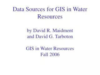
Data Sources for GIS in Water Resourcesby David R. Maidment and David G. TarbotonGIS in Water ResourcesFall 2006
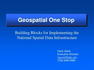
Geospatial One-Stop http://www.geodata.gov/gos
Watersheds of the US 2-digit water resource regions 8-digit HUC watersheds
Hydrologic Unit Code Watersheds ~ 2000 for US, about the size of counties
Watershed Hierarchy Digit # 2 4 6 8 HUC 10 12 NHDPlus Available In Progress
National Program by USGS and USDA (NRCS) Boundaries for 10- and 12- digit watersheds First cut is by automated delineation from NED Hand checked and edited Watershed Boundary Dataset 10-digit watersheds
BASINS - Integrating GIS and Water Quality Modeling Data Cartographic Monitoring Loadings Tools Target Assessment Data Mining Reporting • Models • HSPF - NPSM • QUAL2E • TOXIROUTE • Post-Processors Target Assess DM Decisions Watershed Management . TMDL . Source Water Protection . Stormwater State and Local Data
River networks for 8-digit HUC watersheds http://nhd.usgs.gov/
Lower West Fork, Trinity River Basin HUC = 12030102
NHD River Reaches 412 River Reaches In Upper West Fork of Trinity Basin
River Reach CodesUsed for river address locations ReachCode = 12030102000151 ReachCode = 12030102000005 Location 0.392 on Reach 12030102000005 Segment# HUC#
NHDPlus for a Portion of Oregon http://www.horizon-systems.com/nhdplus/
NHDPlus Reach Catchments ~ 3km2 Average reach length = 2km 2.3 million reaches for continental US About 1000 reach catchments in each 8-digit HUC
Slope Elevation Mean annual flow Corresponding velocity Drainage area % of upstream drainage area in different land uses Stream order NHDPlus Reach Attributes
Digital Elevation Model with 1 arc-second (30m) cells Seamless in 1° blocks for the United States 10 billion data Derived from USGS 1:24,000 quadrangle sheets Get the data: http://seamless.usgs.gov/ National Elevation Dataset http://gisdata.usgs.net/ned/
Digital Elevation Model (DEM) 720 720 Contours 740 720 700 680 740 720 700 680
32 64 128 16 1 8 4 2 Eight Direction Pour Point Model Water flows in the direction of steepest descent
32 64 128 16 1 8 4 2 Flow Direction Grid
1:250,000 Scale Soil Information http://www.ncgc.nrcs.usda.gov/products/datasets/statsgo/
SSURGO: County Level Digital Soil Maps 1:24,000 scale soil information http://www.ncgc.nrcs.usda.gov/products/datasets/ssurgo/
National Land Cover Dataset http://landcover.usgs.gov/nationallandcover.html Get the data: http://seamless.usgs.gov/
Hydrologic Landscape Regions USGS Characterization of nature of soil and groundwater systems http://water.usgs.gov/lookup/getspatial?hlrus
PRISM Mean Annual Precipitation http://www.wcc.nrcs.usda.gov/climate/prism.html
National Water Information System Web access to USGS water resources data in real time http://waterdata.usgs.gov/usa/nwis/
USGS Water Watch Web access to USGS water resources data in real time http://waterdata.usgs.gov/nwis/rt
USGS National Water Information System. • Real-time and Historic Data • Streamflow and stage • Groundwater levels • Water Quality • Site information • Tabular or Graphical Format
http://www.maproom.psu.edu/dcw/ 1:1,000,000 scale vector data for the world
GTOPO30 - 1 km Digital Elevation Model of the Earth http://edcdaac.usgs.gov/gtopo30/gtopo30.html
Drainage in North America Hydro1K is derived from GTOPO30 using raster GIS analysis http://edcdaac.usgs.gov/gtopo30/hydro/index.html
NASA Satellite Data http://edcimswww.cr.usgs.gov/pub/imswelcome/
Global Energy and Water Experiment http://www.gewex.org/
“National Map” in Nebraska http://nmviewogc.cr.usgs.gov/viewer.htm?bbox=-104.5,39.5,-95,43.5