Download
1 / 30
300 likes | 427 Vues
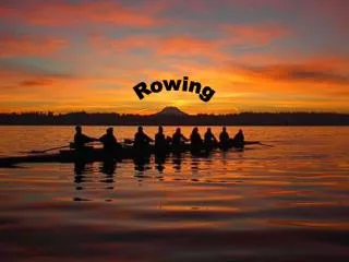
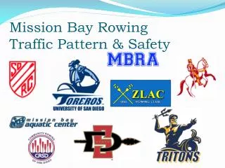
Mission Bay Rowing Traffic Pattern & Safety. Introduction. Who we are ZLAC Masters & Jrs ., SDRC Masters & Jrs ., UCSD Men, UCSD Women, USD Men, USD Women, SDSU Men, SDSU Women, MBRA Masters, MBAC, CCHS Jrs ., CRSD Our purpose today To promote safety and cordial relations

E N D
Introduction • Who we are • ZLAC Masters & Jrs., SDRC Masters & Jrs., UCSD Men, UCSD Women, USD Men, USD Women, SDSU Men, SDSU Women, MBRA Masters, MBAC, CCHS Jrs., CRSD • Our purpose today • To promote safety and cordial relations • To review our coordinated agreement of the Mission Bay Rowers Traffic Pattern • To set mutual expectations that we will each honor in our organizations
General Principles • Safety of all crews, coaching staffs and other boaters is paramount, on and off the water. • Courtesy and civil language at all times • Keep the shore close to the starboard side of your boat • Row in a counterclockwise direction • Overtaking boats pass to the port; those being overtaken yield and steer to shore • Turn using right angles, not diagonals • Move towards the shore if you have to stop or stage • Lights! Bow required, Coaches required, stern recommended.
Safety • San Diego Mission Bay Lifeguard – on water • 619-221-8800 • Off the water, dial 911 • US Rowing Safety Information • http://www.usrowing.org/safety.aspx • Basics • Each organization has a safety policy, read it • Know how to swim • Understand basic safety & emergency procedures • Know the weather • Know the traffic pattern
Handling Problems • Stop your boat and don’t contribute to, or become part of an existing problem • Be cordial and direct with regard to continuing your respective rows – stay focused and safe • Discuss the issue with your safety officer, coach, captain, or other leadership off the water • Leadership is encouraged to contact other leadership, express the date, time, place of the incident in the form of accurate feedback.
Mission Bay Geography • Rowing Organizations • ZLAC • MBAC, SDSU, MBRA • USD, SDRC, UCSD • CCHS, CRSD
Mission Bay Geography • Bodies of Water • West Bay • East Bay • Sea World Chan. • De Anza Cove • Tecolote Chan.
Mission Bay Geography • Bridges • “Short” aka N. Ingraham St. Bridge • “Long” aka S. Ingraham St. Bridge • West Mission Bay Drive Bridge
Mission Bay Geography • Islands & Points • Santa Clara Pt. • El Carmel Pt. • Bahia Pt. • Crown Pt. • Vacation Island • Fiesta Island • Radar Island • Palm tree aka Water ski Island • Rocks
General Traffic Flow • Counterclockwise • Starboard oar closest to shore • Cross traffic patterns at a 90 degree angle, not diagonals • Stage outside of traffic lanes and close to shore • No stopping in Sea World channel • Don’t take your half from the middle • Divide the area into thirds, row in the outer third, not the middle of the pattern
Rule of Thirds – an example • Think of it as a two lane highway with a large open divider to protect you from oncoming traffic • Avoid the middle span(s) of bridges • If in doubt, row closer to shore
El Carmel Cove • Counterclockwise • Enter north of buoys • No wakes, no power pieces • Exits: • MBAC exit North of buoys • SDRC,UCSD,USD exit South of buoys • Give way to North/South traffic in West Bay • Stage in “pink” area, not in front of MBYC dock
West Bay, Cove/ZLAC/Bridges • North/South traffic has right of way over East/West • To ZLAC: proceed along SOUTH of E/W buoy line, turn North after the 2nd yellow buoy, point at white condo complex. • To Short bridge: proceed South to MBYC, then East, but South of channel markers • To Long bridge: proceed South, but do not stage in front of MBYC. • Communicate – lots of cross traffic in and out of the cove
West Bay, Return to Cove • North/South traffic has right of way over East/West • All traffic enters NORTH of the two buoys in the cove • From Short Bridge: stay NORTH of channel markers and 50m south of Skiers buoys • From Long Bridge: stay NORTH and EAST until even with the Short Bridge return path, turn 90 degrees WEST, don’t cut corners
West Bay, North-South • North/South traffic has right of way over East/West • Southbound from ZLAC: starts West of ZLAC, cross skiers between western-most white buoys • Northbound to ZLAC: cross the skiers bouy EAST of the 2nd yellow channel marker and remains EAST of brown condos
West Bay, South Channel exit • Give way to traffic moving in the channel • Proceed SOUTH past the western-most channel marker, turn 90 degrees to port. Yield to North/South traffic at the turn. • Stage near the rocks or Dana landing
Long Bridge • East/West traffic has right of way • Stage in “pink” areas • Extreme caution in “yellow” area • Eastbound proceed through 2nd arch from south shore • Westbound proceed through 2nd arch from north Vacation Is. Shore • To rocks: Proceed EAST and make a 90 degree turn to port at western-most Sea World Tower
Sea World Channel – Jet Ski Area • East/West traffic has right of way • Stage in “pink” areas • Extreme caution in “yellow” area • Eastbound: stay south of center channel buoys • Westbound: stay north of center channel buoys • No rowers in Jet-Ski area when occupied by skiers
East Bay – South End • North/South traffic has right of way • Northbound: stay on the East side, do not stage at the rocks • 2000m course, stay far East of Radar Island • Southbound: stay on the West side, yield to East/West traffic in Sea World Channel
East Bay – North End • East/West from De Anza Cove has right of way • North/South into De Anza has right of way • South/North from Palm Tree Island South has right of way • Extreme caution in “yellow” area • Stage in “pink” areas
De Anza Cove, Tecolote • Enter with buoys to port, stay WEST heading SOUTH • Exit with buoys to port, stay EAST of yellow exit buoy, row NORTH further than you think, then turn 90 degrees WEST, yield to East/West traffic • Extreme caution in “yellow” area • Stage in “pink” area
Tecolote • Keep buoys to port • Stage in “pink” areas, avoid narrow areas • Extreme caution in “yellow” area near the Hilton Hotel. • North/South traffic has right of way • Exiting Enchanted Isle yields to traffic
Short Bridge – Radar Island • Traffic is counterclockwise around Radar Island at all times. • East-West traffic yields to southbound traffic • Stage in “pink” areas • Westbound traffic is to use the 2nd span south of Crown Point, not the middle.
Pattern Exceptions • Exceptions are rare and predictable. Talk to your coach, captain, or other leadership • Fall Classic – November • Reverses traffic pattern East of Short bridge, North to Crew Classic finish line • Crew Classic – March/April • East bay and Sea World patterns change to CLOCKWISE • Various junior regattas may change the pattern
Race Courses • 1000m course marked in Sea World channel • 2000m course from the Rocks, north along Fiesta Island • Wires-to-Poles from Sea World towers north along Fiesta Island, South in Tecolote channel, around Enchanted Isle, North out of Tecolote, West around Palm Tree Island, South along Vacation Island, West through the Long bridge, North to MBYC channel buoy. • West Bay from W. Mission Bay Dr. Bridge North to ZLAC
Race Courses • Fall Classic – Sea World West through Long Bridge, South around Vacation Island, East through Short Bridge, North to Crew Classic finish • Crew Classic – Sea World towers north to Palm Tree Island, 8 lanes across
Lights & Clothing • Bow lights are required, red & green (port & starboard), attached to the bow marker clip or well forward of the washbox. • Stern lights are highly recommended, white only, mounted aft of the stern washbox or above the stern. • Coaches launches must be properly illuminated with a white light • Wear high visibility clothing, bright white, fluorescent colors, reflective strips. Refrain from dark colors.
Safe Weather Conditions • Do not row if the environmental conditions are not safe • Fog: When the lights of the Ingraham St. bridge cannot be seen from El Carmel or Santa Clara point, rowing is not advised (not permitted at SDRC) • Electrical storms: Rowing is not advised (or permitted at SDRC) if there is lightning, thunder, or hair standing on end. If you are on the water, head to shore, and move away from your boat, and oars • Wind: Rowing is not recommended if whitecaps or worse are present. • Water quality: Mission Bay may be, at times, not conducive to rowing, especially 48 hours after a storm.
Misc. • MBAC & others run Learn to Row classes in the El Carmel / Santa Clara cove with novice eights and barges • SDRC hosted Mission Bay Safety Documents • http://www.sandiegorowing.org/rowing-safety-information • Mission Bay Park regulations • http://www.sandiego.gov/planning/programs/parkplanning/pdf/mbpmasterplan9.pdf