Download
1 / 24
240 likes | 256 Vues
Explore the development phases and upgraded services of the EGNOS Programme, integrating GNSS technologies for enhanced navigation across various industries in Europe. Stay updated on the latest advancements and potential applications.

E N D
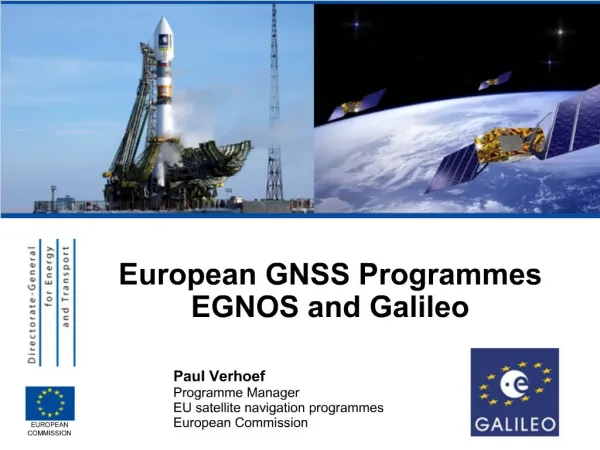
European GNSS ProgrammesGalileo and EGNOS Edgar Thielmann European Commission June 2009 EUROPEANCOMMISSION
2002 2003 2004 2005 2006 2007 2008 2009 2010 2011 2012 2013 2014 2015 2016 2017 2018 2019 EGNOS TimelineRegional Infrastructure & Services EGNOS Programme Phases Operational Phase (Long Term Operations, Extensions, Replenishments) IOP Phase Definition Phase IOP … Initial Operations
EGNOS System Architecture 3 GEOSatellites 6 NavigationLand EarthStations Users &ServiceProviders 2 Support Facilities 4 MissionControlCentres 34 Ranging & Integrity MonitoringStations (RIMS) GPS & GLONASS
EGNOS Services SLA … Service Level Agreement, EDAS … EGNOS Data Access Server
EGNOS Services – Current Status SIS … Signal in Space, SARPS … Standards and Recommended Practices, SoL … Safety of Life
EGNOS Data Access Service (EDAS) EGNOS data (real-time): • RIMS raw observations • SBAS messages Phased approach: • Phase 1: prototyping (2008) • EDAS data free-of-charge • No guarantee/liability • 12 months duration minimum • Phase 2: commercial exploitation (from 2009) • Example of applications : road transport in urban areas End users Value-added service provider User-specific information
EGNOS Performance (January 2009) Source: Service Management Report ESSP for January 2009 APV … Approach with vertical guidance
EGNOS Programme Status • EGNOS is already broadcasting signals of excellent quality • 2009: • Assets have been transferred from ESA to the European Community in April 2009 • First EGNOS operator contract as of 1st April 2009 • OS declaration of "entry into service" planned for late 2009 • EC has finalized the procurement and lease of an EGNOS transponder to replace ARTEMIS as of 2011 • Procurement action ongoing for replacement of 2nd EGNOS transponder • Geographical service extension is under study • 2010: • SOL declaration of "entry into service" planned for mid-2010 (after certification milestone) • EC intends to launch tests to demonstrate the added value of EGNOS for different market segments • GSA web portal for user communities and developers of applications starting early 2010
EGNOS Extensions Eastern Europe Middle-East MEDA Depending on the extension area, technical implementation may vary from: • Homogeneous extension with deployment of additional RIMS • Regional infrastructure including additional processing capabilities
EGNOS enables a reduction in the decision height Long-term Aviation was first to recognise EGNOS benefits (mostly GA and smaller airports) EGNOS competitive space • General operational benefits • Reduction in angle of approach (direct and curved) • Better lateral guidance • Allows for IFR-like operation in non ILS-equipped airports • Increase in airports capacity • Increase in safety • Increase in flight capability (e.g. helicopters) • Expensive land based navaids can be avoided • Enables their long term decommissioning => lower terminal charges
Initial position of identified applications • LBS E112 / LBS non regulated High • Road eCall • Road (RUC / PAYD) • Comm. Veh. Telematics • Civil Aviation (APV) • Farming (Precision Agriculture) • General Aviation Segment attractiveness (size, growth) Medium • Multimodal Transport (Dangerous goods) • Specialist tracking (Livestock, City logistics) • A-SMGCS • HPP • Inland Waterways (Traffic Management Surveillance) Low • Rail Freight • Rail Fleet Mgt Low Medium High EGNOS added value
EGNOS potential (with appropriate market enablers) • LBS E112 / LBS non regulated • LBS E112 / LBS non regulated High • Road eCall • Road eCall • Road (RUC / PAYD) • Road (RUC / PAYD) • Comm. Veh. Telematics • Comm. Veh. Telematics • Civil Aviation (APV) • Civil Aviation (APV) • Farming • Farming (Precision Agriculture) Segment attractiveness (size, growth) • General Aviation • General Aviation Medium • Multimodal Transport • Multimodal Transport (Dangerous goods) • Specialist tracking • Specialist tracking (Livestock, City logistics) • A-SMGCS • A-SMGCS • HPP • HPP • Inland Waterways • Inland Waterways (Traffic Management Surveillance) Low • Rail Freight • Rail Freight • Rail Fleet Mgt • Rail Fleet Mgt Low Medium High EGNOS ability to compete based on technical performance versus other GNSS solutions e.g. GPS, GPS+Galileo, dGPS in the corresponding application. EGNOS ability to compete
Galileo Implementation Plan Full Operational Capability 27 (+3) Galileo satellites 2013 In-Orbit Validation 4 IOV satellites plusground segment 2010 Galileo System Testbed v2 2 initial test satellites 2005 Galileo System Testbed v1 Validation of critical algorithms 2003
Galileo – 5 Services Open Service Free to air; Mass market; Simple positioning Commercial Service Encrypted; High accuracy; Guaranteed service Safety of Life Service Open Service + Integrity and Authentication of signal Encrypted; Integrity; Continuous availability Public RegulatedService Search and Rescue Service Near real-time; Precise; Return link feasible
Galileo Performance Standards (Dual Frequency) * Availability figures for global average
Road Market : Road Tolling • Galileo / Egnos can bring : • Better accuracy • Better availability of the signal • Authentication to avoid spoofing • Service guarantee to operators • All receivers will use two or more constellations for better performance : • Galileo + GPS • Galileo + Compass • Galileo + Glonass • Standardization process to be achieved in the interoperability Directive
Road Transport : Dangerous Goods • Proposal for an EC directive for real time tracking of dangerous materials • Aiming first at improving road safety and civil security • Should however benefit to hauliers as well as it will help smoothering traffic restrictions • Nuclear material as primary target • all other kinds of dangerous ggods concerned Satellite navigation tracking: position, date and time, speed, course, respect of pre-defined path, excluded zones, faster emergency operations, etc.
Road Transport : Monitoring of coaches • New EC directive proposal based on real-time satellite tracking to avoid this : • Monitoring of the itinerary • Real time Access control • Monitoring the driving conditions • Real time info service + automatic eCall for emergency situations
ADAS (advanced driver assistance systems) • Safety critical application • Needs total reliability and very high accuracy (up to 10 cm) • Galileo required with service guarantee • Certification process to be implemented : which agreed body to do it ? • To be on the market around 2020
PRS applications : Justice & home affairs, civil protection • Offenders & Asylum seekers • Electronicdevices attached to offenders • Alerts when allowed perimeters are broken • Cut prison overcrowding • Emergency Services • Help emergency team operations • Provide route guidance in difficult terrains • Civil protection • Define and apply keep-away zones • Identify location to drop material • Police forces • Police fleet monitoring • Fight against piracy • Vehicule and individual traking and tracing
Conclusions EGNOS will soon enter into its operational phase • EGNOS Open Service in 2009 • EGNOS Safety of Life Service in 2010 Galileo is at the handover between the development (IOV) and deployment (FOC) phases • GIOVE-A, GIOVE-B missions on-going • FOC procurement started in July 2008 • 4 IOV satellites in 2010 • Full Operational Capability in 2013 International coordination is an important feature • Ensure compatibility as a minimum • Achieve interoperability when desired
Thank you for your attention. SOURCE