Download

1 / 7
70 likes | 158 Vues
UN-GGIM and the Geospatial Industry Working Together to Advance a Global Agenda. Paul Cheung Director GGIM Secretariat United Nations Statistics Division. Contributions from Geospatial Industry. Commercial success has led to rapid growth in industry;

E N D
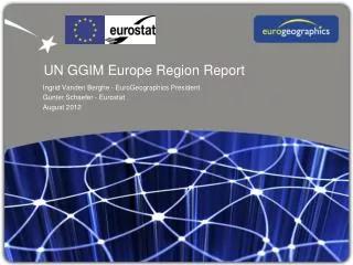
UN-GGIM and the Geospatial IndustryWorking Together to Advance a Global Agenda Paul Cheung Director GGIM Secretariat United Nations Statistics Division
Contributions from Geospatial Industry Commercial success has led to rapid growth in industry; Provides technological platforms, applications, solutions; Establishes new geospatial services based on privately sourced information, analytical tools; Develops new sources of data and technology – open data, crowd sourcing, VGI, outer-space, UMV; Enhances availability of global geospatial information, forcing governments to face new paradigm;
Key Questions Could the ‘industry’ be sole producer of geospatial data? What is the role and responsibility of the Government? What is the relationship between the private sector and Government? As regulator? As competitor? Do we need a collective voice among the Governments? How do we work together in a joint effort to build a global geospatial information system and a community of practice?
The Forgotten Role of the Government No clear direction, coordination, ownership, policy, or institutional arrangements; The value of reliable, credible and authoritative geospatial information not fully realized by many Governments; Geospatial capabilities have evolved in fragmented and inconsistent manner, and with duplication of effort; Governments are struggling to deal with privately sourced information – credibility, accuracy, legitimacy, status; Governments, not the private sector, have the mandate and accountability to maintain and deliver the national geospatial information base;
GGIM: A Global Initiative An Inter-Governmental Mechanism to make joint decisions and set directions on the production and use of geospatial information within national and global policy frameworks; Working with Governments to improve policy, institutional arrangements, and legal frameworks; Addressing global issues and contributing collective knowledge as a community with shared interests and concerns; Developing effective strategies to build geospatial capacity in the developing countries;
Four Critical Tasks Evolving a shared vision for the future in management of geospatial information nationally and globally; Evolving an inclusive platform for improving, sharing and disseminating national and global geospatial data; Evolving a global ‘Statement of Ethics’ and supporting code of conduct to enhance public trust; Evolving a mutually beneficial relationship between the Government and the non-Government entities;
Realizing a Vision Private sector has an important role, but cannot do it all. Similarly, Governments cannot do it all either; Need a global regulatory framework to safeguard the interests of Governments and the public, and to promote continual investment by the private sector; Need to work together – GGIM, Governments, international organizations, and the private sector – to improve technology, quality, and management; Realizing a Vision: To make accurate, authoritative, reliable geospatial information readily available to support national, regional and global development……