Download
1 / 19
210 likes | 463 Vues
ET for famine early warning, water use reporting, and drought monitoring. James Verdin and Gabriel Senay Famine Early Warning Systems Network (FEWS NET) National Integrated Drought Information System (NIDIS) Department of the Interior WaterSMART

E N D
ET for famine early warning, water use reporting, and drought monitoring James Verdin and Gabriel Senay Famine Early Warning Systems Network (FEWS NET) National Integrated Drought Information System (NIDIS) Department of the Interior WaterSMART U.S. Geological Survey, EROS Center, Sioux Falls, South Dakota
Famine Early Warning Systems Network An activity of the Office of Food for Peace at USAID, which directly supports its goal: “to ensure that appropriate… emergency food aid is provided to the right people in the right places at the right time and in the right way” FEWS NET is a food security decision support system with its own climate services
Famine Early Warning Systems Network • FEWS NET identifies the times and places that aid is need by the most food insecure populations of the developing world • The activity has been continuous since 1985 • The Office of Food for Peace distributed $2.8 B in aid in 2008
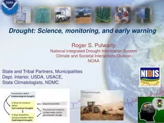
Famine Early Warning Systems Network • Livelihood systems are based on subsistence agriculture and/or pastoralism, and are highly climate-sensitive • Conventional climate station networks are sparse and/or late reporting • Satellite remote sensing and atmospheric models fill the gap, and provide the basis for early detection of agricultural drought
Famine Early Warning Systems Network • Rainfall, vegetation, snow pack, ET are monitored for rangelands, rain fed crops, and irrigated crops • A convergence of evidence approach is used
eMODIS FEWS NET NDVI250 m, NASA LANCE – USGS eMODIS
Time Series Rainfall Grids • Use of NOAA satellite RFE since mid-1990s • A blend of TIR, MW, and station observations • Used in crop water balance models
GDAS ETo Validation Using CIMIS Station Data (San Benito: 2004) Senay, Verdin, Lietzow and Melesse, 2008. JAWRA.
Water Requirement Satisfaction Index WRSI = f (ppt, pet, WHC, Crop Type, SOS, EOS, LGP) calculated from NOAA GDAS at EROS RFE (NOAA) FAO soils map of the world Kc (FAO)
Mapping Agricultural Drought WRSI Soil Water Index
Simplified Surface Energy Balance (SSEB) Approach LST Weather Data Radiation Temp, Wind, RH Pressure Ta NDVI ETfraction ETo ETa Adapted the “hot” and “cold” pixel concept from SEBAL (Bastiaanssen et al., 1998) and METRIC (Allen et al., 2005) to calculate ET fraction and combine it with ETo. Senay, et al., 2007. Sensors, 7, 979-1000.
Columbia Plateau Regional Aquifer Study Withdrawal Recharge
WaterSMART Availability and Use Assessment Program – Irrigation Water Use Location of irrigated fields • MODIS national irrigated lands classification • State government field boundary databases • USDA NASS common land unit or cropland data layer Status of irrigated fields • Irrigated or not in 2007? Vegetation index threshold • Crop type or group? Vegetation index seasonal curve Crop water use • Surface energy balance methods with LST • Joint use of Landsat and MODIS to get good frequency of observations Link consumptive use with point of withdrawal via state GIS databases
WaterSMART Availability and Use Assessment Program – Irrigation Water Use David Eckhardt, USBR Crop type classification Crop water use totals
California Drought Impact California’s Drought of 2007-2009: An Overview California Department of Water Resources