Download
1 / 5
50 likes | 164 Vues
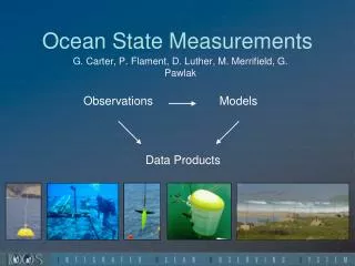
The Kilo Nalu Observatory offers extensive ocean state measurements through moored profilers, wave buoys, and advanced AUV surveys. Our network includes nodes at 10m and 20m depths, with 30m and 65m moored profilers, enabling real-time and archived data collection on critical metrics such as wave height, direction, and water properties (temperature, salinity, turbidity). This data is essential for local modeling of waves, currents, and water levels, allowing predictive insights for high-water level events. Join us in fostering better understanding and management of ocean conditions.

E N D
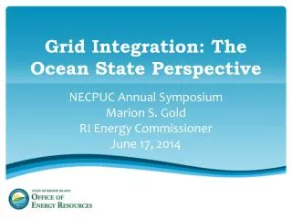
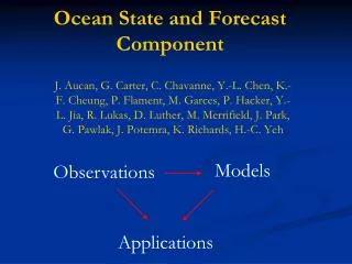
Ocean State Measurements Observations Models G. Carter, P. Flament, D. Luther, M. Merrifield, G. Pawlak Data Products
Ocean State: Kilo Nalu Observatory • Observational array: • Nodes at 10, 20 m • Moored profilers (30 m, 65 m) • Spatial sampling: REMUS AUV surveys • Real-time/archived data, products: • Wave height, direction, period • Water properties (T, S, turbidity) • Nearshore currents (10, 20 m) • Near-bed velocities (surge) • 24-hr particle tracks KN website ~8000 hits per month, >1000/day during south swells • Input/validation for local wave, current, water level modeling
Ocean State: Wave Buoys • Observational array: • Waverider buoys off Lanai, Waimea Bay, Mokapu, and soon off Barbers Point. • Buoys possible through partnerships with USACE and CDIP (Scripps) • Real-time/archived data: • Wave height, direction, period • Conditions surround harbor entrances • Input/validation for local wave, current, water level modeling • Input to prediction of high-water level events (flooding, inundation)
Ocean State: Harbor Measurements • Observational array: • Water level station in Kalaeloa Harbor and Kaumalapau • Current meter in Kalaeloa Harbor Channel • Waverider offshore Barbers Point and Kaumalapau • Real-time/archived data: • Offshore wave height, direction, period • Conditions within and near harbor (currents, swell, surge) • Input/validation for local wave, current, water level modeling • Input for prediction of high-water level events (flooding, inundation) • Real-time reporting of harbor conditions at Kaumalapau and Barbers Point (under development)
Ocean State: Gliders and Moored Profilers • Observational array: • 2 McLane moored profiling arrays (1 pre-deployment prep, 1 pre-deployment planning) • 1 iRobotSeaGlider (250 days of data collection thus far) • Real-time/archived data: • Currents, CTD, turbidity with profiler • Currents, CTD at subsurface mooring • CTD at mooring anchor • CTD, DO, chlorophyll, location along multiple lines around Oahu • Input/validation for numerical models Profiler Glider