GPS Fundamentals
GPS Fundamentals. Jie Liu Microsoft Research Redmond, WA 98052 Jie.liu@microsoft.com. Mobile Location Sensing Tutorial at MobiSys 2013. GPS Basics. 32 Satellites (SVs) Ground management stations Time synced to nanosecond level Estimate trajectories for each SV


GPS Fundamentals
E N D
Presentation Transcript
GPS Fundamentals Jie Liu Microsoft Research Redmond, WA 98052 Jie.liu@microsoft.com Mobile Location Sensing Tutorial at MobiSys 2013
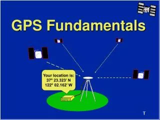
GPS Basics • 32 Satellites (SVs) • Ground management stations • Time synced to nanosecond level • Estimate trajectories for each SV • Transmit time and trajectory parameters (Ephemeris) periodically • Receiver estimates its location by: • time of flight (pseudorange) from each visible satellite • SV locations at time when signals left SVs.
GPS Data Packets @50bps 300 bits (10 words) 6 TLM TLM TLM TLM TLM HOW HOW HOW HOW HOW Ephemeris parameters Almanac, ionospheric model, dUTC Almanac Ephemeris parameters Clock corrections and SV health 12 Time (sec) 18 24 30 Time of week preamble
GPS Time • GPS Time is a uniformly counting time scale beginning at the 1/5/1980 to 1/6/1980 midnight. January 6, 1980 is a Sunday. • GPS Time counts in weeks and seconds of a week from this instant. The weeks begin at the Saturday/Sunday transition. This is week 1746. • The days of the week are numbered, with Sunday being 0, 1 Monday, etc. • There are no "leap seconds" in this time system. Currently, GPS is ahead of UTC by 15 SECONDS.
Gps signal structure • Each GPS satellite transmits continuously using two radio frequencies in the L-band, where: • All codes initialized once per GPS week at midnight from Saturday to Sunday • Chipping rate for C/A is 1.023 MHz • Chipping rate for P(Y) is 10.23 MHz
GPS Signals Modulation • Using CDMA, satellite k sends signal: • Received signal: 1023 kbps repeats every 1ms C/A: Coarse/Acquisition
GPS Signals Modulation • Using CDMA, satellites send the signal: • Received signal: 1023 kbps repeats every 1ms 50 bps 1.575GHz
GPS Signals Modulation • Using CDMA, satellites send the signal: • Received signal: 1023 kbps repeats every 1ms 50 bps 1.575GHz DSSS
GPS Signals Modulation • Using CDMA, satellites send the signal: • Received signal: 1023 kbps repeats every 1ms 50 bps 1.575GHz DSSS, 280~460W
Received Signal • After travel 20,000 km the receiver power is watts • Natural noise and man-made radio-frequency interference are much stronger than the GPS signal. • The signal power must be amplified by approximately ten orders of magnitude.
Antenna GPS Receiver • Burnout protection • Bandpass filter • Low-noise amplifier • Satellite #1 • Acquisition • Tracking • Data Dem. Application-Specific processing • Amplifiers • Down converters • Bandpass filters A/D . . • Estimation of: • Position • Velocity • Time Analog signals Digital signals
GPS Receiver Signal Processing • Analog signals: • Signal conditioner • Removes interfering signals in adjacent frequency bands • Amplifies the power of the signal by • Reduces the carrier frequency of 1575.42 MHz by a factor between 10 and 1000 – intermediate frequency • A/D converter – bandpass sampling • Sampling rate is dominated by the bandwidth of the signal (not the highest frequency component) • Up to order of 100 MHz
GPS Receiver Signal Processing • Digital signals: • Doppler removal • Correlators • Delay lock loop filter • Phase lock loop filter • Data demodulation • Application specific processing Figure courtesy: F. Van Diggelen “A-GPS”
Auto-Correlation Correlation peaks, every millisecond.
Doppler Shifts • A rising GPS satellite can move at up to 800m/s towards a receiver, causing a frequency shift of L1*800/c = 4.2kHz, where c is the speed of light. Simulated acquisition with no noise. Figure courtesy: F. Van Diggelen “A-GPS”
Acquisition Result Doppler bins (500Hz) Code phases
Tracking Doppler bins • Continuous local peak adjustment based on acquisition results . . . . . . . . . Code phase
Pseudorange Estimation t1 TLM HOW Ephemeris s1 t2 TLM HOW Ephemeris s2 NMS (~70ms) t3 TLM HOW Ephemeris code phase s3 t4 Distance: TLM HOW Ephemeris s4 Time signal left satellite i Receiving time T
Distance Estimation Distance: • Clocks have errors: , Absolute time Local drift: common bias Satellite drift: sent in message Real distance Important to use satellite position at transmit time. Satellites can move up to 60m during propagation time.
Find Transmission Time • Many possible methods. • Light time equation (assume a few ms, and a loc. estimate) …
Observation Equations • Solve by linearization near Observation Equations:
Dilution of Precision • Measure the error sensitivity. smaller is better. • 1meter std in measurement gives xDOPstd in results. • HDOP • PDOP is considered good.
A-GPS • Two types: • Mobile Station Assisted AGPS • Mobile Station Based AGPS • Cloud send assisted information to mobile devices • Ephemeris (typically valid for 6 hours) • Visible satellites at any given time • Doppler for each satellite at any given time
Android Low Level GPS Log +++++++++++ starting ++++ 1362715901273 GPSSC:STARTED:1362715901296 1524:NMEA:1362715902:$GPGSA,A,1,,,,,,,,,,,,,,,*1E … 10790:SATs:1,31.0,93.0,44.0:8,27.0,354.0,59.0:11,27.0,63.0,41.5:17,30.0,237.0,39.0 10826:NMEA:1362715912:$GPGSV,1,1,04,08,59,354,26,17,39,237,30,01,44,093,30,11,41,063,26*7A … 15884:SATs:1,24.0,133.5,47.0:8,29.0,294.0,73.0:11,27.0,100.5,59.5:15,22.0,331.5,0.0:17,25.0,235.5,16.0:19,21.0,48.0,31.0:26,30.0,301.5,18.5:28,25.0,303.0,42.0 15888:NMEA:1362715917:$GPGSV,2,1,08,08,73,294,28,17,16,235,24,01,47,133,21,11,59,100,26*71 15889:NMEA:1362715917:$GPGSV,2,2,08,19,31,048,20,26,18,301,29,15,00,331,21,28,42,303,24*7D 15952:NMEA:1362715917:$GPGGA,041158.427,4738.283017,N,12207.949706,W,1,08,1.0,133.4,M,-17.2,M,,*67 15954:NMEA:1362715917:$GPRMC,041158.427,A,4738.283017,N,12207.949706,W,2.5,107.4,080313,,,A*7C 15957:GPSSC: 1st fix in:15938 gpsListener: received location (-122.132495,47.638050) accuracy: 5.000000 15964:GPSSC:STOPPED ---------- stopping ----------
NMEA Sentences: $GPGSV • GPS Satellites in view 15888:NMEA:1362715917:$GPGSV,2,1,08,08,73,294,28,17,16,235,24,01,47,133,21,11,59,100,26*71 15889:NMEA:1362715917:$GPGSV,2,2,08,19,31,048,20,26,18,301,29,15,00,331,21,28,42,303,24*7D • 1 = Total number of messages of this type in this cycle2 = Message number3 = Total number of SVs in view4 = SV PRN number5 = Elevation in degrees, 90 maximum6 = Azimuth, degrees from true north, 000 to 3597 = SNR, 00-99 dB (null when not tracking) • Repeat Azimuth angle Elevation angle
NMEA Sentences : $GPGGA 15952:NMEA:1362715917:$GPGGA,041158.427,4738.283017,N,12207.949706,W,1,08,1.0,133.4,M,-17.2,M,,*67
Summary Baseband 300 bits (10 words) Time stamp Acquisition Tracking Decoding LeastSquare (lat, lon) Ephemeris 6 SV IDs Code Phases TLM TLM TLM TLM TLM HOW HOW HOW HOW HOW Ephemeris parameters Almanac, ionospheric model, dUTC Clock corrections and SV health Ephemeris parameters Almanac Code Phases Doppler 12 Time (sec) 18 1 ms data (4kB) Intense computation Time stamp: 6s Ephemeris: 30s Every mscontinuous ~10ms AP 24 30 Time of week preamble
GPS Power Consumption (Succeeded) Position Calculation Tracking Acquisition
GPS Power Consumption (Failed) Acquisition