Download
1 / 60
600 likes | 620 Vues
Explore the southern Appalachian Mountains and the arrival of the First Nation People alongside geology in the news, including extraction of lithium, magnesium, and copper. Dive into human migration theories, ancient artifacts, and the geological history of Appalachia.

E N D
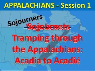
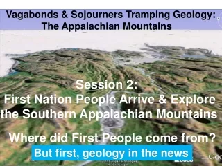
Vagabonds & Sojourners Tramping Geology: The Appalachian Mountains Session 2: First Nation People Arrive & Explore the Southern Appalachian Mountains Where did First People come from? But first, geology in the news
Extraction begun of lithium, magnesium, & copper from very hot brines used to generate electricity in the Salton Sea of southern California Lithium and magnesium are important industrial raw materials in short supply in the USA The Canadian-USA oil pipeline
Bringing oil from the Canadian tar sands to mid-America Unhappy “campers” in the exploration for Marcellus shale gas in New York state
Unhappy “campers” in the exploration for Marcellus shale gas in New York Exploration leases signed 5 years ago are being extended under forced majeure without increased compensation equivalent to compensation being offered today for new leases A new book you may or may not want to read
The Quest: what’s in our energy future and our options Let’s try serious conservation of our energy resources From Patricia Windsor
From Patricia Windsor Government bureaucracy is delaying the creation of a large number of new, high pay jobs by delaying permits to drill in the USA offshore, New York state, etc. What’s not mentioned is the need now to begin the recruiting and training of 1,000’s of new geologists and engineers to handle the phenomenal growth of the oil and gas industry in the next 40 years Some news from Africa
Geology in the News Diagram up close
Human language began far from central Africa where fossils indicate humans evolved Now recall from last week; where did First Nation Peoples in North America come from? Rift Valley Area Advent of humans?
Human migration out of Africa Last continental glacier: North America Last continental glacier: Eurasia Human land path Several current theories on the migration routes Out of Africa
The awesome challenge of migrating by sea Alternate route current theory: Asia to North America by sea
The awesome challenge of migrating by sea Early human artifacts in the vicinity of the Appalachian Mountains
Evidence of early humans in the Appalachians Appalachian Mountains Pre-Clovis artifact sites 15,000 years ago What might have been the environment 15,000 years ago in Appalachia?
Last Four Ice Ages Homo sapiens Focus on the time of Homo sapiens Looking at the last glacial period: events favoring migration into North America
Possible migration times of early humans into North America: 35,000 & 15,000 years ago Last glacial period 35,000 years ago glacial recession 15,000 years ago pre-Clovis The big picture
Human History Time Line: aka Recent Geologic Time Line One Million Years Ago Now 500,000 Years 1,000,000 Years 100,000 Years 10,000 Years Ago 100,000 Years Ago Now 15,000 35,000 Now recall the possible routes to Appalachia Last Ice Age AD Human history Humans in North America? Advent of Humans
Possible Intra-glaciation Migration of Humans from Asia to North America 15,000 years ago 35,000 years ago mid-late glacial period What might have the Canadian portion of the migration routes looked like?
Possible drainage challenges of migration during a glacial recession What might the Canadian portion of the migration route looked like?
North South Glacier Cold hostile climate!
Possible drainage challenges of migration during a glacial recession Cold hostile climate What did First Nation People find when they finally got to Appalachia?
Melting glacier Maximum extent of last glacier Following the rivers, staying away from the melting glacier Appalachian Mountains What did Appalachia look like as First Nation People approached it from the west?
A Land of Long Ridges and Valleys Time for a little more geology
What made the valleys & ridges? Marine Sandstones, Limestones, & Shales: The rocks of the Valley & Ridge Province How did these marine rocks get here, miles from the ocean? Dense white limey rock made low ridges A gray soft rock made these low hills A black mud stone made this stream valley rocks made from sediments deposited in the oceans along continental margins A yellow sandy rock made prominent ridges Let’s go back to our Central Texas model of making rocks from sediments
Let’s follow the erosional debris Deeply buried layers are uplifted, weathered and the debris is moved to the oceans
River Erosion in Central Texas Land surface 65 million years ago Present day Land surface Sedimentary rocks 145 to 65 million years old on continental crust (metamorphic in igneous rocks) Weathered rock debris moved by rivers to the Gulf of Mexico geosyncline What is a geosyncline? Continental Crust
What is a Geosyncline? Answer: A thick (1000’s of feet) accumulation of rock debris in the ocean at the continental margin Debris brought to the ocean by rivers and spread along the coast by ocean currents
Geosyncline Example: land River debris Ocean Rocks of the Iberian continental crust river debris A modern example of a geosyncline: The Gulf of Mexico geosyncline
Example of a Geosyncline:Gulf of Mexico 1. Integration of the debris of several rivers Swamp Muds Shallow water Sands Modern Sediment Accumulations Deep water Muds 2. Accumulation of thick layers of debris
Subsurface Cross Sections Gulf of Mexico Geosyncline Gulf of Mexico Austin Sun City New Orleans Shale Source Rocks SandstoneReservoir Rocks 65,000 feet thick Gulf of Mexico Geosyncline Mature Source Rocks 2. Accumulation of thick layers of debris What is the “fate” of all geosynclines?
What is the “fate” of all geosynclines? Sediments in ocean at the margin of the continent Building a new mountain range by crushing & melting the sedimentary rocks creating metamorphic & igneous rocks Where have sedimentary rocks in North America been converted to metamorphic & igneous rocks?
The Appalachian Geosynclinal Model The Fate of Thick Debris in the Sea along Continental Margins Rocks at the surface today The Appalachian geosyncline has been welded back into the North American continent as a mountain range Limestones East Dipping Sandstones and Shales Metamorphic and Igneous Mountains Folded Sandstone and Shale Mountains Here’s how mountain building works Debris of the Appalachia geosyncline turned into the Appalachian Mountains
Mountain Building Appalachian Example Mountains welded onto continent Appalachian Geosyncline 250 million years ago Pennsylvania Virginia Illinois Ohio Pennsylvania Virginia Sandstones and Shales Limestones Sandstones Crushed Melted Rocks = Mountains Shales Purple “mountains” = metamorphic rocks Red “mountains” = igneous rocks Mountain building produces two types of igneous rocks Today’s Gulf of Valencia Geosyncline
Ocean Basalt: oceanic crust Granite: continental crust Pre-Cambrian granites Mountain building: Partial melting stage
Schists Slate Gneiss
Ocean Basalt: oceanic crust Granite: continental crust Pre-Cambrian granites Then complete rock melting Mountain building: Complete melting stage
Rhyolite lavas Granites at depth Black basalt lavas Gabbros at depth Then complete rock melting
Basalt Schist Rhyolite Let’s put it all together from the creation of the earth, 4.8 billion years ago Granite Gabbro Gneiss
Our “earth” 4.8 billion years ago Hot cloud of gas & dust Hot cloud: Cools forming rocky lithosphere
Hot-gas cloud cools: core, mantle, & crust crust mantle core As the still molten crust forms, it separated into continental crust & oceanic crust
Granite Molten mantle Granite Basalt Continental crust congealing on molten mantle Oceanic Crust congealed Granite Granite
Granite Steam from the cooling ocenic crust forms the oceans Molten mantle Granite Basalt Oceans Oceanic Crust congealed Hot gasses cool to form the atmosphere Rain combined with sunlight begin the weathering and erosion of the continental crust Granite Granite
Erosional debris from the continents is moved by rivers to the continental margins forming geosynclines Granite Molten mantle Granite Basalt When geosynclines have been filled to “capacity” they are crushed & melted into mountain ranges Granite Granite
Mountain Building Granite Molten mantle Granite How are the rock types arranged in all this? Basalt Granite Granite
What rocks are produced by these geologic processes? Geosyncline Sandstone Shale Limestone Mountains Marble Schist Gneiss Rhyolite Granite Basalt Continental Crust Granite: coarse grained light color light weight Oceanic Crust Mantle Basalt: no grains black heavy weight Gabbro: coarse grained black heavy weight Let’s look more closely at rocks
Rocks are made of minerals Minerals are naturally occurring compounds of elements (remember the periodic table from chemistry) Most common minerals: clays (half a dozen): make shale feldspars (half a dozen): make igneous & metamorphic rocks quartz: make sandstones, in granite & rhyolite calcite: make limestones Now the big picture
Ancient Mountains of North America Appalachian Mountains A schematic diagram of North America
Hypothetical Diagram: Ages of Ancient Mountains of the Continental Crust Back to the Blue Ridge Mountains of Appalachia Crust 3.5 B Crust 3 B Crust 2 B Original Crust: 4.8 B Crust 1.4 B Volume of continental crust appears constant over time. Therefore, original continental crust might have been much thicker that later crust as the various mountains were created by compressing their corresponding geosynclines
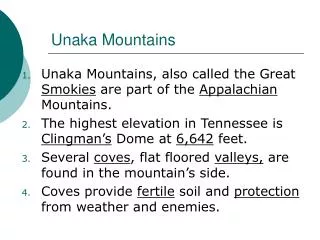
The Blue Ridge Mountains of Appalachia Valley and Ridge province Great Smoky and Blue Ridge mountains What type of rocks did they find in mountains?
What type of rocks did they find in mountains? Metamorphic Rocks: sedimentary rocks buried to great depth, squeezed , crushed, & partially melted Metamorphic Rocks of the Blue Ridge Schists Gneisses What did first Nation People find east of the Blue Ridge Mountains in the Piedmont foothills?
Geological Provinces: Central & Southern Appalachians Pennsylvania Valleys & Ridges of ss, sh, & ls Ohio Mountains of metamorphic rocks Virginia Kentucky Foothills of igneous rocks North Carolina Tennessee What do the igneous foothills look like?
Geological Provinces: Central & Southern Appalachians Mt. Airy granite Valley & Ridge (folded) mountains Piedmont foot hills North Carolina Blue Ridge Mountains Mt. Airy area up close