Download
1 / 16
160 likes | 332 Vues
ArcGIS has a 3 part interface. ArcCatalog – organizes spatial data contained on your computer and various other locations and allows for you to search, preview, and add data to ArcMap as well as manage metadata and set up address locator services ( geocoding )

E N D
ArcGIS has a 3 part interface • ArcCatalog– organizes spatial data contained on your computer and various other locations and allows for you to search, preview, and add data to ArcMap as well as manage metadata and set up address locator services (geocoding) • ArcMap– is the main mapping application which allows you to create maps, query attributes, analyze spatial relationships, and layout final projects • ArcToolbox– powerful geoprocessing tools (embedded into ArcMap and ArcCatalog)
Choropleth Maps Map using different colors or patterns to show different values over space
“Layers” of GIS Information Municipalities
“Layers” of GIS Information Census Tracts
“Layers” of GIS Information Lakes and Rivers
“Layers” of GIS Information Polluting Companies
“Layers” of GIS Information Schools
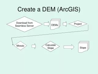
ARCMAP Raster Data Formats • Images (.tif, .jpg, .img, .sid, .jp2) • Grids – ESRI proprietary (folders) • E00 – Grid exchange (.e00) • SDTS • DEM – Digital Elevation Model (.dem, folders) • ASCII (.txt, .asc)
ARCMAP Vector Data Formats • CAD – subclasses (.dxf) • Coverage – supports subclasses (folders) • E00 – coverage exchange format (.e00) • Shapefile– industry standard (.shp) • Geodatabase– (.mdb) • Smart Data Compression – new proprietary ESRI file format (.sdc)
GIS • Another skill that takes many hours to acquire and master. • If you master GIS – you have a career if you want it.