Download
1 / 15
150 likes | 314 Vues
H 2 0 Systems: NC Watersheds and Pollution. Unit 2 Lesson 2 PowerPoint 1. NC as an Aqueduct. Imagine NC as an aqueduct. From which direction would the source of your water come from? How does the geography of NC affect the flow of water through our state?

E N D
H20 Systems: NC Watersheds and Pollution Unit 2 Lesson 2 PowerPoint 1
NC as an Aqueduct • Imagine NC as an aqueduct. • From which direction would the source of your water come from? • How does the geography of NC affect the flow of water through our state? • Where does all the water in NC try to drain out into? • What carries the water there?
Watersheds • NC has 17 watersheds. • Watersheds are geographic boundaries that confine runoff to a particular region. • The largest NC watershed is the Cape Fear watershed. It is drained by the Cape Fear River.
Watersheds cont… • Watersheds are separated by divides. When precipitation hits the ground it is known as runoff. The topography of the land influences the direction in which runoff will travel.
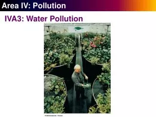
The Mighty Cape Fear • The Cape Fear River is NC’s largest river basin. • It drains 27 counties, including Duplin. • Empties into the Atlantic Ocean at Wilmington, NC. • About 35% of the streams in the Cape Fear River Basin are considered threatened and 18% are impaired by pollution. • Sediment is the major pollutant, but other types of pollution which pose significant threats to water quality include nutrients, oxygen-demanding wastes, and toxic substances. The pollution comes from different sources: urban stormwater, construction, agriculture, and wastewater treatment plants. Source: http://www.water.ncsu.edu/capefear.html
Point Source vs. Non-point Source Pollutants • Pollutants are the substances that cause pollution. • The Cape Fear River Basin is affected by many types of pollutants. These pollutants come from several different sources. • Point source pollution – the source of pollution is directly identifiable. • Nonpoint source pollution – the source of pollution is not directly identifiable.
Cape Fear Meets the Ocean • The Cape Fear ends in New Hanover County. It empties into the Atlantic ocean at the historic port of Wilmington. The area where a river meets the ocean is known as an estuary. • Estuary – unique ecosystem • Breeding ground for certain breeds. • Dilution of salt creates a unique habitat.
Conclusion • A large amount of NC’s population relies heavily on the Cape Fear River Basin (watershed) for potable water. It is important that we keep this basin free of pollutants and do our part to sustain the water needed for this area.
Tying it all together. • How might pollution affect water sustainability efforts in NC and what are some ways that we can help decrease the amount of pollutants entering our water systems? • Write a “BLT” essay and submit it by the end of class.