
Chapter 10
Chapter 10. Early Paleozoic Earth History. New York State Most surface rocks are from the Paleozoic. Paleozoic History of North America. Major mountain-building activity Shallow-water marine transgressions and regressions over the interiors Causes: global changes in sea level

Chapter 10
E N D
Presentation Transcript
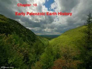
Chapter 10 Early Paleozoic Earth History
New York State Most surface rocks are from the Paleozoic
Paleozoic History of North America • Major mountain-building activity • Shallow-watermarine transgressions and regressionsover the interiors Causes: global changes in sea level • plate activity along continental margins • glaciation
Continental Architecture • Cratons are stable and “immobile” a shield and a platform (granite-gneiss) form the foundation upon which Phanerozoic sediments were deposited
Mobile Belts • Areas of mountain building activity – • “orogenic activity”along the margins of continents • sediment are deposits in shallow waters • continental shelf • and the deeper waters at the base of the continental slope During plate convergence along margins, the sediments are deformed • intruded by magma • mountain ranges are formed from subduction volcanoes • Or continental collision
Epeiric Seas • The transgressing and regressingshallow seas • common feature of Paleozoic as evidenced by sediments deposited now forming the surface rock in New York State MarcellusShaleDevonian Age
Oriskany Sandstone Near Utica NY
Paleogeographic Maps • Geologists use • paleoclimatic data: (glacial, rock types, coal) • paleomagnetic data: (preserved in igneous rocks) tells latitude and magnetic pole directions • paleontologic data: pollens, plants, animals • sedimentologic data: structures, environments • Stratigraphic: data rock relationships and age • tectonic data : evidence of plate boundaries
Six Major Paleozoic Continents • At the beginning of the Paleozoic: • 1. Baltica- Russia west of the Ural Mountains and the major part of northern Europe • 2. Gondwana - Africa, Antarctica, Australia, Florida, India, Madagascar, and parts of the Middle East and southern Europe • 3. Laurentia - most of present North America, Greenland, northwestern Ireland, and Scotland
Six Major Paleozoic Continents • 4. China- include China, Indochina, and the Malay Peninsula • 5. Kazakhstan - a triangular continent centered on Kazakhstan, • 6. Siberia - Russia east of the Ural Mountains and Asia north of Kazakhstan and south Mongolia • AND numerous small microcontinents • and island arcs associated with various microplates
Paleogeography of the World • For the Late Cambrian Period
Paleogeography of the World • For the Late Ordovician Period
Paleogeography of the World • For the Middle Silurian Period
Early Paleozoic Evolution of North America • epeiric seas transgressed and regressed Over the stable continental interior • mobile belts where mountain building occurred
Cratonic Sequences of N. America • Cordilleraorogenies • Appalachia • orogenies • White areas represent sequences of rocks That are separated by large-scale unconformities shown in brown
Cratonic Sequence • A cratonic sequence is • a large-scale lithostratigraphic unit representing a major transgressive-regressive cycle bounded by cratonwide unconformities Regressing Sea
White areas = sequences of rocks • Sauk sequence
The Sauk Sequence • Rocks of the Sauk Sequence • Late Proterozoic-Early Ordovician (long, slow process) • first major transgression onto the North American craton • Deposition of marine sediments : • passive shelf areas of the East and West borders of craton • Many of the Sauk carbonates (limestones) contain fragments of organic remains – bioclastic rock • The craton was above sea level • and experiencing extensive weathering & erosion SHALLOW WATER DEPOISITION!
The Sauk Sequence:Middle Cambrian Period • North America was located in a tropical climate at this time • there is no evidence of any terrestrial vegetation, NO plants! • Rapid weathering and erosion of the exposed Precambrian basement rocks = widespread unconformity
Highlands:Transcontinental Arch • By the Late Cambrian, • the epeiric seas covered most of North America, • Above the sea: • a portion of the Canadian Shield • and a few large islands • “Transcontinental Arch”
Cambrian Paleogeography of North AmericaSauk Transgression • During this time North America straddled the equator • Trans-continental Arch
A Transgressive Facies Model • Facies are sediments that represent a particular environment • During a transgression: the coarse (sandstone), fine (shale) and carbonate (limestone) facies migrate in a landward direction
The Cambrian of the Grand Canyon Region • Grand Canyon at western margin of the craton during Sauk time, a passive shelf • most of the craton was still above sea level • deposition of marine sediments • was at the margins of the craton • on continental shelves and slopes
Evidence of Transgression • The Tapeats Sandstone represents the shoreline depositsare clean, well-sorted sands • of the type one would find on a beach today • By Middle Cambrian, • muds of the Bright Angle Shale • were deposited over the Tapeats Sandstone By Late Cambrian • carbonates of the Muav Limestone were being deposited over the Bright Angel Shale
Cambrian Transgression • Cambrian strata in the Grand Canyon • The three formations exposed • along the Bright Angel Trail, Grand Canyon Arizona
Cambrian Transgression • Observe the time transgressive nature of the three formations
Regression and Unconformity • The Sauk Sea regressed • rocks exposed were predominately • Limestones: deep extensive erosion • North America was still located in a tropical environment – increased weathering • The resulting cratonwide unconformity • marks the boundary between the Sauk • and the NEXT Cratonic sequence Tippecanoe
Cratonic Sequences of N. America • White areas = sequences of rocks Brown areas = large-scale” uncon-formities • Regression • Tippecanoe sequence
Ordovician Period • Paleo-geography of North America • showing change in the position of the the equator • The continent • was rotating counter-clockwise
Transgression of the Tippecanoe Sea Resulted in deposition of the St. Peter Sandstone • Middle Ordovician over a large area of the craton
St. Peter Sandstone Outcrop of St. Peter Sandstone in Governor Dodge State Park, Wisconsin
The Tippecanoe Sequence • The Tippecanoe basal sandstones were followed by widespread carbonate deposition • The limestones were generally the result of deposition • by calcium carbonate-secreting organisms such as • corals, • brachiopods, • stromatoporoids, • and bryozoans
TippecanoeReefs and Evaporites • Organic reefs limestone structures constructed by living organisms, • Today, corals, and calcareous algae • are the most prominent reef builders, • but in the geologic past other organisms • played a major role in reef building • Reefs appear to have occupied • the same ecological niche in the geological past as today
Present-day reefs are 30 degrees north and south of the equator • Corals require warm, clear, shallow water • of normal salinity for optimal growth
Present-Day Reef Community • with reef-building organisms
Reef Environments • Block diagram of a reef showing the various environments within the reef complex
Michigan Basin Evaporites • significant structure in the region a broad, circular basin surrounded by large barrier reefs • reefs contributed to restricted circulation • and the precipitation of Upper Silurian evaporites within the basin • Evaporites form when water evaporates and leaves salts and brines behindhalite, gypsum, sylvite
Silurian Period • Paleogeography of North America Silurian Period • Reefs developed in the Michigan, Ohio, and Indiana-Illinois-Kentucky areas
Origin of Thick Evaporites – 1500 m(Gypsum, Halite) • When sea level dropped, the tops of the barrier reefs were as high as or above sea level, • Preventing influx of new seawater into the basin Evaporation of the basin seawater would result in the precipitation of salts 2. Alternatively, the reefs grew upward so close to sea level • that they formed a sill or barrier that eliminated interior circulation
Silled Basin Model • Silled Basin Model for evaporite sedimentation by direct precipitation from seawater
Basin Brines • Because North America was still near the equator during the Silurian Period, • temperatures were probably high
The Appalachian Mobile Belt • Phanerozoicorogeny – mountain building Iapetus Ocean was widening as a divergent plate boundary caused movement • Beginning with the subduction of the Iapetus plate beneath Laurentia • which was an oceanic-continent convergent plate boundary • the Appalachian mobile belt was born
The Taconic Orogeny • The resulting Taconic orogeny, • Today’s Taconic Mountains • eastern New York, • central Massachusetts, • and Vermont • First of 3 to form Appalachians
Appalachian Mobile Belt • Transition to convergence resulted in orogenic activity
Queenston Delta Clastic Wedge • Evidence for the Taconic orogeny • The remnants of the mountains The remains of a large clastic wedge, • detrital sediments adjacent to an uplifted area • thinner and finer grained away from the source area, • eventually grading into the carbonate cratonicfacies • The clastic wedge resulting from the erosion of the Taconic Highlands is referred to as the Queenston Delta