Download
1 / 48
510 likes | 1.1k Vues
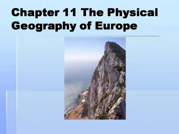
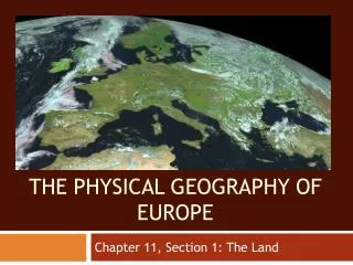
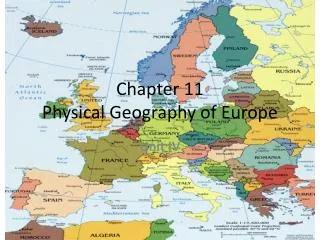
Chapter 11 Physical Geography of Europe. Unit IV. Satellite View of Europe. R E G I O N S. Seas, Peninsulas, and Island. Most of Europe= 300 miles from a seacoast . Shapes lifestyles of Europeans Examples: A. 25 % of Netherlands lies below sea level

E N D
Seas, Peninsulas, and Island • Most of Europe= 300 miles from a seacoast. • Shapes lifestyles of Europeans Examples: A. 25 % of Netherlands lies below sea level B. Dutch have constructed dikesto hold back water. • Scandinavian Peninsula- Northern Europe mountainous area. Ice Age glaciers melted here, leaving thousands of lakes. • Fjords- areas carved by glaciers: Jutland, main peninsula of Denmark. • http://asterweb.jpl.nasa.gov/gallery-detail.asp?name=netherlands
Norwegian Fjords • Glaciers cut deep valleys in the ocean during the Ice Age.
Northern Peninsulas Scandinavian Peninsula Jutland Peninsula
Southern Peninsulas • Iberian Peninsula- contains Spain and Portugal, separates Mediterranean Sea from Atlantic Ocean. • Contains Pyrenees Mountains a. ApenninePeninusula- long, thin, boot-shaped piece of land which contains Italy. -Contains Apennines Mountains, which includes the active volcano, Mount Vesuvius. b. Balkan Peninsula- Southeastern Europe, tangle of mountain ranges and valleys.
Southern Peninsulas CrimeanPeninsula Iberian Peninsula Italian Peninsula Balkan Peninsula AnatoleanPeninsula
http://travel.wallpapers.tc/pictures/Spain/Spain Torla in Ordesa Huesca Province Pyrenees Mountains.jpg
Bodies of Water ArcticOcean AtlanticOcean North Sea Baltic Sea English Channel CaspianSea Bay ofBiscay BlackSea DardanellesStrait Adriatic Sea AegeanSea TyrrhenianSea Strait ofGibraltar Mediterranean Sea
Mt. Vesuvius, Italy • Pompeii, 79 CE • Herculaneum, 79 CE • 1944 eruption
Mt. Etna, Sicily • An active volcano
Europe’s Islands • Iceland- South of the Arctic Circle in the North Atlantic Ocean. • Features volcanoes, hot springs, and geysers! British Isles- Ireland and Britain- cool, hilly, and rainy Mediterranean • Sicily • Corsica • Sardinia • Cyprus • Crete Aegean Sea- nearly 2,000 islands with sunny climate. Popular tourist destination…
The Mediterranean Sea: Mare Nostrum Strait of Gibraltar & the“Pillars of Hercules” • 2,400 miles long & 1,000 miles wide • “Crossroads of 3 Continents” Caesarea on the Israeli coast
http://www.daiwasports.co.uk/news-and-features/recent-features/061708221012/steve-souters-iceland-report/http://www.daiwasports.co.uk/news-and-features/recent-features/061708221012/steve-souters-iceland-report/
http://www.travelwizard.com/luxurycruise/cruise-destinations/british-isles-cruises/http://www.travelwizard.com/luxurycruise/cruise-destinations/british-isles-cruises/
Milos is one of the most beautiful Cycladic islands in central Aegean sea.
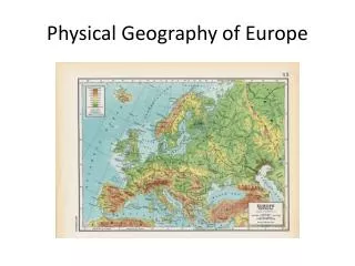
Mountains and Plains • Mont Blanc- highest peak in the Alps- 15,771 Feet high • Carpathians- long mountain chain that runs through Eastern Europe. • North European Plain- stretches from southeastern England and western France to Russia. (home to some of Europe’s largest cities) • Great Hungarian Plain- fertile region that extends from Hungary to Croatia, Serbia, and Romania.
Elevation Urals Caucasus Pyrennes Carpathians Alps Apennines
Water Systems • Europe has a network of canals that aid transportation and irrigation. • Thames River- large river that allows ships easy access to London. • The Rhine River- Western Europe’s major river, runs through France and Germany into the Netherlands. • The Danube River- Eastern Europe’s major river, flows from Germany’s Black Forest to the Black Sea. • Main-Danube Canal- links North Sea and Black Sea. Completed in 1992.
The Danube River 1770 miles
The Danube River Where Buda & Pest Meet Biking Along the Danube • Flows through the 12 countries of Germany, Austria, Slovakia, Hungary, Serbia, Croatia, Bosnia and Herzegovina, Slovenia, Bulgaria, Romania, and the Ukraine.
Capitals on the Rivers (1) Paris, right bank of the Seine London on the Thames Prague on the Vltava Budapest on the Danube
Capitals on the Rivers (2) Moscow on the Moscow River Berlin on the Spree Rome on the Tiber Vienna on the Danube
Natural Resources • At one time, an abundant supply of coal and oil supported the development of modern industry. • Today, European coalfields are depleted. Fuel Sources: • Peat- dense, mossy substance dug up in swamps and dried for fuel. • Coal, oil, natural gas, nuclear, and hydroelectric power.
Climate and Vegetation • European climates vary according to distance from the sea. 1. Western Europe- forests include deciduous and evergreen trees. Conifers thrive in cooler sections of the region. • Alps- highlands climate with colder temperatures and more precipitation; dry winds trigger avalanches. • Deforestation- by 1922, Ireland had cut down 99 percent of its original forest. Government and private sponsored reforestation efforts have increased woodland areas as of late.
Climate and Vegetation 2. Southern Europe- Mediterranean climate with warm, dry summers and mild, rainy winters. a. Alps block Atlantic winds=less precipitation falls in southern Europe. b. Mistral- an Alpine wind; occasionally blows bitter cold air into Southern France. c. Siroccos- high, dry winds from North Africa—bring hot weather to Europe.
Climate and Vegetation 3. Eastern and Northern Europe- humid continental climate—cold, snowy winters and hot summers. a. Grasslands cover much of eastern Europe, especially Hungary and Romania. Mixed deciduous and coniferous forests are found here. b. Northern parts of Scandinavia feature subarctic and tundra climates. Bitter cold winters, short and cool summers, permanently frozen soil beneath the surface.